
Kirthar Mountains facts for kids
Quick facts for kids Kirthar Mountains Darihyaro (Dogs Grave) |
|
|---|---|
| Arbiti Mountains | |

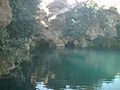
A cave near water spring in Kirthar Mountain
|
|
| Highest point | |
| Elevation | 2,151 m (7,057 ft) |
| Geography | |

Kirthar Mountains Darihyaro (Dogs Grave)
Location in Pakistan
|
|
The Kirthar Mountains are a long chain of mountains in Pakistan. They stretch across two parts of Pakistan: Balochistan and Sindh. These mountains go for about 190 miles (306 km) from the Mula River all the way down to Cape Monze by the Arabian Sea.
The Kirthar Mountains act like a natural border. They separate the lower Indus Plain (which is to the east) from southern Balochistan (which is to the west).
Contents
How Tall are the Kirthar Mountains?
The Kirthar Mountains are made up of many parallel hills. In the southern part, these hills are about 4,000 feet (1,219 meters) high. As you go north, they get much taller, reaching almost 8,000 feet (2,438 meters).
The highest point in the Sindh part of the mountains is about 7,056 feet (2,151 meters) above sea level. There are many paths through these mountains that people can use, especially with camels. The mountains have a simple shape, like a series of gentle arches.
Who Lives in the Kirthar Mountains?
Many different groups of people live in the Kirthar Mountains. They include the Chhutto people from the Bhootani tribe, as well as Sindhi and Balochi tribes. These communities live on both sides of the mountain range.
Most of the people living here make their living by grazing their flocks of animals. Some of the main Baloch tribes in the Kirthar area are the Chhutta, Burfat, Gabol, Marri, Bozdar, Lund, Nohani, Bugti, Chandio, and Lashari.
Images for kids
-
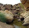
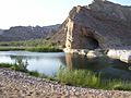
Cold water spring in the Kirthar National Park
-
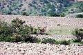
Chinkara gazelle in the Kirthar Mountains
-
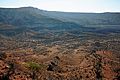
Another view of the Kirthar National Park
-
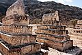
The Taung Tombs
-
Spring of Piprasar in Kirthar Mountain
-
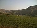
Agricultural vale in Kirthar Mountain
-
A cave near water spring in Kirthar Mountain
-
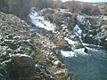
Water fall in the Kirthar Mountain
-
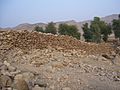
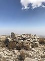
A wall of oldest fort in the Kirthar Mountain
-
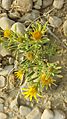
A kind of flowery plant in Kirthar mountain
-
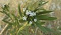
Senwar (in Sindhi) plant in Kirthar Mountain
-
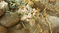
A thorny plant in Kirthar Mountain
-
The "Dog's Grave" at Kutte-ji-Qabar


_plant_in_Kirthar_Mountain.jpg)


See also
 In Spanish: Montañas de Kirthar para niños
