Klemtu facts for kids
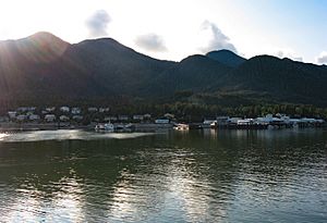
Klemtu is a small community located on Swindle Island in the beautiful coastal fjords of British Columbia, Canada. Fjords are long, narrow sea inlets with steep cliffs on either side. Klemtu is also part of the Kitasoo Indian Reserve No. 1.
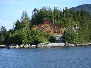
Klemtu is home to two important First Nations groups: the Kitasoo and the Xai'xais. The Kitasoo people originally came from Kitasu Bay, and the Xai'xais people are from Kynoch Inlet. These two groups live together and are governed by the Kitasoo/Xai'xais Nation. This nation is a member of the Oweekeno-Kitasoo-Nuxalk Tribal Council, which helps different First Nations work together.
The traditional languages spoken in Klemtu are Southern Tsimshian, which is a dialect of the Tsimshian language, and Xaixais, a dialect of the Heiltsuk language. Many people in the community are part of the United Church of Canada.
In 1983, about 269 people lived in Klemtu. By As of 2007[update], the population had grown to 505 people.
What Does the Name Klemtu Mean?
Klemtu has had a few different names over time. An older name for the community was Kitasoo. It was also sometimes called China Hat because of the shape of Cone Island, which protects Klemtu from the open ocean.
The name Klemtu comes from the Coast Tsimshian language. The original word was "Klemdoo-oolk," which means "impassable."
Klemtu's Climate and Weather
Klemtu is located in a coastal area, which means it experiences a lot of rain. The weather here can change quite a bit throughout the year.
| Climate data for Boat Bluff (1981–2010) | |||||||||||||
|---|---|---|---|---|---|---|---|---|---|---|---|---|---|
| Month | Jan | Feb | Mar | Apr | May | Jun | Jul | Aug | Sep | Oct | Nov | Dec | Year |
| Record high humidex | 15.1 | 12.2 | 17.6 | 21.1 | 27.5 | 30.1 | 36.2 | 30.5 | 27.9 | 23.4 | 13.3 | 12.0 | 36.2 |
| Record high °C (°F) | 18.0 (64.4) |
17.0 (62.6) |
20.0 (68.0) |
25.5 (77.9) |
31.5 (88.7) |
33.5 (92.3) |
32.5 (90.5) |
33.0 (91.4) |
30.0 (86.0) |
21.0 (69.8) |
16.5 (61.7) |
15.5 (59.9) |
33.5 (92.3) |
| Mean daily maximum °C (°F) | 6.0 (42.8) |
6.6 (43.9) |
8.3 (46.9) |
10.9 (51.6) |
14.1 (57.4) |
16.6 (61.9) |
18.7 (65.7) |
19.0 (66.2) |
16.2 (61.2) |
11.7 (53.1) |
7.6 (45.7) |
5.8 (42.4) |
11.8 (53.2) |
| Daily mean °C (°F) | 3.6 (38.5) |
3.9 (39.0) |
5.3 (41.5) |
7.4 (45.3) |
10.4 (50.7) |
12.9 (55.2) |
14.7 (58.5) |
15.1 (59.2) |
12.8 (55.0) |
9.0 (48.2) |
5.2 (41.4) |
3.6 (38.5) |
8.7 (47.6) |
| Mean daily minimum °C (°F) | 1.2 (34.2) |
1.2 (34.2) |
2.2 (36.0) |
3.9 (39.0) |
6.6 (43.9) |
9.0 (48.2) |
10.8 (51.4) |
11.1 (52.0) |
9.4 (48.9) |
6.4 (43.5) |
2.9 (37.2) |
1.4 (34.5) |
5.5 (41.9) |
| Record low °C (°F) | −16.0 (3.2) |
−17.5 (0.5) |
−14.0 (6.8) |
−1.0 (30.2) |
−1.0 (30.2) |
4.0 (39.2) |
5.5 (41.9) |
6.5 (43.7) |
4.0 (39.2) |
−7.6 (18.3) |
−20.2 (−4.4) |
−14.0 (6.8) |
−20.2 (−4.4) |
| Record low wind chill | −18 | −15 | −10 | 0 | 0 | 0 | 0 | 0 | 0 | 0 | −11 | −21 | −21 |
| Average precipitation mm (inches) | 601.9 (23.70) |
428.5 (16.87) |
428.4 (16.87) |
389.1 (15.32) |
257.7 (10.15) |
226.2 (8.91) |
179.8 (7.08) |
231.4 (9.11) |
366.0 (14.41) |
631.8 (24.87) |
677.8 (26.69) |
628.1 (24.73) |
5,046.7 (198.71) |
| Average rainfall mm (inches) | 574.5 (22.62) |
400.3 (15.76) |
414.6 (16.32) |
386.9 (15.23) |
257.7 (10.15) |
226.2 (8.91) |
179.8 (7.08) |
231.4 (9.11) |
366.0 (14.41) |
630.0 (24.80) |
670.1 (26.38) |
606.2 (23.87) |
4,943.7 (194.64) |
| Average snowfall cm (inches) | 27.4 (10.8) |
28.3 (11.1) |
13.9 (5.5) |
2.3 (0.9) |
0.0 (0.0) |
0.0 (0.0) |
0.0 (0.0) |
0.0 (0.0) |
0.0 (0.0) |
1.9 (0.7) |
7.6 (3.0) |
21.9 (8.6) |
103.3 (40.6) |
| Average precipitation days (≥ 0.2 mm) | 23.3 | 19.6 | 22.9 | 21.4 | 19.7 | 17.8 | 16.7 | 17.4 | 19.4 | 24.7 | 24.9 | 24.9 | 252.7 |
| Average snowy days (≥ 0.2 cm) | 4.0 | 3.7 | 3.3 | 1.0 | 0.0 | 0.0 | 0.0 | 0.0 | 0.0 | 0.3 | 2.0 | 4.2 | 18.5 |
| Source: Environment Canada | |||||||||||||
 | Laphonza Butler |
 | Daisy Bates |
 | Elizabeth Piper Ensley |


