Klondyke, Indiana facts for kids
Quick facts for kids
Klondyke, Indiana
|
|
|---|---|

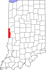
Vermillion County's location in Indiana
|
|
| Country | United States |
| State | Indiana |
| County | Vermillion |
| Township | Clinton |
| Elevation | 600 ft (183 m) |
| Time zone | UTC-5 (Eastern (EST)) |
| • Summer (DST) | UTC-4 (EDT) |
| ZIP code |
47842
|
| Area code(s) | 765 |
| GNIS feature ID | 437381 |
Klondyke is a small, quiet place in Clinton Township, Vermillion County, in the U.S. state of Indiana. It is known as an unincorporated community. This means it's a settlement without its own local government. Instead, it's managed by the larger county or township.
Contents
History of Klondyke
This community got its name from something very important in its past: the local Klondyke Mines. These mines were very busy in the early 1900s. They were likely coal mines, which were common in Indiana at that time.
Mining in the Early 1900s
During the early 20th century, coal mining was a big industry in many parts of the United States, including Indiana. Mines like those in Klondyke provided jobs for many people. They also supplied the coal needed for homes, factories, and trains.
The name "Klondyke" itself might remind you of the famous Klondike Gold Rush in Canada. While this Klondyke didn't have gold, it was a place of hard work and industry. The mines helped shape the community that grew around them.
Where is Klondyke?
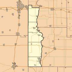
Klondyke is located in Vermillion County, which is in the western part of Indiana. You can find it at these geographic coordinates: 39.668400 degrees North latitude and -87.437790 degrees West longitude.
Understanding Klondyke's Location
Geographic coordinates help us pinpoint exact spots on Earth. Klondyke is situated about 183 meters (or 600 feet) above sea level. This elevation is typical for many areas in Indiana. The community is part of the Terre Haute metropolitan area. This means it's near the larger city of Terre Haute.
 | Stephanie Wilson |
 | Charles Bolden |
 | Ronald McNair |
 | Frederick D. Gregory |


