Knik River facts for kids
Quick facts for kids Knik River |
|
|---|---|

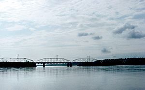
Railroad bridge on Knik River, from the Glenn Highway
|
|
 |
|
| Physical characteristics | |
| Main source | Knik Glacier 400 ft (120 m) drop 61°24′25″N 148°34′00″W / 61.40694°N 148.56667°W |
| River mouth | Cook Inlet, at Anchorage / Matanuska-Susitna Borough |
| Length | 25 miles (40 km) |
| Basin features | |
| Tributaries |
|
The Knik River is a 25-mile-long (40 km) river located in the U.S. state of Alaska. It begins at the Knik Glacier and flows towards the northwest and west. The river then empties into the upper part of Cook Inlet, known as Knik Arm. This area is close to where the Matanuska River also meets the inlet.
The Knik River is crossed by bridges in a few places. The Old Knik River Bridge and New Knik River Bridge are where the Old Glenn Highway goes over it. There is also a bridge on the Hayflats.
About the Knik River
The Knik River flows through a wide, flat area. Its riverbed is made of very fine gravel, sand, and silt. When strong winds blow, a lot of this fine material is lifted from the riverbed. It then gets carried and dropped in new places, usually further downstream or to the west.
The river itself is quite wide but not very deep. It is considered a "Class I float," which means it's easy to float down in a boat. From the glacier to the saltwater, the river drops about 400 feet (120 m). This is roughly 16 feet (4.9 m) for every mile.
River Features
An interesting part of the Knik River is a 4-mile (6.4 km) section above the Hayflats bridge. This section usually stays unfrozen during most winters. This happens because the Eklutna project releases warmer water into the river here.
Normally, the river's flow, or discharge, is about 5,000 to 6,000 cubic feet per second (140 to 170 m3/s) in the summer. However, it's not unusual for the river to have much larger flows during floods, sometimes reaching 60,000 cubic feet per second or more.
What's in a Name?
The word "Knik" is used in many names in this area. You'll find it in the river's name, the arm of Cook Inlet, and the glacier. It's also part of the names of communities like Knik-Fairview and Knik River.
The name "Knik" comes from the Inupiaq word igniq. This word means "fire." The native Denaina people had their own name for the Knik River, which was "Skitnu." This meant "Brush River," but this name is now very old and not used much anymore.
Where is it?
The Knik River runs very close to the dividing line between two important areas in Alaska. These are the Matanuska-Susitna Borough and the Municipality of Anchorage.
For much of its length, the river runs alongside two paved roads. These are the Old Glenn Highway and the Knik River Road. The community of Knik River can be found along the Knik River Road.
 | William Lucy |
 | Charles Hayes |
 | Cleveland Robinson |

