Knockewart Loch facts for kids
Quick facts for kids Knockewart or Loch Jargon |
|
|---|---|

Knockewart Loch site
|
|
| Lua error in Module:Location_map at line 420: attempt to index field 'wikibase' (a nil value). | |
| Location | Knockewart, North Ayrshire, Scotland |
| Lake type | Drained freshwater loch |
| Primary inflows | Rainfall and runoff |
| Primary outflows | Rowanside Burn |
| Basin countries | Scotland |
| Max. length | 500 m (1,600 ft) |
| Max. width | 140 m (460 ft) |
| Surface elevation | 188 m (617 ft) |
| Islands | None |
| Settlements | Ardrossan |
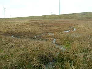
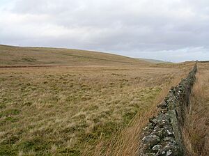
Knockewart Loch or Loch Jargon was once a freshwater loch (a Scottish lake). It was located in a low area near Knockewart Hill in Ardrossan, North Ayrshire, Scotland. Since the late 1800s, most of the old loch has been drained. It is now largely covered by plants and overgrown.
Contents
The Story of Knockewart Loch
On older maps, this loch was called Loch Jargon. This name came from a strong fort located nearby. Later, when Knockewart Farm was built, maps started using the name Knockewart Loch.
By 1897, maps showed that the loch had been drained. This happened because a natural dam bank was broken. Also, the water's outflow path was made much deeper for about 100 metres.
In 1858, people said the loch was a good place for pike fish. However, lots of plants grew in the loch's bed. This made it hard for pike to live there. Instead, it became a great spot for wild ducks to breed. By 1876, the loch had almost dried up. It was more like a swamp. In 1887, a group called the Natural History Society of Glasgow visited. They noted that the loch was almost completely covered with plants.
Why the Loch Dried Up
The draining of the loch might have started in the 1700s. At that time, Alexander Montgomerie, 10th Earl of Eglinton, was improving his large farms. Other landowners followed his lead. More drainage work may have happened in the mid-1800s. This was done to give jobs to Irish workers during the potato famines. Many drainage projects also took place after World War I. This helped soldiers returning home find work.
Busbie Muir Reservoir
The Busbie Muir Reservoir was built below the loch. It opened in 1903. Water from the old loch still flows into this reservoir. From there, it becomes the Rowanside Burn. This burn then joins the Stanley Burn. It flows over an aqueduct and into the sea at Ardrossan South Beach. Today, the Ardrossan Eglinton Angling Club uses the reservoir for fishing.
Ancient History of the Area
There are signs of ancient life around Knockewart Hill. A pile of stones called a cairn is found at North Hill. There might also be a vitrified fort there. A vitrified fort is a stone fort that has been partly melted by fire.
Near some rising ground, there is an old enclosure. It looks like this area was once cleared of stones for farming. However, no old farm plots or stone piles can be seen.
A well-preserved fort is located at Knock Jargon. It sits on a rocky outcrop with steep sides. Around the top of the hill, you can see the remains of two walls and ditches. These were built on the slopes. They are best preserved on the south side, where each has an entrance. Some historians believe Knockjargon Fort was built on an ancient Neolithic burial mound.
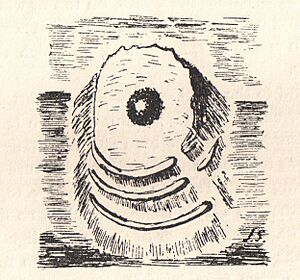
You can also find special "cup-and-ring marked stones" nearby at Blackshaw Hill. These are rocks with carved circles and hollows. Another fort with a double ditch carved from rock is near Coalhill.
Who Owned the Land?
The land around Knockewart was owned by different families over time. After the Battle of Largs, the Crawfurds of Auchnames owned it. Later, it belonged to the Mures of Caldwell.
In 1713, John Simson bought the property. His son, Dr. Robert Simson, became a famous mathematics professor. In 1787, James Montgomerie bought the estate. His daughter, Mary, inherited it. She married Captain John Brooks, who then became the owner.
Old Maps Tell a Story
Old maps help us understand the loch's history:
- Blaeu's map from 1654 (based on a survey from around 1604) clearly shows the loch. It wrongly shows its water flowing into the sea near Montfode. The map also shows a home called 'Iargan' and a place called 'Knokawart'.
- Herman Moll's map of 1745 marks the loch but does not name it.
- Roy's map of 1747 shows and names 'Loch Jargen'. It does not show any burn flowing into it.
- Armstrong's map of 1775 does not show the loch. However, Knock Jargon fort is clearly marked.
- William Aiton's map of 1811 shows a loch at Jargon. But the water's outflow goes in the wrong direction.
- Thomson's map of 1832 marks and names Loch Jargon.
The Ordnance Survey map from 1854-1859 shows the loch as open water. It had small wooded areas above and below it. Even in 2011, the drainage here was not perfect. The area is still mostly marsh plants.
What's in a Name?
The name Knockjargon is very old and unique. The word 'Jargoun' in Scots language, from as early as the 1300s, means the "twittering or chattering of birds." The word 'Knock' comes from the Gaelic word 'An Cnoc'. This means "a small hill," and such hills were often used for forts.
Wildlife of the Old Loch
The old loch area is now a special place for wildlife. The Scottish Wildlife Trust studied it in 1982. They found that the loch is now completely covered in plants, like a soft mossy carpet. It is very interesting because it has many different plant types. These include cotton grass, bottle sedge, and various mosses, especially a common moss called Polytrichum commune.
The edges of the area have lots of sharp-flowered rush. The wet area slowly changes into dry land, where soft rush and grasses grow.
This site is a good home for birds of prey, snipe, and curlew. Birds like willow warblers, tawny owls, and chaffinches have been seen here. Roe deer also live in the area. Common lizards and frogs are present too. The site is full of sphagnum mosses and heathers. You can also often find the carnivorous sundew plant here. The roe deer have stopped new trees from growing in some parts of the woodland.
Interesting Facts
- The Earl of Eglinton once held the rights to fish in the Rowanside and Stanley Burns.
- At one time, there were also reservoirs at Whitlees, Parkhouse, and Millglen.
- Coalhill got its name because coal was once mined on its eastern side.
 | Victor J. Glover |
 | Yvonne Cagle |
 | Jeanette Epps |
 | Bernard A. Harris Jr. |


