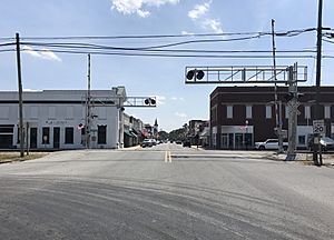
La Grange, North Carolina facts for kids
Quick facts for kids
La Grange, North Carolina
|
|
|---|---|
 |
|

Location of La Grange, North Carolina
|
|
| Country | United States |
| State | North Carolina |
| County | Lenoir |
| Named for | Château de la Grange-Bléneau |
| Area | |
| • Total | 2.31 sq mi (5.99 km2) |
| • Land | 2.30 sq mi (5.97 km2) |
| • Water | 0.01 sq mi (0.02 km2) |
| Elevation | 108 ft (33 m) |
| Population
(2020)
|
|
| • Total | 2,595 |
| • Density | 1,126.79/sq mi (434.97/km2) |
| Time zone | UTC-5 (Eastern (EST)) |
| • Summer (DST) | UTC-4 (EDT) |
| ZIP code |
28551
|
| Area code(s) | 252 |
| FIPS code | 37-36400 |
| GNIS feature ID | 2405964 |
| Website | www.lagrangenc.com |
La Grange is a small town located in Lenoir County, North Carolina, in the United States. In 2010, about 2,873 people lived there. This town is part of North Carolina's Inner Banks, an area known for its rivers and coastal plains.
Contents
Geography: Where is La Grange?
La Grange covers a total area of about 2.3 square miles (5.9 square kilometers). Most of this area is land. Only a very small part, about 0.44%, is water.
History: How La Grange Got Its Name
La Grange was named after a famous French estate. This estate, called the Château de la Grange-Bléneau, belonged to the Marquis de Lafayette. He was a French hero who helped America during the American Revolutionary War.
Some important buildings and areas in La Grange are listed on the National Register of Historic Places. This means they are special and protected because of their history. These include the Herring House, La Grange Presbyterian Church, and the La Grange Historic District.
Population: Who Lives in La Grange?
| Historical population | |||
|---|---|---|---|
| Census | Pop. | %± | |
| 1880 | 522 | — | |
| 1890 | 775 | 48.5% | |
| 1900 | 853 | 10.1% | |
| 1910 | 1,007 | 18.1% | |
| 1920 | 1,399 | 38.9% | |
| 1930 | 1,500 | 7.2% | |
| 1940 | 1,647 | 9.8% | |
| 1950 | 1,852 | 12.4% | |
| 1960 | 2,133 | 15.2% | |
| 1970 | 2,679 | 25.6% | |
| 1980 | 3,147 | 17.5% | |
| 1990 | 2,805 | −10.9% | |
| 2000 | 2,844 | 1.4% | |
| 2010 | 2,873 | 1.0% | |
| 2020 | 2,595 | −9.7% | |
| U.S. Decennial Census | |||
2020 Census: A Look at the Community
In 2020, there were 2,595 people living in La Grange. These people made up 1,133 households and 732 families.
| Race | Number | Percentage |
|---|---|---|
| White (non-Hispanic) | 1,005 | 38.73% |
| Black or African American (non-Hispanic) | 1,342 | 51.71% |
| Native American | 8 | 0.31% |
| Asian | 18 | 0.69% |
| Pacific Islander | 1 | 0.04% |
| Other/Mixed | 96 | 3.7% |
| Hispanic or Latino | 125 | 4.82% |
Education: Schools and Learning in La Grange
La Grange has several schools that are part of the Lenoir County Public School system.
Local Schools
- North Lenoir High School
- E.B. Frink Middle School
- La Grange Elementary School
For students seeking education after high school, there is a local branch of Lenoir Community College.
La Grange was also home to La Grange Colored High School, where Emmett Bentley Frink served as principal.
Public Library
The Neuse Regional Library system has its main office in Kinston. It also runs a branch right in La Grange, where you can find books and other resources.
Transportation: Getting Around La Grange
Air Travel
- The closest airport is the Kinston Regional Jetport (airport code: ISO).
- For bigger flights, Raleigh-Durham International Airport (RDU) is the nearest major airport. It offers flights to over 45 places both in the U.S. and other countries.
Highways and Roads
- I-42 is the closest major highway, located about 3 miles east of town.
- The main highway running through La Grange is US 70. This road connects the town to the North Carolina coast and I-95.
- NC 903 is another important highway that passes through La Grange.
Train Travel
Local Events: The Garden Spot Festival
The Garden Spot Festival is a fun event held every year in La Grange. It usually takes place from September 7th to 9th. The festival features live bands, delicious food, and artistic performances for everyone to enjoy.
Notable People: Famous Faces from La Grange
- The Corsairs: This was a popular Doo-wop music group. It included brothers Jay "Bird," James, and Moses Uzzell, along with their cousin George Wooten.
- Sam Shepherd: He was a basketball player who represented Venezuela in the Olympics.
See also
 In Spanish: La Grange (Carolina del Norte) para niños

