La Pellerine, Mayenne facts for kids
Quick facts for kids
La Pellerine
|
|
|---|---|

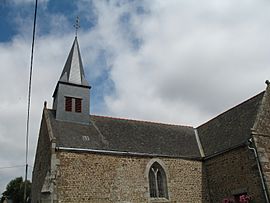
The church in La Pellerine
|
|
| Country | France |
| Region | Pays de la Loire |
| Department | Mayenne |
| Arrondissement | Mayenne |
| Canton | Ernée |
| Area
1
|
8.18 km2 (3.16 sq mi) |
| Population
(Jan. 2019)
|
305 |
| • Density | 37.29/km2 (96.57/sq mi) |
| Time zone | UTC+01:00 (CET) |
| • Summer (DST) | UTC+02:00 (CEST) |
| INSEE/Postal code |
53177 /53220
|
| Elevation | 158–236 m (518–774 ft) (avg. 208 m or 682 ft) |
| 1 French Land Register data, which excludes lakes, ponds, glaciers > 1 km2 (0.386 sq mi or 247 acres) and river estuaries. | |
La Pellerine is a small village, also known as a commune, located in the northwest of France. It is part of the Pays de la Loire region and the Mayenne department. In January 2019, about 305 people lived in La Pellerine. It's a quiet place, typical of many small French communities.
Contents
Where is La Pellerine Located?
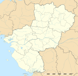
La Pellerine is found in the western part of France. It's in a region called Pays de la Loire, which is known for its beautiful castles and rivers. The village is also part of the Mayenne department, which is like a county or district. This area is in the northwest of France, not too far from the Atlantic Ocean.
What is a Commune?
In France, a "commune" is the smallest kind of local government area. Think of it like a town or a village that has its own local council and mayor. La Pellerine is one of many thousands of communes across France. Each commune manages its own local services and represents its residents.
Who is in Charge in La Pellerine?
Every commune has a mayor who is the head of the local government. The mayor helps run the village and makes decisions for the people living there. From 2008 to 2014, the mayor of La Pellerine was Pierre Chataigner. Mayors are elected by the people in the commune to serve a specific term.
How Big is La Pellerine?
La Pellerine covers an area of about 8.18 square kilometers (which is about 3.16 square miles). This makes it a fairly small commune. The village is also located at different heights above sea level. The lowest point is 158 meters (about 518 feet), and the highest point is 236 meters (about 774 feet). The average height is around 208 meters (about 682 feet).
See also
 In Spanish: La Pellerine (Mayenne) para niños
 | Selma Burke |
 | Pauline Powell Burns |
 | Frederick J. Brown |
 | Robert Blackburn |


