La Reforma, San Marcos facts for kids
Quick facts for kids
La Reforma
|
|
|---|---|
| Country | |
| Department | |
| Climate | Am |
La Reforma is a town, also called a municipality, located in the San Marcos area (or department) of Guatemala. Most people living here are Mam, an indigenous group. They speak their own language, Mam, and also Spanish. In La Reforma, both Catholic Church traditions and older local religious practices are important. Growing coffee is the main way people earn money here.
Contents
History of La Reforma
La Reforma started as a small village called Caserío. It was part of the San Cristóbal Cucho municipality in the San Marcos Department. The main landowner back then was Mariano Maldonado. He grew coffee and sugar cane, and also raised cattle. In those early days, only about nineteen people lived there. A government count in 1880 did not even list La Reforma separately. It only mentioned San Cristóbal Cucho and its small rural areas.
In 1893, La Reforma was still a village within San Cristóbal Cucho. By 1921, a new count showed that 6,125 people lived there. The people realized their village was growing fast. They needed their own local government to help with basic needs. Finally, in 1988, La Reforma became its own municipality. They named it "La Reforma" to honor General Justo Rufino Barrios. He was known as "the Reformer" and was born in the San Marcos Department.
The Immaculate Conception Church
The "La Inmaculada Concepción" (meaning "The Immaculate Conception") church in La Reforma was started on January 1, 1956. At first, it served both La Reforma and El Quetzal towns. The first priest was Father Jaime López. He was a Franciscan and led the church until March 5, 1958.
The church building itself was finished on April 23, 1961. It was officially opened and blessed by Bishop Celestino Fernández from the San Marcos area. In 1965, El Quetzal got its own church and priest. This meant the La Reforma church focused only on its own town. Father Francisco Herrero Sánchez took over in 1968. He was in charge of the church for more than twenty years.
How La Reforma's Communities Grew
La Reforma is made up of several smaller communities. Many of these communities started from large farms called "haciendas." Over time, these big farms were divided into smaller pieces of land. This allowed more families to live there and create new villages.
For example, the area where Los Ochoa now stands used to be a large farm. It belonged to two brothers, Bonifacio and Víctor María Ochoa Barrios. They had many children, and their large families helped turn the farm into a small village.
Another interesting story is Recuerdo Asturias. This area was once part of a big farm owned by Stuardo Samayoa Brahaman. After a government change in 1954, the land was sold in small parts. Francisco Asturias bought some of the land from the bank. He then sold small plots to his workers at a fair price. The new residents named their settlement "Recuerdo Asturias" to remember him.
These stories show how different parts of La Reforma grew and developed over many years.
Climate in La Reforma
La Reforma has a tropical climate. This type of climate is known as Am in the Köppen climate classification system. This means it is generally warm all year round. It also has a lot of rain, especially during certain months.
| Climate data for La Reforma | |||||||||||||
|---|---|---|---|---|---|---|---|---|---|---|---|---|---|
| Month | Jan | Feb | Mar | Apr | May | Jun | Jul | Aug | Sep | Oct | Nov | Dec | Year |
| Mean daily maximum °C (°F) | 28.7 (83.7) |
28.6 (83.5) |
29.5 (85.1) |
29.3 (84.7) |
29.0 (84.2) |
27.7 (81.9) |
28.3 (82.9) |
28.7 (83.7) |
28.0 (82.4) |
28.2 (82.8) |
28.4 (83.1) |
28.8 (83.8) |
28.6 (83.5) |
| Daily mean °C (°F) | 22.5 (72.5) |
22.5 (72.5) |
23.1 (73.6) |
23.3 (73.9) |
23.4 (74.1) |
22.5 (72.5) |
22.7 (72.9) |
23.1 (73.6) |
22.6 (72.7) |
22.9 (73.2) |
22.8 (73.0) |
22.8 (73.0) |
22.8 (73.1) |
| Mean daily minimum °C (°F) | 16.3 (61.3) |
16.5 (61.7) |
16.8 (62.2) |
17.4 (63.3) |
17.8 (64.0) |
17.4 (63.3) |
17.2 (63.0) |
17.5 (63.5) |
17.3 (63.1) |
17.6 (63.7) |
17.2 (63.0) |
16.8 (62.2) |
17.2 (62.9) |
| Average precipitation mm (inches) | 32 (1.3) |
44 (1.7) |
91 (3.6) |
186 (7.3) |
454 (17.9) |
635 (25.0) |
495 (19.5) |
480 (18.9) |
673 (26.5) |
558 (22.0) |
163 (6.4) |
57 (2.2) |
3,868 (152.3) |
| Source: Climate-Data.org | |||||||||||||
Where is La Reforma Located?
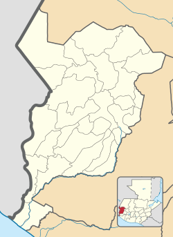
La Reforma is entirely surrounded by other towns in the San Marcos Department. It covers an area of about 60 square kilometers (about 23 square miles).
 |
San Cristóbal Cucho |  |
||
| Nuevo Progreso | El Quetzal | |||
| El Quetzal | El Quetzal |
Images for kids
See also
 In Spanish: La Reforma (Guatemala) para niños
 | Lonnie Johnson |
 | Granville Woods |
 | Lewis Howard Latimer |
 | James West |


