Lac au Sable (Mont-Élie) facts for kids
Quick facts for kids Lac au Sable |
|
|---|---|
| Location | Mont-Élie |
| Coordinates | 47°56′32″N 70°15′26″W / 47.94222°N 70.25723°W |
| Lake type | Natural |
| Primary inflows | Petit Saguenay River, ruisseau Bazile, ruisseau au Sable |
| Primary outflows | Petit Saguenay River |
| Basin countries | Canada |
| Max. length | 2.7 km (1.7 mi) |
| Max. width | 1.4 km (0.87 mi) |
| Surface elevation | 449 m (1,473 ft) |
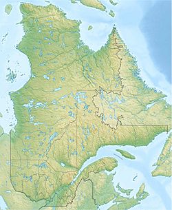
Lac au Sable is a beautiful lake in Quebec, Canada. It is located in the unorganized territory of Mont-Élie. The Petit Saguenay River flows right through it, from the south to the north.
This lake is part of the Charlevoix-Est Regional County Municipality. This area is in the Capitale-Nationale region of Quebec.
A forest road, R064, helps people reach the southeastern part of Lac au Sable. This road gets as close as 0.6 km (0.37 mi) to another lake, Lac au Bouleau.
The main activities around the lake are forestry, which means managing forests. Tourism and recreation, like visiting for fun, are also important.
The lake's surface usually freezes over from late November to early April. It's generally safe to walk or play on the ice from mid-December to the end of March.
Exploring Lac au Sable's Surroundings
Lac au Sable is surrounded by many other waterways. Knowing these helps us understand its geography.
- To the north: You'll find Lac au Bouleau and Lac Emmuraillé. The Petit Saguenay River also continues its journey north.
- To the east: There's McLagan Lake, Étienne stream, Deschênes Lake, and the Deschênes River. The Noire River is also nearby.
- To the south: You'll see the third Lac des Marais and the Petit Saguenay River.
- To the west: There's Sable stream, East Lake, and the Grosse Épinette flow.
Lac au Sable is about 2.7 km (1.7 mi) long. The Petit Saguenay River flows through it. After Lac au Sable, the river goes through Lac au Bouleau (Mont-Élie), which is 4.3 km (2.7 mi) long. Then, it flows through the eastern part of Emmuraillé Lake, which is 1.8 km (1.1 mi) long.
The place where the Petit Saguenay River leaves Lac au Sable is important.
- It's about 13.8 km (8.6 mi) southwest of lac Deschênes.
- It's about 32.0 km (19.9 mi) south of the village of Petit-Saguenay.
- It's about 32.9 km (20.4 mi) south of where the Petit Saguenay River meets the Saguenay River. This meeting point is called "Anse du Petit Saguenay Bay".
From Lac au Sable, the Petit Saguenay River flows for about 71.1 km (44.2 mi). It goes north, then northeast, and then north again. Finally, it reaches the south bank of the Saguenay River. The Saguenay River then flows east for 36.6 km (22.7 mi) to Tadoussac. At Tadoussac, the Saguenay River joins the mighty Saint Lawrence River.
The Name of Lac au Sable
The word "toponymy" means the study of place names. The name "Lac au Sable" was officially recognized on December 5, 1968. This was done by the Commission de toponymie du Québec, which is like a special group that names places in Quebec.
 | Emma Amos |
 | Edward Mitchell Bannister |
 | Larry D. Alexander |
 | Ernie Barnes |


