Lake Caroline, Virginia facts for kids
Quick facts for kids
Lake Caroline, Virginia
|
|
|---|---|

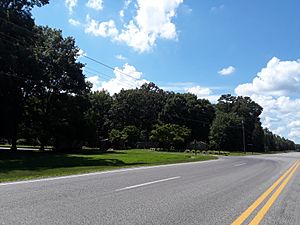
Entrance to the CDP off of U.S. Route 1
|
|
| Country | United States |
| State | Virginia |
| County | Caroline |
| Area | |
| • Total | 3.3 sq mi (8.5 km2) |
| • Land | 2.9 sq mi (7.4 km2) |
| • Water | 0.4 sq mi (1.1 km2) |
| Elevation | 230 ft (70 m) |
| Population | |
| • Total | 2,260 |
| • Density | 796/sq mi (307.5/km2) |
| Time zone | UTC−5 (Eastern (EST)) |
| • Summer (DST) | UTC−4 (EDT) |
| ZIP code |
22546
|
| FIPS code | 51-43359 |
| GNIS feature ID | 2630780 |
Lake Caroline is a special kind of community in Caroline County, Virginia, United States. It's called a census-designated place (CDP), which means it's an area that looks like a town but isn't officially a city or town with its own local government. In 2010, about 2,260 people lived here.
About Lake Caroline
Lake Caroline is a unique neighborhood built around a lake. It's a gated community, which means there are special entrances that control who can come in and out. This helps keep the area private and safe for the people who live there.
Where is Lake Caroline?
This community is located in the state of Virginia. You can find it about 2 miles (3.2 km) south of a place called Ladysmith. It's also about 10 miles (16 km) north of Doswell.
The area is easy to find because it's bordered by some main roads. To the east, you'll find U.S. Route 1. Cedar Fork Road is to the south, and State Route 683 is to the north. These roads help people get to and from Lake Caroline easily.
Living in Lake Caroline
Life in Lake Caroline is centered around the beautiful lake. Residents can enjoy activities like boating, fishing, and swimming. The community is designed to offer a peaceful and scenic place to live.
The total area of Lake Caroline is about 8.5 square kilometers (3.3 square miles). Most of this area is land, but a good part of it is water, thanks to the lake itself. This mix of land and water makes it a great spot for outdoor fun.
See also
 In Spanish: Lake Caroline (Virginia) para niños
 | Charles R. Drew |
 | Benjamin Banneker |
 | Jane C. Wright |
 | Roger Arliner Young |


