Lake Kagawong facts for kids
Quick facts for kids Lake Kagawong |
|
|---|---|

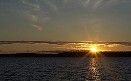
Sunrise
|
|
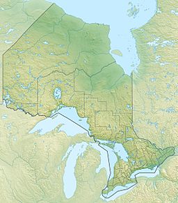
| Location | Manitoulin Island, Ontario |
| Coordinates | 45°50′00″N 82°18′36″W / 45.833344°N 82.309914°W |
| Primary outflows | Kagawong River |
| Basin countries | Canada |
| Surface area | 13,728 acres (55.56 km2) |
| Max. depth | 45 m (148 ft) |
| Surface elevation | 213 m (699 ft) |
| Frozen | December - early May |
| Islands | Kakawaie Is, Gull Is, Little Is, Bass Is. |
| Settlements | Kagawong, Long Bay |
Lake Kagawong is the second largest lake on Manitoulin Island in Ontario, Canada. It is found in the middle of the island. The lake's water flows into the Kagawong River. This river then creates the beautiful Bridal Veil Falls before reaching Lake Huron. The name Kagawong comes from the local Ojibwe language. It means "where mists rise from the falling waters."
Contents
About Lake Kagawong
Lake Kagawong has clear, green water. It is usually about 10 to 15 meters deep. You can often see 5 to 6 meters down into the water. The deepest parts of the lake are surprisingly close to the shore. On the eastern side, there is a steep rocky edge. This edge can be 1 to 2 meters high, but it reaches 15 meters at a spot called Red Rock. The cliffs at Red Rock rise from water that is over 40 meters deep!
Islands in the Lake
In the center of Lake Kagawong, there is a group of islands. The biggest one is Kakawaie Island, which is about 1.6 kilometers long. There are also smaller islands called Little Island and Gull Island. Another island in this group is hidden underwater.
About 3.2 kilometers north of Kakawaie Island, you'll find Bass Island. All of these islands are empty, meaning no one lives on them. Sometimes, large animals like deer are seen on Kakawaie Island. People think these deer walk onto the island when the lake freezes in winter. They might get stuck there when the ice melts in spring.
Boating on Lake Kagawong
Most of Lake Kagawong is safe for boats used for fun and fishing. However, there are a few spots where you need to be careful.
- Hidden Island: There's an island hidden underwater about 178 meters east of Kakawaie Island.
- Shallow Areas: Watch out for shallow spots near Kerr's Point and Ednie's Point.
- Mud Bay and Prior's Bay: These bays are also quite shallow.
- Twin Harbours: One of the trickiest spots is near Twin Harbours. Here, a hidden ridge of large rocks rises quickly from deep water. This area is right at the entrance to a bay where a boat ramp is located. This makes it the most well-known danger for boaters on Lake Kagawong.
When boating near the cliffs of Red Rock, it's important to be careful. Rocks can sometimes fall from the cliffs.
Fishing in Lake Kagawong
Fishing has always been a big reason why people visit Lake Kagawong. Over the years, different types of fish have been popular to catch.
Fish Species Over Time
- Early 1900s: In the early 1900s, many smallmouth bass and northern pike were caught. Old photos show fishermen with huge catches of nearly 100 bass and pike from just one trip!
- 1950s and 1960s: During these years, whitefish were caught by people who sold them. Today, there are almost no whitefish left in the lake.
- 1970s to 1990s: Yellow perch and smallmouth bass were the main fish that people tried to catch.
Fishing Today
Today, there's a plan to add yellow walleye fish to the lake. This idea has caused some debate. Many fishermen believe that adding walleye is causing fewer yellow perch to be caught. However, other things might also be to blame. More people fishing and the recent arrival of cormorants (birds that eat fish) could also be reasons for fewer perch.
Other types of fish you might catch in Lake Kagawong include rock bass, pumpkinseed, and catfish.
 | Leon Lynch |
 | Milton P. Webster |
 | Ferdinand Smith |


