Lake Manouane (La Tuque) facts for kids
Quick facts for kids Lake Manouane |
|
|---|---|
| Location | La Tuque / Baie-Obaoca, Quebec |
| Coordinates | 47°33′54″N 74°06′49″W / 47.56500°N 74.11361°W |
| Primary outflows | Manouane River |
| Basin countries | Canada |
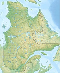
Lake Manouane is a beautiful lake located in the heart of Quebec, Canada. It's found just northeast of Kempt Lake and mostly sits within the area of the City of La Tuque. A tiny part of its southern tip reaches into Baie-Obaoca. It's important not to mix up this lake with another one further north that also shares the name Lake Manouane!
Contents
Exploring Lake Manouane
Getting to the Lake
If you want to visit Lake Manouane, the main roads to get there pass through two towns. You can travel from Saint-Michel-des-Saints in the Lanaudière region or from Rivière-aux-Rats in the Mauricie region.
Lake Kempt's Connection
The Lac Kempt, which is southwest of Lake Manouane, is the main source of water for Lake Manouane. A narrow channel, about 1.9 kilometers long, connects these two lakes. The main road coming from the south goes right between these two lakes, helping people reach the areas north of them.
Interesting Spots on the Lake
The "Baie du chien" (which means "dog bay") is a long bay, about 40 kilometers deep, located north of Lake Manouane. It gets its water from smaller lakes called Sarto and Lortie.
Near the entrance to the "Baie du chien" (on its south side), you'll find Kanawata Aeroparc. This is a special airport with a runway that's about 3,000 feet long and 100 feet wide. It even has a place to refuel planes! This aeroparc makes it easy for visitors to fly in and reach the many hunting and fishing camps set up by local guides.
In the middle of Lake Manouane, there's an island called Herons Island. It's almost directly across from the "Baie aux dorés" (meaning "walleye bay"), which is on the west side of the lake. On the east side of the lake, near its center, you'll find the "Baie au calumet" (or "Pipe Bay"). This bay receives water from Lake Drouin.
The Manouane River
A dam was built at the northeast end of Lake Manouane. It's at the end of a long, narrow stretch of water about 7 kilometers long. This dam also allows a road to cross the river, helping people reach areas further north.
Lake Manouane itself is about 18 kilometers long. This length includes the long bay in the northeast, which forms the beginning of the Manouane River. The lake is also about 8.2 kilometers wide. This measurement is taken between the bay near the airport (on the northwest side) and the "Baie au calumet" (on the east side).
The lake's water flows into the Manouane River. This river travels about 4.2 kilometers from the dam before it empties into Lake Châteauvert, which is to the east. The Manouane River is one of the five main rivers that flow into the Saint-Maurice River. It joins the Saint-Maurice River on the opposite side of the village of Wemotaci, which is about 115 kilometers northeast of the city of La Tuque in the Haute-Mauricie region.
The area around Lake Manouane is mostly covered by forests. For the local economy, tourism is very important, especially activities organized by the First Nations communities in the region.
 | Jewel Prestage |
 | Ella Baker |
 | Fannie Lou Hamer |


