Lake Roland (Maryland) facts for kids
Quick facts for kids Lake Roland |
|
|---|---|

Lake Roland
|
|
| Location | Towson, Baltimore County, Maryland |
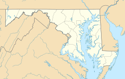
| Coordinates | 39°23′10″N 76°38′39″W / 39.38611°N 76.64417°W |
| Type | reservoir |
| Primary inflows | Jones Falls, Towson Run, Roland Run |
| Primary outflows | Jones Falls |
| Basin countries | United States |
| Surface area | 100 acres (40 ha) |
| Surface elevation | 246 ft (75 m) |
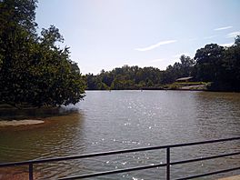
Lake Roland is a 100-acre lake in Baltimore County, Maryland. It was once a reservoir, which is a place where water is collected and stored. The lake gets its name from Roland Run, a stream that flows into it. This stream eventually joins the Jones Falls river. The Jones Falls then flows through Baltimore City to the Patapsco River and the Baltimore Harbor. Lake Roland is just north of Baltimore City.
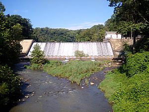
The lake is inside Lake Roland Park. This park started in the 1920s. The Baltimore City Department of Parks and Recreation looks after it. Lake Roland is an artificial lake. It was made by building a dam across the Jones Falls river. Two smaller streams, Towson Run and Roland Run, also feed into it. The lake is home to many animals. You can see Canada geese, largemouth bass, and common carp there. The lake area is also part of the Lake Roland Historic District.
Contents
The Story of Lake Roland: From Water Supply to Park
How Lake Roland Got Its Name
The lake was once called Lake Swann. This name honored Mayor Thomas Swann of Baltimore City. He started building the dam for the lake. The name Roland comes from Roland Run. This stream was named before 1694. That's when a person named Roland or Rowland Thornberry owned land nearby.
Building Baltimore's First Water Supply
In 1854, Baltimore City bought a private water company. This company had supplied water to the city for 50 years. Between 1854 and 1857, the city also bought land from two factories. These were the Bellona Gunpowder Mill and the Eagle Factory textile mill. These factories had to move because of the land purchase. A railroad, the Baltimore & Susquehanna Railroad, stayed in place. This railroad was later damaged during the American Civil War. It was rebuilt by Union forces.
An engineer named James Slade and a supervisor named Charles P. Manning began building the dam in 1858. They wanted to create a very strong dam. In 1861, Lake Roland became the first main water supply for Baltimore City. People thought it was an amazing engineering achievement at the time. The dam and a pump building were finished the next year. By 1877, water from the Gunpowder River was also sent to Lake Roland through a pipe. This helped supply more water to the city.
Challenges and Changes for the Lake
Lake Roland faced some problems. Sometimes, the water became cloudy from dirt and particles carried by rain. People tried to make the reservoir deeper by removing mud. By 1912, too much mud and silt had built up. This caused the lake to be closed for many days. It also cost a lot of money to maintain. In 1877, a local newspaper even called the lake a "receptacle of filth" because of pollution from nearby industries.
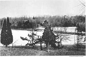
Despite these issues, some people still admired Lake Roland. In 1893, a publication called it "one of our reservoirs." It noted that the lake had many fish like Black Bass and Carp. Many different birds could also be seen there. These included least terns, American black ducks, green herons, and great blue herons. Around this time, the Lake Roland Elevated Railway started in 1891. It carried people from the city to Roland Park. This railway operated until the 1950s.
The Lake's New Purpose
Because of the problems, Lake Roland stopped being used as a main water supply. On November 19, 1915, its use was officially ended. This was mainly due to the silting problems. Also, a much larger reservoir, the Loch Raven Reservoir, had been built the year before. Some parts of the lake were later sold. The county's water department saw the lake as an "emergency backup" water source.
In 1918, Baltimore City took over managing the lake. In 1971, college students studied the lake's condition. They found that silt in Lake Roland increased a lot. By 1974, silt made up 60% of the lake's volume. This was partly due to the building of new highways like I-695. Today, you can still find old ruins from the railroad and mills near the lake. Since 1986, fish in the lake have had high levels of a chemical called chlordane. Because of this, people are advised not to eat fish from the lake.
Exploring Lake Roland's Location

Lake Roland Park is surrounded by some of the nicest communities in the Baltimore area. The L'Hirondelle Club was started by wealthy people. They used to go rowing on the lake. The park is bordered by different communities in Baltimore County. To the north is Ruxton-Riderwood. To the east is Woodbrook. To the south is north Roland Park–Poplar Hill. Farther south are wealthy Baltimore City neighborhoods like Roland Park and Homeland.
To the west of the lake is Bare Hills. This is an old community where free African-Americans settled.
West and southwest of the lake are the remains of old railroads. These include the Greenspring Branch railroad and the Northern Central Railroad. You can still find the site of an old station called the "Relay House." It burned down in 1869.
The Baltimore Light RailLink also runs through the lower part of the lake. It crosses over the dam on a track and bridge.
 | Lonnie Johnson |
 | Granville Woods |
 | Lewis Howard Latimer |
 | James West |


