Lake Wister facts for kids
Quick facts for kids Lake Wister |
|
|---|---|

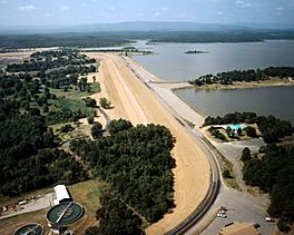
Aerial view of lake and Wister Dam
|
|
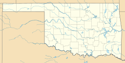
| Location | Le Flore County, Oklahoma, United States |
| Coordinates | 34°56′13″N 94°43′59″W / 34.93694°N 94.73306°W |
| Type | reservoir |
| Primary inflows | Poteau River, Fourche Maline creek |
| Basin countries | United States |
| Water volume | 49,400 acre⋅ft (0.0609 km3) (conservation) 383,000 acre⋅ft (0.472 km3) (full flood control) |
| Surface elevation | 478 feet (146 m) |
| Settlements | Wister, Oklahoma |
Lake Wister is a large reservoir located in Le Flore County, in the southeastern part of Oklahoma. This lake was created by blocking the flow of the Poteau River and the Fourche Maline creek. Lake Wister was built to help control floods and to protect natural resources. It is a popular spot for outdoor activities today.
The Story of Lake Wister
The idea for Lake Wister came from the Flood Control Act of 1938. This law allowed for the lake to be built to prevent flooding and help with conservation. The Tulsa District Corps of Engineers designed and built the project.
Construction started in April 1946. The lake was ready for full flood control use by December 1949. The entire project cost about $10.5 million. Today, Lake Wister is an important part of Lake Wister State Park. The lake is named after the nearby town of Wister, Oklahoma. Other towns close by include Heavener and Poteau.
Long before the lake was built, people lived in this area for thousands of years. Ancient Native Americans built many mounds here. During the time when Oklahoma was a territory, this area was part of the Choctaw Nation. It was specifically in Sugar Loaf County.
Exploring Lake Wister
Lake Wister is located inside the beautiful Ouachita National Forest. The lake covers a surface area of about 7,300 acres (3,000 ha). It has a long shoreline, stretching for about 115 miles (185 km).
The normal water level of the lake is 478 feet above sea level. The lowest it can go is 450 feet, and the highest it can reach is 503 feet. The lake collects water from an area of 993 square miles. This means a lot of water flows into it from the surrounding land.
 | George Robert Carruthers |
 | Patricia Bath |
 | Jan Ernst Matzeliger |
 | Alexander Miles |


