Lamplugh Glacier facts for kids
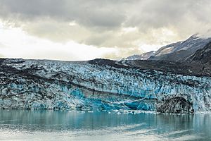
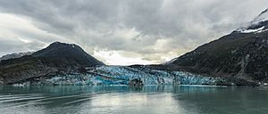
Lamplugh Glacier is a large river of ice found in Glacier Bay National Park and Preserve in Alaska, USA. It stretches about 8 miles (13 kilometers) long. This amazing glacier flows north towards Johns Hopkins Inlet.
It was named around 1912 by Lawrence Martin from the United States Geological Survey. He named it after George William Lamplugh, an English geologist. George Lamplugh visited Glacier Bay way back in 1884.
What is Lamplugh Glacier?
Lamplugh Glacier is a huge, slow-moving mass of ice. It is located in a beautiful national park in Alaska. Glaciers are formed over many years as snow piles up and turns into ice. They slowly flow downhill due to their own weight.
The "terminus" of a glacier is simply its end. For Lamplugh Glacier, its end point in 1961 was in Johns Hopkins Inlet. This area is about 1.4 miles (2.3 km) west of Ptarmigan Creek. It's also about 76 miles (122 km) northwest of a town called Hoonah.
A Big Landslide Event
On June 28, 2016, something incredible happened at Lamplugh Glacier. A large part of a nearby mountain collapsed! This caused a massive landslide.
The landslide sent a huge amount of rock and dirt onto the glacier. Imagine between 62 million and 79.8 million cubic meters of material falling! That's like 120 million tons of rock and debris. This event left a long trail of rocky mess, about 9 kilometers (5.6 miles) long, right on top of the glacier's icy surface.
See also
 In Spanish: Glaciar Lamplugh para niños


