Land o' Lakes, Wisconsin facts for kids
Quick facts for kids
Land o' Lakes, Wisconsin
|
|
|---|---|

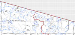
2010 Town of Land o' Lakes map
|
|
| Country | |
| State | |
| County | Vilas |
| Area | |
| • Total | 95.3 sq mi (246.8 km2) |
| • Land | 83.1 sq mi (215.2 km2) |
| • Water | 12.2 sq mi (31.7 km2) |
| Elevation | 1,755 ft (535 m) |
| Population
(2010)
|
|
| • Total | 861 |
| • Density | 10.6/sq mi (4.1/km2) |
| Time zone | UTC-6 (Central (CST)) |
| • Summer (DST) | UTC-5 (CDT) |
| Area code(s) | 715 & 534 |
| FIPS code | 55-42325 |
| GNIS feature ID | 1583525 |
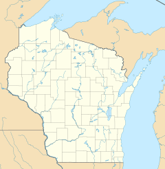
Land o' Lakes is a small town in Vilas County, Wisconsin, in the United States. In 2010, about 861 people lived there. The main part of the town is also called Land o' Lakes, which is a smaller community within the town.
Contents
History of Land o' Lakes
The town of Land o' Lakes was first created on January 4, 1907. Back then, it had a different name: the Town of State Line. On April 28, 1948, its name was officially changed to the Town of Land o' Lakes.
Geography and Location
The Town of Land o' Lakes is located in the northern part of Vilas County. It sits right along the border with the Upper Peninsula of Michigan.
Rivers and Lakes
This area is special because it's where some important rivers begin. A branch of the Ontonagon River starts here, flowing from the Cisco Chain of lakes. The upper part of the Wisconsin River also flows through the town. Its very beginning, called the headwaters, is just to the east at Lac Vieux Desert.
Area and Size
The town covers a total area of about 95.3 square miles (246.9 square kilometers). Most of this area, about 83.1 square miles (215.2 square kilometers), is land. The rest, about 12.2 square miles (31.7 square kilometers), is water, mostly lakes and rivers. The town is long and narrow. The main town center, where the government offices and most services are, is in the community also called Land o' Lakes. This community is located at the far eastern end of the town.
 |
Watersmeet Township |  |
||
| Town of Presque Isle | Town of Phelps | |||
| Town of Boulder Junction | Town of Plum Lake | Town of Conover |
Population and People
In 2010, the town had 861 people living in 433 households. About 264 of these households were families. The population density was about 10.6 people per square mile (4.1 people per square kilometer).
Diversity of Residents
Most of the people living in Land o' Lakes are White (98.41%). A smaller number of residents are Native American (0.68%) or Asian (0.34%). Some people are from other backgrounds or a mix of two or more races. About 0.45% of the population identified as Hispanic or Latino.
Age Groups
The ages of people in Land o' Lakes vary. About 13.5% of the population was under 18 years old. About 28.9% of the people were 65 years old or older. The average age in the town was 54 years.
Education in Land o' Lakes
Most students in Land o' Lakes attend schools in the Northland Pines School District.
Local Schools
- There is an elementary school in the community of Land o' Lakes. It serves students from kindergarten up to fifth grade.
- For middle school and high school, students usually travel to the nearby city of Eagle River, Wisconsin.
- Conserve School is a special private school for high school juniors. It focuses on learning about the environment and doing outdoor activities. This school is located on the shore of Black Oak Lake.
- Some students in the far southwestern parts of the town go to North Lakeland Elementary School and Lakeland Union High School.
Getting Around: Transportation
Land o' Lakes has several roads and an airport that help people travel.
Roads and Highways
The town is served by a few main roads:
- USH 45 runs north and south through the eastern part of the town. It goes north into Michigan and south towards Eagle River.
- STH 32 starts at the Michigan border and runs south, sharing the road with USH 45.
- Vilas County also has three main roads, called County Trunk Highways (CTH).
- CTH B runs across the town and is the main street in the community of Land o' Lakes. It connects to Presque Isle in the west.
- CTH B also meets CTH M, which leads to Boulder Junction.
- CTH S goes south from CTH B and serves areas around Clair and Joyce Lakes.
- CTH E goes east from USH45/STH 32 in the southeast corner of the town. It provides access to Lac Vieux Desert and Phelps.
- Thousand Island Lake Road is a local town road that leads to the Sylvania Wilderness area.
Airport Access
Land o' Lakes has its own airport called Kings Land o' Lakes Airport (KLNL). It's located in the southeast part of the town. The airport is mainly used for general aviation, like private planes, and some air taxi services. It has one asphalt runway that is 4,001 feet long.
Notable People
- Wendy Lansbach Boglioli, an Olympic gold medal swimmer, grew up in Land o' Lakes.
Climate
The climate in Land o' Lakes is described as a Humid Continental climate. This means it has warm summers and cold, snowy winters.
| Climate data for Land o' Lakes, Wisconsin | |||||||||||||
|---|---|---|---|---|---|---|---|---|---|---|---|---|---|
| Month | Jan | Feb | Mar | Apr | May | Jun | Jul | Aug | Sep | Oct | Nov | Dec | Year |
| Mean daily maximum °C (°F) | −7 (19) |
−7 (20) |
1 (34) |
9 (49) |
18 (64) |
24 (75) |
26 (78) |
23 (74) |
19 (67) |
12 (54) |
3 (37) |
−4 (25) |
10 (50) |
| Mean daily minimum °C (°F) | −20 (−4) |
−19 (−2) |
−13 (8) |
−4 (25) |
2 (36) |
8 (47) |
11 (51) |
9 (48) |
5 (41) |
1 (33) |
−7 (19) |
−14 (6) |
−3 (26) |
| Average precipitation mm (inches) | 36 (1.4) |
28 (1.1) |
48 (1.9) |
64 (2.5) |
89 (3.5) |
110 (4.2) |
110 (4.5) |
100 (4) |
94 (3.7) |
76 (3) |
56 (2.2) |
41 (1.6) |
850 (33.6) |
| Source: Weatherbase | |||||||||||||
See also
 In Spanish: Land O' Lakes (Wisconsin) para niños


