Lands of Threepwood facts for kids
Quick facts for kids Lands of Threepwood |
|
|---|---|
| Beith, North Ayrshire, Scotland UK |
|
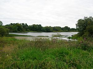
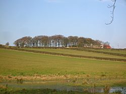
Cuffhill Reservoir from the site of the old Threepwood Bleach Works.
|
|
| Coordinates | 55°46′09″N 4°33′48″W / 55.76909°N 4.563425°W |
| Grid reference | NS 39287 55820 |
| Type | Laird's dwelling and estate |
| Site information | |
| Owner | Private |
| Controlled by | Montgomerie |
| Open to the public |
No |
| Condition | Incorporated into a farm |
| Site history | |
| Built | 18th century |
| Built by | Love family |
| Materials | Stone |
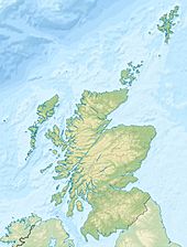
The Lands of Threepwood were an old estate in Beith, Scotland. They were located on the eastern border between East Renfrewshire and North Ayrshire. This area included small settlements like Midtown, Townhead, and Townend.
The highest point nearby is Cuffhill, which is 675 feet tall. It offers great views of the area. Today, Cuffhill Reservoir, a man-made lake, is also found here.
Contents
History of Threepwood Lands
The name 'Threepwood' might come from the Scots word 'Threap-wood'. This means a piece of woodland whose ownership was argued over. In Scottish history, 'Threaplands' also referred to disputed areas.
Who Owned Threepwood?
In the 12th century, Avice de Morville gave the lands of Threppe-wood to Kilwinning Abbey. Later, in 1556, Gavin Hamilton of Kilwinning Abbey leased the land to Adam Hamilton.
In 1557, Adam passed the lease to John Hamilton. John paid a lot for it, including money, oats, barley, oxen, and a horse! A few months later, John bought the land outright. This meant his family would own it forever for a yearly payment.
In 1574, John gave the land to his son, James. Then, in 1633, James Hamilton sold the lands to Robert Luiff, also known as Love.
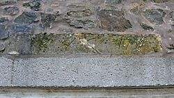
The Love family used to be called McKinnon. A stone from 1613 at Threepwood has the initials 'I.L. & B.S. 1613'. These likely stand for James Luiff and Barbara Stewart. The name Love comes from the French word 'Luef' or 'Lufe' in Scots, both meaning wolf.
Robert Love, possibly their son, sold parts of Threepwood. He sold Townend Farm to Thomas Fulton and Midtoun to William Anderson. His son, James Love, married Barbara Stewart in 1652. Another stone at Threepwood shows their initials 'J.L. & B.S. 1652'. James inherited the rest of Threepwood in 1649.
Later, Robert Love the younger inherited the land in 1693-94. He married Agnes Stevenston in 1690, and their marriage is also recorded on a stone. The Love family continued to own and pass down the Threepwood lands through generations.
John Love, born in 1781, became an important person. He was a Commissioner of Supply, a Justice of the Peace, and a Road Trustee. He bought more lands, including the 'Tower of Auchenbathie'. John married Jean Fulton. Their oldest son, Robert, became a writer and had a daughter named Mary.
Threepwood Estate
The Threepwood lands were part of the Barony of Beith. Old maps suggest the lands might have stretched to the Barrcraigs. The eastern border was with the Barony of Auchinbathie. To the west were the lands of Auchingown Stewart and Brownmuir. To the south-west was Hessilhead, and to the south, Shutterflat.
Old maps show different names for settlements in the area. Roy's map (1747-55) shows Townhead and Middletown, but not Threepwood itself. Armstrong's map (1775) marks Threepwood and two settlements. By 1832, Thomson's map shows a laird's (landowner's) house for Threepwood.
The three 'Towns' of Threepwood were likely 'ferm toun' settlements. These were small farm villages common in medieval times. They were based on a 'ploughgate' of land, which was about 104 acres. This was the amount of land a team of oxen could farm in a year. These settlements often had houses for several families.
Threepwood House
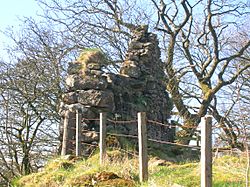
Threepwood House first appeared as a 'Laird's' house on maps in 1832. By 1858, it was a large group of buildings. It had a square garden with paths, surrounded by a walled area. An older house was changed into a farm with barns and other buildings. Many trees were planted around it.
Mid Town of Threepwood
William Anderson bought Mid Town Farm in the 1630s from Robert Love. In 1858, maps show one building with a roof and a ruin next to the lane leading to Threepwood House. By 1895, Mid Town was completely in ruins.
Town Head of Threepwood
In 1858, Town Head was a single building. By 1895, it had no roof. However, a new house has been built on the site in recent times.
Townend of Threepwood
Thomas Fulton bought Townend Farm from Robert Love in the 1630s. Hugh Stevenson was a farmer here in the early 1800s. After he died, his sons took over. Later, the land was divided and sold.
John Shedden, known as "The Lang Laird" because he was very tall, married Mary Stevenson from Townend of Threepwood. They had five daughters and one son, John, who was called "Jack the Marshalland".
- Jack the Marshalland
John Shedden was born in 1756. He was a strong, tall man. He was known for hunting hares, which was against the rules at the time. After some trouble, Jack moved to England. He worked as a head gamekeeper, which meant he looked after wild animals on a large estate. He earned good money and saved a lot.
When he returned, he was jokingly called "The Gem keeper" because of his new job. When he died, his friend fired a gun over his grave. This surprised the local minister!
- Uses of Townend
In 1858, maps show several buildings at Townend. Some were in use, others were ruins. The road here was wider, and there was a small building with a well. This area was busy with horse-drawn carts and people walking. The buildings might have offered a place to stay for travelers or workers from the bleach works.
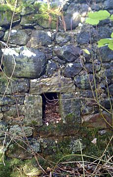
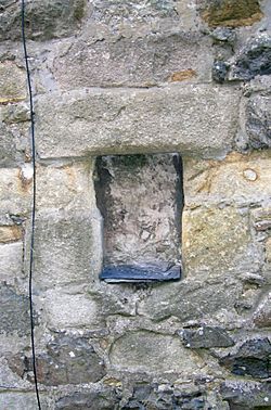
An unusual 'window' at the back of one building looks like a 'Jug' hatch. These were found in old pubs. People could get a jug or bottle of beer filled and take it away. A poem about 'The Den' at Barkip mentions this:
|
The narrow area by the road with a well suggests it was a stop for horses to get water and food.
Threepwood Bleach Works
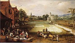
Long ago, cotton or linen cloth was bleached using a long process. First, it was soaked in a solution called 'lye', made from ash tree or fern ashes. This was called 'bucking'. Then, the cloth was washed and laid out in sunny fields, called 'bleachfields' or 'crofts', to dry.
After that, it was soaked in buttermilk, called ‘souring’. Finally, it was washed again and dried. This whole process took a very long time, sometimes up to eight months!
Two separate bleach works are shown on old maps. There were large open areas for the bleachfields. Plenty of water was available from the Cadgerford Burn and the Dusk Water. Ash trees were common, so there was a good supply of ashes for the lye.
In 1828, 'Bleachfield' is recorded with two buildings. The largest bleach works was next to a millpond. This pond supplied water for both the bleaching process and to power a waterwheel. Dye works buildings were also nearby. By 1895, both bleach works and the dye house were ruins. This happened because Chlorine was discovered in the late 1700s. Chlorine made bleaching much faster and cheaper, so the old bleach works were no longer needed.
Around 1855-57, records show the works bleached linen thread. They used water power and provided homes for workers. Mr. John Stevenson was in charge, and the Love family owned the property.
Lows Cottage, near Coldhame, was a 'retting' works. Retting is a process to prepare flax. It was next to one of the Lowes Lochs, which was used for retting. These industrial activities along Threepwood Road might have been connected businesses. Flax was used to make linen thread by the Crawford Brothers in Beith and Barrmill.
Sunnyside of Threepwood
Between the two bleach works, a building with a fancy walled garden is shown in 1858. This was probably the home of the works manager. It has two stones with dates: 1790 and 1759. The 1790 stone has the initials 'I(J)R and JC'. The older stone is hard to read.
This building was relatively small and had access from Threepwood Road. In 1858, it didn't have a name on the map. By 1895, it was called Sunnyside of Threepwood and had grown much larger. The fancy garden was gone. The name 'Sunnyside' might have been used because this was a sunny, south-facing spot. It was likely where the bleached cloth was dried in the old bleachfield.
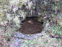
The Weaver's or Threepwood Well
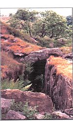
Near Coldhame Cottage, you can find a rare old spring called the Weaver's or Threepwood Well. Fresh water flows steadily from the rock into a shallow, stone-bordered area. It's surrounded by plants like heather, ferns, and wild roses.
This well was once the site of the 'Weaver's Parliament'. Local weavers would meet here to talk about their work and other important things. Flax mills were nearby, and weavers made linen that was then bleached at Sunnyside of Threepwood. The well is on Threepwood Road, which was a route to Paisley. Weavers sold most of their finished products there.
Cuffhill Reservoir
The 'Lower Reservoir' first appears on the 1895 map. It was managed by the Beith Water Committee. By 1908, the reservoir, its dam, and sluice were managed by Ayr County Council.
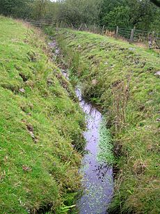
The Cadgerford Burn
The name of the burn, Cadgerford, tells us about an old ford on this road. 'Cadgers' were people who carried goods on horseback. They might have carried things like Dunlop cheeses. This burn flows from Lowes Loch to the Dusk Water.
Today, the burn flows into Kirkleegreen Reservoir, built between 1858 and 1891. The water from this old reservoir, now a fishing loch, goes into Cuffhill Reservoir and then into the Dusk Water. The ford might have been where a pipe now carries water from a small loch near Lows Cottage.
Beith used to have an annual fair called Tennant's or Saint Tinnan's Day. It was held on Cuff Hill. It was famous for its show and a parade and sale of horses by the 'Cadgers'.
Archaeology
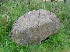
The Cuff Hill rocking stone is a very large boulder. Some people think it's connected to the Druids, who were ancient Celtic priests. It used to rock, but it doesn't anymore because people dug under it. It's in a small wood and surrounded by a circular stone wall.
On Cuff Hill, there were once four standing stones. Also, the 'Druid's Grave' and the likely site of an old chapel at Kirklee Green were located here.
In the late 1600s, Hugh Stevenson was plowing in Barn-fauld. His plow hit some loose stones, and a large pot with bones was found. Inside the pot was a smaller object, described as a small 'incense-cup' urn.
Smith records a 'Law Mound' at Threepwood, about twelve paces wide. However, this place name is not on maps and locals don't seem to know it.
An arrowhead, a bone comb, and a stone tool were found near Sunnyside of Threepwood.
Finkillgreen, on the Threepwood lands, is a rocky hill covered in grass. A rocking-stone was once here. In the 1860s, this stone could be easily rocked with one hand.
The Roads
Threepwood Road was a 'Statute Labour Road'. This meant that in 1669, people living nearby had to do unpaid work to maintain it. There were fines if they didn't show up. Landowners also had to provide money for repairs, and tolls were collected.
A 'Parish' road was built in 1810. Stones from the Druids Graves cairn were used to build it. In 1767, a committee looked at the road from Beith to Coldstreem Bridge. They decided it wasn't good enough to improve. Instead, they built a new, easier, and shorter road. The old road went over the hill, past Threepwood.
Interesting Facts
- A New Zealand flatworm (Arthurdendyus triangulatus) was found near Sunnyside of Threepwood in 2014. This worm is not from Scotland. It eats earthworms and was once seen as a possible threat to local earthworm populations.
- Bleachfield Grangehill was a small house next to an old bleachfield.
- The flax mill near Brownsmuir was still working between 1855 and 1857.
 | Janet Taylor Pickett |
 | Synthia Saint James |
 | Howardena Pindell |
 | Faith Ringgold |


