East Renfrewshire facts for kids
Quick facts for kids
East Renfrewshire
Aest Renfrewshire Siorrachd Rinn Friù an Ear |
||
|---|---|---|
 |
||
|
||
| Sovereign state | United Kingdom | |
| Country | Scotland | |
| Lieutenancy area | Renfrewshire | |
| Admin HQ | Giffnock | |
| Government | ||
| • Body | East Renfrewshire Council | |
| Area | ||
| • Total | 67.3 sq mi (174.2 km2) | |
| Area rank | Ranked 28th | |
| Population | ||
| • Total | 95,170 | |
| • Rank | Ranked 23rd | |
| • Density | 1,415.0/sq mi (546.33/km2) | |
| ONS code | S12000011 | |
| ISO 3166 code | GB-ERW | |
East Renfrewshire is one of 32 special areas in Scotland that has its own local government. It was created in 1996. Before that, it was part of the Eastwood district.
This area is close to Glasgow, especially its northeastern part. Many towns in the north of East Renfrewshire are part of the larger Greater Glasgow city area.
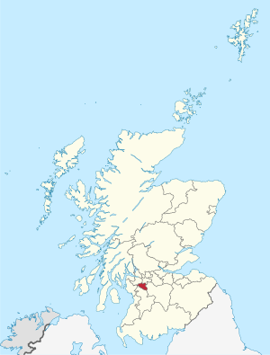
East Renfrewshire shares borders with several other areas. To the northeast, it borders Glasgow City council area. To the southeast, it borders South Lanarkshire. East Ayrshire is to the southwest, and North Ayrshire is to the west. Finally, Renfrewshire is to the northwest.
Before 1975, this area was part of the historic county of Renfrewshire. Today, East Renfrewshire, Renfrewshire, and Inverclyde still form one combined area for certain official purposes.
Contents
History of East Renfrewshire
East Renfrewshire was officially formed in 1996. This happened when Scotland changed how its local governments worked. The new system created single "council areas" like East Renfrewshire. These areas handle all local services.
The new East Renfrewshire area included all of the old Eastwood district. It also took a part of the former Renfrew district. This part included the town of Barrhead and the village of Neilston.
The name "East Renfrewshire" shows its place within the historic county of Renfrewshire. That older county was replaced in 1975.
Early History and Industry
People have lived in the area now known as East Renfrewshire for a very long time. There are signs of Iron Age hill forts at Dunwan Hill and Duncarnock. These forts were used between about 1200 BC and 400 AD.
During the Industrial Revolution, the Levern valley became important for making textiles. Many mills were built in Neilston and Barrhead.
Giffnock grew because of the Giffnock Quarries, which opened in 1835. The special honey-colored stone from these quarries was used in famous buildings. Examples include Glasgow University and Glasgow Central station. As railways grew in the mid-1800s, areas near Glasgow became more like suburbs.
Notable Events in East Renfrewshire
In 1941, a German official landed by parachute near Waterfoot. He was on a secret mission but was captured.
In 1971, a gas explosion happened in Clarkston. Sadly, 22 people lost their lives, and over 100 were injured.
In 2007, a survey found that East Renfrewshire was the second-best place in Britain to raise a family. It was just behind East Dunbartonshire.
In 2008, East Renfrewshire became the first local authority in Scotland to use Facebook. They used it to share information about their services.
Geography and Landscape
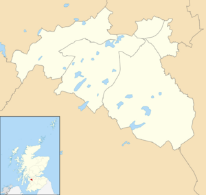
East Renfrewshire is located south and southwest of Glasgow. Many of its towns are considered part of the larger Glasgow urban area. The biggest towns are Newton Mearns, Barrhead, Giffnock, and Clarkston.
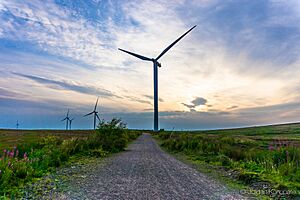
Away from the city, the area becomes more rural. You can find moorland and many small lochs (lakes). Many of these lochs are now used as reservoirs. Part of the large Whitelee Wind Farm is also located on the moors here.
A survey in 2011 showed that 41% of Scotland's Jewish population lived in East Renfrewshire. This made up 2.4% of the area's total population.
Community Areas
East Renfrewshire is divided into eleven community council areas. Each of these areas has its own community council:
Main Towns and Villages
Here are the largest towns and villages in East Renfrewshire by population:
| Settlement | Population (2020) |
|---|---|
| Newton Mearns | 28210 |
| Barrhead | 17890 |
| Giffnock | 12250 |
| Clarkston | 9800 |
| Neilston | 5170 |
| Netherlee | 4530 |
| Thornliebank | 4170 |
| Stamperland | 3630 |
| Eaglesham | 3470 |
| Busby | 3310 |
Economy and Local Media
East Renfrewshire has many small and medium-sized businesses. The East Renfrewshire Chamber of Commerce helps these businesses.
The local newspapers keep residents informed. The Barrhead News covers the western part of the area. This includes Barrhead, Neilston, and Uplawmoor. The Glasgow South and Eastwood Extra is a free newspaper. It focuses on the eastern half but also covers news from the west and south Glasgow.
How East Renfrewshire is Governed
| East Renfrewshire | |
|---|---|
 |
|
| Leadership | |
|
Owen O'Donnell,
Labour Since 25 May 2022 |
|
|
Steven Quinn
Since July 2023 |
|
| Structure | |
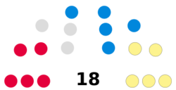
| Seats | 18 councillors |
 |
|
|
Political groups
|
Administration (8)
Other parties(14)
|
| Elections | |
| Single transferable vote | |
|
Last election
|
5 May 2022 |
|
Next election
|
6 May 2027 |
| Meeting place | |
| Eastwood Park, Rouken Glen Road, Giffnock, G46 6UG | |
East Renfrewshire is run by the East Renfrewshire Council. This council is made up of elected members called councillors. They make decisions about local services.
Council Leadership
The leader of the council is the main person in charge. Here are the leaders since 1996:
| Councillor | Party | From | To | |
|---|---|---|---|---|
| Owen Taylor | Labour | 1 Apr 1996 | Dec 2004 | |
| Jim Fletcher | Labour | 2005 | May 2017 | |
| Tony Buchanan | SNP | 24 May 2017 | May 2022 | |
| Owen O'Donnell | Labour | 25 May 2022 | ||
Council Buildings
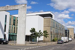
The main office for the council is at Eastwood Park in Giffnock. This building was finished in 1980.
The council also has an office and customer service center in Barrhead. This building opened in 2003.
Council Elections
Elections for the council happen every five years. People vote using a system called "single transferable vote." This system helps make sure votes are counted fairly.
Here's a summary of how many councillors each main party has had:
| Year | Seats | SNP | Conservative | Labour | Liberal Democrats | Independent / Other | Notes |
|---|---|---|---|---|---|---|---|
| 1995 | 20 | 0 | 9 | 8 | 2 | 1 | Labour and Liberal Democrats worked together. |
| 1999 | 20 | 0 | 8 | 9 | 2 | 1 | New voting areas were created. |
| 2003 | 20 | 0 | 7 | 8 | 3 | 2 | |
| 2007 | 20 | 3 | 7 | 7 | 1 | 2 | New voting areas were created. |
| 2012 | 20 | 4 | 6 | 8 | 0 | 2 | Labour, Independent, and SNP worked together. |
| 2017 | 18 | 5 | 7 | 4 | 0 | 2 | New voting areas and fewer seats. SNP, Labour, and Independent worked together. |
| 2022 | 18 | 6 | 5 | 5 | 0 | 2 | Labour and Independent formed a minority government. |
Voting Wards
For the 2007 election, East Renfrewshire was divided into six "wards." These wards had 20 seats in total. In 2017, the number of seats changed to 18 across five new wards.
Here are the wards and how many councillors each elects:
See also
 In Spanish: East Renfrewshire para niños
 | James B. Knighten |
 | Azellia White |
 | Willa Brown |


