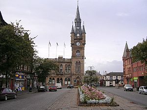
Renfrewshire (historic) facts for kids
| Renfrewshire | |
| Motto: Avito viret honore ('Flourishing through ancestral honour') |
|
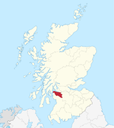 Renfrewshire within Scotland |
|
| Geography | |
| Status | Local government county (until 1975) Lieutenancy area (1794-present) Land registration county (1996-present) |
| 1975 area | 245 sq. miles (634 sq. km) (27th) |
| HQ | Renfrew (county town) Paisley (County Council headquarters) |
| Chapman code | RFW |
| History | |
| Origin | Lordship of Strathgryfe |
| Succeeded by | Strathclyde Region |
Quick facts for kids Demography |
|
|---|---|
| 2014 est population | 346,470 |
| 1981 est population | 366,509 |
| Politics | |
| Governance | County: Renfrewshire County Council (1890-1975) District: Eastwood District Council, Renfrew District Council, Inverclyde District Council (1975-1996) Modern: East Renfrewshire Council, Inverclyde Council, Renfrewshire Council (1996-present) Lieutenancy: Lord Lieutenant of Renfrewshire (1794-present) |
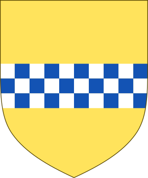
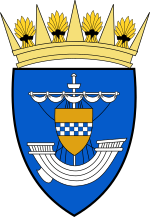 Coat of arms of the county council |
|
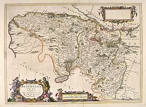
Renfrewshire, also known as the County of Renfrew, is a historic area in the west of Scotland. It's a place with a long history, important for land records, and has a special role for royal events. Today, the area that was once Renfrewshire is split into three modern council areas: Inverclyde, Renfrewshire, and East Renfrewshire. Sometimes, people call this larger area Greater Renfrewshire to avoid confusion with the modern Renfrewshire council area.
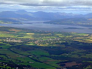
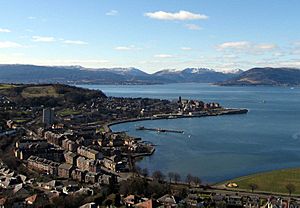
This historic county shares borders with Glasgow and Lanarkshire to the east. To the south and west, it meets Ayrshire. Its northern edge is the Firth of Clyde, a large sea inlet. Across the Firth, you can see Dunbartonshire and Argyll.
Renfrewshire's story began with ancient British and Roman settlements. It grew from the lands of Strathgryfe, given to Walter FitzAlan, Scotland's first High Steward. Renfrewshire became its own shire (like a county) in the early 1400s. Before that, it was part of Lanarkshire. The county got its name from its main town, Renfrew.
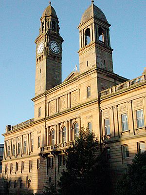
During the Industrial Revolution, many towns here became busy centers for making things. They were famous for cotton, calico, and silk, continuing a long tradition of weaving. Other industries like shipbuilding and distilleries also thrived. Paisley grew to be the biggest town and business hub. The Renfrewshire County Council managed the area from 1890 to 1975, with its main office in Paisley.
Over time, parts of the county, like Pollokshaws and Nitshill, became part of Glasgow as the city expanded. In 1975, Renfrewshire stopped being a local government county. It was replaced by a larger region called Strathclyde and three smaller districts. These districts were then replaced in 1996 by the three council areas we know today: Renfrewshire, East Renfrewshire, and Inverclyde.
Contents
A Journey Through Time
What's in a Name?
The name Renfrewshire comes from its main town, Renfrew. This name has been around since the Romans were in Britain! It likely comes from an old language, meaning "a point of land near flowing water." This makes sense, as Renfrew is located where the Cart and Clyde rivers meet.
Ancient Roots
The oldest signs of people living here are from the Iron Age, with traces of a fort near Busby. When the Romans arrived around 80 AD, the area was home to the Damnonii tribe.
The main Roman base was near what is now Paisley. After the Romans left in 410 AD, the local Britons kept control of the area. This became part of the Kingdom of Strathclyde. Later, this kingdom joined the Kingdom of Alba, which grew into Scotland.
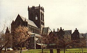
In the 1100s, a nobleman named Walter FitzAlan came to Scotland from England. He became the first High Steward of Scotland. King David I gave him the lands of Strathgryfe, which later formed the county. In 1163, Walter founded a monastery in Paisley, which grew into Paisley Abbey.
Many people believe that Sir William Wallace, a famous Scottish knight and leader, was born in 1272 in Elderslie, within this county.
How the County Began
Walter FitzAlan's family eventually became the powerful House of Stuart (or Stewart), who would rule Scotland. The Stewarts controlled the area that became Renfrewshire as a barony, which was part of Lanarkshire.
In 1371, Robert Stewart became King Robert II of Scotland. Sometime between 1404 and 1414, the barony of Renfrew got its own sheriff, making it separate from Lanarkshire. The new shire was named after the town of Renfrew, where the Stewarts had their castle. Because of this, the county has always been linked to the Scottish monarchy. Even today, the heir to the British throne holds the title of Baron of Renfrew.
Recent History
Renfrewshire played a big part in the Radical War of 1820. Many local factory workers took part in protests and strikes.
During the Second World War, Renfrewshire faced heavy bombing because of its shipbuilding industries along the River Clyde. A major bombing raid happened in May 1941, known as the Greenock Blitz. Also in May 1941, Rudolf Hess, a high-ranking official from Nazi Germany, parachuted into a field near Eaglesham. He hoped to meet a Scottish duke for peace talks but was arrested.
In 1975, the county stopped being used for local government. It became part of the Strathclyde region and was divided into three districts. Then, in 1996, these districts were replaced by the three modern council areas: East Renfrewshire, Inverclyde, and Renfrewshire.
How Renfrewshire is Governed Today
Past Local Government
Historically, areas in Scotland were managed by a sheriff. From 1667, local government outside the main towns was run by Commissioners of Supply, who collected taxes. In 1794, the first Lord Lieutenant of Renfrewshire was appointed. This person represents the monarch in the county.
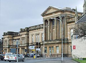
The county's main meetings used to be in Renfrew. But the sheriff court moved to Paisley in 1705. By the late 1800s, meetings happened in both towns.
In 1890, elected county councils were set up. Renfrewshire County Council held its first meeting in Paisley. At first, large towns like Greenock, Paisley, and Port Glasgow managed their own affairs. But after 1930, they came under the county council's control. Also, parts of eastern Renfrewshire, like Cathcart and Yoker, became part of Glasgow as the city grew.
In 1975, Renfrewshire was absorbed into the Strathclyde region and divided into three districts: Renfrew District, Eastwood District, and Inverclyde District. In 1996, these districts became the current single council areas: Renfrewshire, Inverclyde, and East Renfrewshire.
Modern Roles
Lieutenancy
Even though Renfrewshire is no longer a local government area, it's still used for special ceremonies. A Lord Lieutenant and their deputies represent the King or Queen. They handle royal visits and other important events. The current Lord Lieutenant of Renfrewshire is Colonel Peter McCarthy.
Land Registration
The County of Renfrew is also a "registration county." This means it's used for keeping land records, like who owns what property. This system started in 1981.
Working Together
The three modern councils in the area often work together. For example, they cooperate on valuing properties for council tax. They also work together on voter registration. There's even a Renfrewshire Education Trust that gives grants for education.
Central government groups, like Scottish Enterprise Renfrewshire, also use the historic county boundaries. This group helps businesses and economic growth in the area. Renfrewshire was also a postal county, used by Royal Mail until 1996.
Political Representation
After Scotland and England joined to form Great Britain in 1707, Renfrewshire had its own representative in the UK Parliament. Over time, the way the area was divided for elections changed.
Today, the three local council areas in Renfrewshire have their own Members of Parliament (MPs). East Renfrewshire and Inverclyde each have one MP. The Renfrewshire council area is divided into two parts, Paisley and Renfrewshire North and Paisley and Renfrewshire South, each with its own MP.
Geography and Landscape
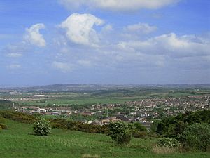
Renfrewshire's landscape has three main types: hilly, gently rising, and flat. The hilliest parts are in the south and west, especially in the Renfrewshire Hills, with large areas of open moorland.
The land slopes down towards the River Clyde. Rivers like the River Cart and the River Gryffe flow through the area, draining into the Clyde.
In the west, you'll find small lochs (lakes) like Loch Thom and Gryfe Reservoir. In the south, there are Barr Loch and Castle Semple Loch. The Dams to Darnley Country Park in the south-east has several artificial lakes.
The northern and eastern parts of the county are very urban, being part of the larger Glasgow city area. The rocks in Renfrewshire show that the area was once very volcanic.
Economy and Industries
Textile History
Renfrewshire was known for its many different industries. Weaving was very common, and Paisley became famous for it. The unique Paisley pattern is still a symbol of the area's weaving past.
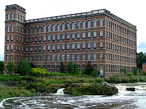
Before the 1800s, weaving was mostly done at home. But the Industrial Revolution brought large mills, especially in Paisley. In the 1930s, about 28,000 people worked in the Coats mills there.
Trade and Shipbuilding
Greenock's location on the coast made it an early center for international trade. Shipbuilding on the River Clyde became very important in the late 1800s, especially in Renfrew and Port Glasgow. Today, only Ferguson Marine Engineering in Port Glasgow continues this tradition.
Many of the county's old industries, like sugar refining and rope-making, relied on exports. Greenock and Port Glasgow were key centers for business. Greenock's Ocean Terminal docks are still busy with shipping today.
Modern Industries
In the second half of the 1900s, many traditional industries declined. Today, many towns in central and eastern Renfrewshire are "commuter towns." This means people live there but travel to work in the Greater Glasgow area.
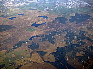
All three local councils in the county are part of the Glasgow City Region City Deal. This is an investment plan to boost economic growth. In the south-east, on Eaglesham Moor, you'll find Whitelee Wind Farm, the largest onshore wind farm in the UK.
Culture and Symbols
County Symbols
The coat of arms for Renfrewshire was given to the county council in 1899. It features a ship, taken from the arms of the town of Renfrew, which was once an important port. The shield also shows the arms of the Royal House of Stewart, reminding us that the county is known as the "cradle of the Stewart Kings."
Another symbol is the Prince of Wales's feathers badge. This shows the connection of the heir to the throne, who is also the Baron of Renfrew. This badge was used by local army groups and police in the past.
The Paisley pattern is used as the logo for Renfrewshire Council. Ships are also common in the symbols of towns and councils in the area, highlighting their link to the River Clyde.
In 2002, a charity named Plantlife held a competition to find county flowers. Renfrewshire's unofficial flower is the Bogbean. There is also a special Renfrewshire tartan for anyone connected to the county.
Sports in Renfrewshire
Renfrewshire has two professional football teams: St Mirren F.C. from Paisley and Greenock Morton F.C.. They often play against each other in the "Renfrewshire derby" and compete for the Renfrewshire Cup.
There are also several rugby union clubs, like Paisley RFC. Cricket clubs, such as Ferguslie CC in Paisley and Greenock CC, play in the Western Division Cricket Union. The Paisley Pirates ice hockey team plays at Braehead Arena.
Renfrewshire is home to five King George's Fields. These are protected green spaces for sports and recreation, honoring King George V.
Getting Around Renfrewshire
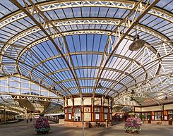
The Inverclyde Line connects Greenock to Glasgow by train. Other train lines link different parts of Renfrewshire to Glasgow.
Ferries connect Gourock to places like Kilcreggan and Dunoon. From Wemyss Bay, you can catch a ferry to Rothesay on the Isle of Bute.
Glasgow Airport is located just north of Paisley. It offers flights to many places both in the UK and around the world.
Famous People from Renfrewshire
Many notable people have come from this area:
- Sir William Arrol - a famous engineer.
- John Galt - a novelist.
- David Stow - an educationalist.
- King Robert II of Scotland - the first king from the Scottish and British royal House of Stewart.
- Robert Tannahill - a poet from Paisley.
- Sir William Wallace - a military leader, believed to be from Elderslie.
- James Watt - an engineer and pioneer of the steam engine, from Greenock.
- Alexander Wilson - a poet and naturalist.
- John Witherspoon - a clergyman and one of the Founding Fathers of the United States.
- John Maclean - a Scottish socialist, born in Pollokshaws.
Towns and Villages
Historically, the main towns in Renfrewshire were Paisley and Greenock. Paisley is still the largest town, and Greenock is the second largest.
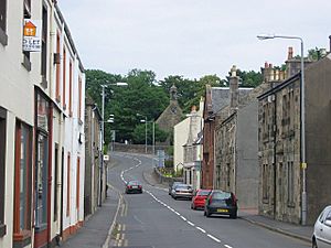
Renfrew was the only town with "royal burgh" status. Other important towns like Paisley, Greenock, and Port Glasgow were "parliamentary burghs." Towns like Barrhead, Gourock, and Johnstone were "police burghs" because they had larger populations, giving them more local control. The county also has many significant villages, such as Kilmacolm and Lochwinnoch.
Today, these old administrative divisions are gone. The three modern councils – Inverclyde, Renfrewshire, and East Renfrewshire – handle all local government. Many towns and villages still have "community councils" that represent local interests, but they don't have official powers.
List of Settlements
Here are some of the places that were part of historic Renfrewshire:
- Glasgow (parts of it were once in Renfrewshire)
- Cardonald
- Cathcart
- Crookston
- Darnley
- Hillington
- Jordanhill
- Nitshill
- Pollok
- Pollokshaws
- Scotstoun
- Yoker
- East Renfrewshire
- Barrhead
- Busby
- Clarkston
- Eaglesham
- Giffnock
- Newton Mearns
- Neilston
- Renfrewshire
- Inverclyde
- Greenock
- Gourock
- Inverkip
- Kilmacolm
- Port Glasgow
- Wemyss Bay
|
See also
- Lord Lieutenant of Renfrewshire
 | Delilah Pierce |
 | Gordon Parks |
 | Augusta Savage |
 | Charles Ethan Porter |


