
Dunbartonshire facts for kids
Quick facts for kids
Dumbarton
Siorrachd Dhùn Breatann
|
|
|---|---|
 |
|
| Country | Scotland |
| County town | Dumbarton |
| Area | |
| • Total | 241 sq mi (624 km2) |
| Ranked 29th of 34 | |
| Chapman code |
DNB
|
Dunbartonshire (which is Siorrachd Dhùn Breatann in Scottish Gaelic) is also known as the County of Dumbarton. It is a historic county in the west of Scotland. It lies north of the River Clyde. Dunbartonshire borders Perthshire to the north, Stirlingshire to the east, Lanarkshire and Renfrewshire to the south, and Argyllshire to the west.
This historic county was once a large area. It was similar to the old earldom and later duchy of Lennox. Today, its name is used for two of Scotland's modern council areas. These are East Dunbartonshire and West Dunbartonshire.
Contents
Understanding the Name Dunbartonshire

The town of Dumbarton gets its name from the Scottish Gaelic words Dùn Breatainn. This means "fort of the Britons". For a long time, the spelling of the town and the county was not fixed.
By the 1700s, people used "County of Dunbarton" and "County of Dumbarton" equally. The "n" in "Dunbarton" comes from the Gaelic word Dùn for "fort". The "m" in "Dumbarton" happened because of how people said the word. The "n" sound changed to an "m" sound next to the "b" sound.
Different groups used different spellings. For example, the police force formed in 1857 was called the Dunbarton County Constabulary.
When elected county councils started in 1890, the law called the area the "County of Dumbarton". However, the county council decided to use "Dunbarton" for its official seal. They felt this spelling was closer to the original Gaelic meaning. Some people disagreed, saying "Dumbarton" was more common. The town of Dumbarton kept using the "m" spelling. The spelling "Dunbarton" for the county became official by law in 1947.
A Look at Dunbartonshire's History

Dunbartonshire became a shire (an area managed by a sheriff) by the late 1100s. It was first similar in size to the earldom of Lennox. This area covered land north of the River Clyde and around Loch Lomond.
Over time, the boundaries changed a few times. For example, in the 1200s, some areas were moved to and from Stirlingshire. This included the parishes of Kirkintilloch and Cumbernauld. These changes were sometimes reversed, making the county's shape a bit complicated.
County Councils and New Buildings
In 1890, elected county councils were created. These councils took over most of the local government jobs. The town of Dumbarton managed its own affairs. However, the county council still chose to have its main office there.
The first county council meeting was held on May 22, 1890. It took place at the County Buildings in Dumbarton. In 1891, the parish of New Kilpatrick was fully brought into Dunbartonshire. Before this, it was split between Dunbartonshire and Stirlingshire.
.jpg)
In 1930, the town of Dumbarton became part of the county council's area. The council stayed at the old county buildings until 1965. Then, they moved to new County Buildings on Garshake Road in Dumbarton. Queen Elizabeth II and the Duke of Edinburgh officially opened the new building on June 28, 1965.
Modern Changes
Dunbartonshire stopped being a local government area in 1975. It became part of the larger Strathclyde Region. Strathclyde was then split into nineteen smaller areas called districts. Dunbartonshire was divided among five of these districts.
In 1996, local government in Scotland changed again. The regions and districts were replaced by new council areas. Today, the area that was once Dunbartonshire is split among four council areas:
- East Dunbartonshire Council, based in Kirkintilloch.
- West Dunbartonshire Council, based in Dumbarton.
- Argyll and Bute Council, which includes the Helensburgh and Lomond part.
- North Lanarkshire, which includes the Cumbernauld area.
Even though the local government changed, the historic boundaries of Dunbartonshire are still used for things like land registration.
Exploring Dunbartonshire's Geography

The northern part of Dunbartonshire is not very crowded. It is mostly covered by the beautiful Loch Lomond. This large loch is shared with Stirlingshire and is now part of Loch Lomond and The Trossachs National Park. Many islands are found in the loch, such as Inchcailloch, Inchmurrin, and Inchconnachan.
You can also find smaller lochs here, like Geal Loch and Loch Sloy. This area is home to Ben Vorlich, the highest point in Dunbartonshire. It stands tall at 943 meters (3,094 feet).

South-western Dunbartonshire has a long coastline along Loch Long. This leads to the Rosneath peninsula, which is separated by Gare Loch. Both of these lochs connect to the Firth of Clyde, which forms the southern border. The area east of the River Leven has the Kilpatrick Hills. These hills also have small lochs and reservoirs. In the far south-east, the county includes part of the large Greater Glasgow city area.

The Cumbernauld exclave, a separate part of the county, is mostly flat. It is also very built-up with towns and buildings.
The Cumbernauld Exclave
Dunbartonshire has a unique feature: a large separate piece of land called an exclave. This area is about 5 miles (8 km) east of the main part of the county. It includes the parishes of Kirkintilloch and Cumbernauld. This exclave is surrounded by Stirlingshire and Lanarkshire.
This area was originally part of Stirlingshire. However, it was moved to Dunbartonshire a long time ago. This happened at the request of the landowner, who was also the Sheriff of Dumbarton.
Over the years, laws were made to decide how to manage this separate part. For example, in 1878, for road management, Cumbernauld and Kirkintilloch came under Stirlingshire's control. However, a law in 1889 made sure that these parishes would stay part of Dunbartonshire for most purposes. Dunbartonshire County Council had to pay Stirlingshire for the road costs.
Getting Around: Transport in Dunbartonshire

The West Highland Line train route goes through the county. It connects Glasgow to Oban and Fort William. This line is very popular with tourists because it offers amazing views of the Highlands.
The North Clyde line serves the towns in the Vale of Leven. Many local train lines also serve the parts of Dunbartonshire that are part of the Glasgow city area. Two train lines run through the Cumbernauld exclave. These connect it to Glasgow and Falkirk.
Various ferries cross Loch Lomond, linking towns along its shores. A ferry also connects the Rosneath peninsula from Kilcreggan to Gourock in Renfrewshire.
Towns and Villages
Towns
- Alexandria
- Balloch
- Dumbarton
- Helensburgh
- Clydebank
-
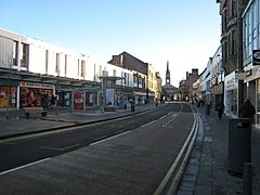
Colquhoun Square, Helensburgh
-
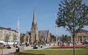
Dumbarton town centre


Villages and Hamlets
- Aldochlay
- Ardlui
- Ardpeaton
- Arrochar
- Auchenvennel
- Bellsmyre
- Blairglas
- Blairvadach
- Bonhill
- Bowling
- Caldarvan
- Cardross
- Clynder
- Cove
- Craigendoran
- Croftamie
- Dalreoch
- Dumfin
- Edentaggart
- Garelochhead
- Gartocharn
- Hardgate
- Inverbeg
- Inveruglas
- Jamestown
- Kilcreggan
- Luss
- Milton
- Old Kilpatrick
- Portincaple
- Portkil
- Rahane
- Renton
- Rhu
- Rosneath
- Shandon
- Shantron
- Stuckgowan
- Tarbet
-
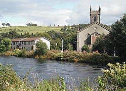
Bonhill
-
Kilcreggan
-
Luss
-
Rhu


Part of the Glasgow Area
- Bearsden
- Blairdardie
- Clydebank
- Dalmuir
- Drumchapel
- Drumry
- Duntocher
- Faifley
- Kilpatrick
- Knightswood
- Linnvale
- Milngavie
- Netherton
- Old Drumchapel
- Temple
- Whitecrook
-
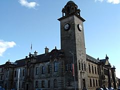
Clydebank Town Hall
-
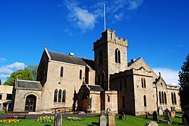
New Kilpatrick Parish Church, Bearsden


Cumbernauld Exclave Settlements
- Abronhill
- Auchinstarry
- Balloch
- Blackwood
- Carbrain
- Craigmarloch
- Croy
- Cumbernauld
- Dullatur
- Greenfaulds
- Kildrum
- Kirkintilloch
- Lenzie
- Lenziemill
- Merkland
- Seafar
- Smithstone
- Twechar
-
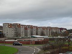
Carbrain
-
Cumbernauld
-
Kirkintilloch


Civil Parishes

- Arrochar
- Bonhill
- Cardross
- Craigrownie
- Cumbernauld
- Dalreoch
- Dumbarton
- Kilmaronock
- Kirkintilloch
- Luss
- New Kilpatrick
- Old Kilpatrick
- Renton
- Rhu
- Rosneath
- Rossdhu
Military Connections
During the time when the Volunteer Force was growing, the military presence in Dunbartonshire increased a lot.
