
Abronhill facts for kids
Quick facts for kids Abronhill
|
|
|---|---|
.jpg) Abronhill and Whitelees in Cumbernauld |
|

Abronhill
|
|
| OS grid reference | NS785762 |
| Council area | |
| Lieutenancy area | |
| Country | Scotland |
| Sovereign state | United Kingdom |
| Post town | GLASGOW |
| Postcode district | G67 |
| Dialling code | 01236 |
| Police | Strathclyde |
| Fire | Strathclyde |
| Ambulance | Scottish |
| EU Parliament | Scotland |
| UK Parliament |
|
| Scottish Parliament |
|
Abronhill is an area located in the north-east of Cumbernauld, North Lanarkshire, Scotland. It stretches about 1 to 2 kilometers from the main Cumbernauld Town Centre. Abronhill was designed with its own shopping area and has three primary schools, plus several churches. There are 41 streets in Abronhill.
Abronhill is famous for being a filming spot for the 1981 movie Gregory's Girl and its sequel Gregory's Two Girls. The now-closed Abronhill High School was used a lot in these films. Students from Abronhill now attend Cumbernauld Academy.
Contents
What's in Abronhill?
Street Names and Design

In the older parts of Abronhill, all the roads are named after trees. You'll find names like Cedar Road or Oak Road. This is different from other areas of the New Town. In those places, streets were often named after local history or famous Scottish people and their art.
Shopping and Schools

Abronhill has a small shopping center. While it's useful, some residents are concerned that it's getting a bit old and needs repairs. The area has expanded recently with new housing. This includes Whitelees, which has its own primary school and homes. Cherry Avenue is another new development, built where the old Glenhead primary school used to be.
Abronhill's History
Early Settlements
Abronhill, along with Condorrat and The Village, is one of the few parts of Cumbernauld that had buildings before the "New Town" was planned. Even so, Abronhill was a very small settlement back then. In the 1800s, areas like Condorrat, The Village, Arns, and Garbethill all had schools.
How Abronhill Got Its Name

The name Abronhill comes from the 1600s. During a time called the Wars of the Three Kingdoms, a group of Scottish Protestants called the Covenanters named the area Abraham the Hebrew's Hill. Over time, this name slowly changed to Abram's Hill and then to Abronhill.
The Covenanters often met in secret because it was against the law to hold religious gatherings without the king's permission. They chose hilltops like Abronhill so they could see if anyone was coming and escape if needed. This was a very difficult time for them, and they faced harsh punishments if caught. Locally, Covenanters also met at Herd's Hill on Fannyside to worship freely.
Old Farms and Buildings

Before Cumbernauld became a "New Town," the land where Abronhill now stands was mostly farms. These included Whitelees, Glenhead, Low Abronhill, and High Abronhill. These farms were part of the Fleming family's estate, who lived at Cumbernauld Castle.
There are four original cottages in Abronhill that were built before the "New Town" arrived. They were for the farm workers and are located on the old Slamannan Road. You can still find this spot near Cumbernauld Glen, now called Broom Road.
Nearby is the Dovecote (pronounced Doo'cot in Scots). This is a historic building from the 1500s that was also part of the original Fleming estate. It has been restored with help from the Scottish Wildlife Trust. In the past, other local jobs included weaving and mining. You can still see entrances to old mines in the Glen and other nearby areas.
Abronhill's Landscape
The Vault Glen and Red Burn

To the west of Abronhill, separating it from Kildrum, is a deep natural valley called the Vault Glen. A river, a sewage pipeline, and a railway line all run through this glen. The river starts as the Glencryan Burn from Fannyside Lochs. It flows through Glencryan Reservoir and under Forest Road, which is the main road into Abronhill. After passing under the road, its name changes to The Red Burn.
There are four footbridges that connect Abronhill to the rest of Cumbernauld. Two are near Cumbernauld Academy, one is close to Abronhill Primary School, and another is at Broom Road. The Red Burn is actually where Cumbernauld's Gaelic name comes from. There's a story that the Red Burn got its name from a historical event that caused its waters to appear red near Castlecary.

Nature and Parks
The area around modern Abronhill is still mostly farmland and woodland. There's a new housing development being built north of Forest Road. Nearby, you can explore Palacerigg Country Park and Fannyside Lochs, which are great places to enjoy nature.
Images for kids
-

Abronhill and Whitelees in Cumbernauld
-
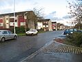
Pine Road, Abronhill
-
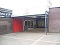
Abronhill Shopping Mall
-
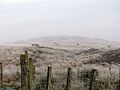
Herd's Hill, West Fannyside, named after a historical lookout
-
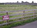
Kilt Farm, near the Walton Burn, Abronhill
-
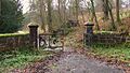
Entering the Glen from Broom Rd, Abronhill near the Dovecote
-
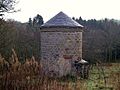
Dovecote (pronounced Doo'cot), Vault Glen near Broom Rd.
