
Cumbernauld facts for kids
Quick facts for kids Cumbernauld
|
|
|---|---|
| Town | |
|
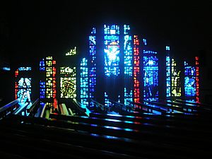
From the top left: St Mungo's Church, Aerial view of Kildrum Estate, The Centre & Arria Statue |
|

Cumbernauld
|
|
| Area | 21.5 km2 (8.3 sq mi) |
| Population | 50,530 (2020) |
| • Density | 2,350/km2 (6,100/sq mi) |
| OS grid reference | NS763736 |
| • Edinburgh | 31 mi (50 km) |
| • London | 345 mi (555 km) |
| Council area | |
| Lieutenancy area | |
| Country | Scotland |
| Sovereign state | United Kingdom |
| Post town | GLASGOW |
| Postcode district | G67, G68 |
| Dialling code | 01236 |
| Police | Strathclyde |
| Fire | Strathclyde |
| Ambulance | Scottish |
| EU Parliament | Scotland |
| UK Parliament |
|
| Scottish Parliament |
|
.jpg)


Cumbernauld (/ˌkʌmbərˈnɔːld/; Scottish Gaelic: Comar nan Allt, lit. 'meeting of the streams') is a large town in Scotland. It's located in the historic county of Dunbartonshire and is now part of the North Lanarkshire council area. Cumbernauld is the tenth largest town in Scotland by population and the biggest in North Lanarkshire. It sits right in the middle of Scotland's Central Belt.
Geographically, Cumbernauld is unique because it's on the Scottish watershed. This means that streams from here flow both east towards the Firth of Forth and west towards the Firth of Clyde. Even though it's central, the town feels more connected to Glasgow. When it was planned, the goal was for 80% of its residents to come from Glasgow to help with housing shortages there.
You can still find signs of Roman times in Cumbernauld. For example, at Westerwood and near the M80, you can see parts of an old Roman road. In Cumbernauld Community Park, there's even Scotland's only outdoor Roman altar!
For many years, the main part of Cumbernauld was around what is now called The Village. A medieval castle was nearby, surrounded by its own park. The castle often hosted kings and queens, and its grounds were famous for rare white cattle that were hunted in the oak forest. The town grew as weaving, mining, and quarrying became important industries. Better travel, thanks to the Forth and Clyde Canal and railways, connected Cumbernauld to places like Glasgow, Falkirk, and Stirling.
Cumbernauld was chosen as a "New Town" on December 9, 1955. This led to fast growth and building for about 40 years. By 2011, the town had about 52,000 people living in many different neighbourhoods. Today, Cumbernauld's economy includes manufacturing on its industrial estates and service industries in the town centre.
Cumbernauld was even shown in Our World, which was the first live TV show broadcast to many countries at once using satellites!
History of Cumbernauld
Early Times
Cumbernauld's history goes way back to Roman times. There was a settlement near the Antonine Wall, which was the northern border of the Roman Empire. This wall likely made the area safe enough for people to live there.
The town's name probably comes from the Gaelic words comar nan allt, meaning "meeting of the waters". One idea is that it refers to streams flowing both east to the Firth of Forth and west to the River Clyde from Cumbernauld's high point. Another idea is that it refers to where the Red Burn and Bog Stank streams meet in Cumbernauld Glen.


Records show that in 1216, the lands of Lenzie and Cumbernauld were given to William Comyn. Cumbernauld Castle was first built as a Norman-style motte and bailey castle. It was owned by the Comyns. The Flemings took over the castle and its land around 1306 after Robert the Bruce defeated the Red Comyn. Robert Fleming was a strong supporter of Bruce. In 1310, Robert the Bruce even wrote a letter from Kildrum trying to make peace with England.
Around 1371, the Fleming family built a second castle where Cumbernauld House now stands. Only one wall of this castle remains, as most of its stones were used for the new house. In 1440, Malcolm Fleming and his friends were sadly killed at the "Black Dinner" in Edinburgh Castle.

Scottish royalty often visited the castle. King James IV (1473-1513) visited Cumbernauld Castle. It's said that in 1500, during his reign, the Black Death caused so many deaths that the people of Cumbernauld asked the church in Glasgow for their own cemetery. They were allowed to use the land at the old Comyns' chapel.

Mary, Queen of Scots also visited the castle. In 1562, while she was staying there, the great hall collapsed, killing several men. Mary was not hurt and visited the families of those affected. Kings and queens often came to hunt the rare Scottish white cattle that lived in the woods around Cumbernauld. These woods were a small part of the ancient Caledonian Forest.

In 1640, Scottish noblemen signed the Cumbernauld Bond at the castle to oppose the Earl of Argyll. Cumbernauld Castle was largely destroyed by Cromwell's army in 1651.


Cumbernauld House, which you can still see today, was designed by William Adam and built in 1731 near the old castle. In 1746, the Jacobite army stayed in Cumbernauld village for a night. The castle was later converted into stables but burned down by accident in 1746. The grounds of Cumbernauld House are now a park called Cumbernauld Park.
After the Industrial Revolution
In the 1800s, many people in Cumbernauld worked on farms. Weaving was also a very important industry during the Industrial Revolution. By 1841, about a fifth of the town's population worked on hand looms. However, it was a tough job, especially as factories grew. Many workers moved away, and by 1896, mining and quarrying became the main jobs.

Mining and quarrying of limestone, coal, and clay became popular after the Forth and Clyde Canal was finished in 1790. You can still see entrances to old fireclay mines at Glencryan. The town also had a gas works and a stocking factory.
Cumbernauld was a busy stop for changing horses between Glasgow and Edinburgh. There were several inns and a blacksmith's shop. Old maps show other jobs like a corn mill. There were also schools, churches, a post office, and even a library.
Over the years, Cumbernauld has been part of different administrative areas, including Stirlingshire and Dunbartonshire. Since 1995, it has been part of North Lanarkshire.
New Town History

Cumbernauld was officially named a "New Town" on December 9, 1955. There are many old films and photos from this time. An opening ceremony took place on June 28, 1957.
After World War II, Glasgow had a big problem with not enough homes and poor living conditions. So, Cumbernauld was chosen as a new town in 1955 to help solve this, becoming the third new town in Scotland.
The Cumbernauld Development Corporation (CDC) was in charge of building and managing the town until 1996.
Cumbernauld is a great example of a "modernist" new town in the UK. Homes were built in different neighbourhoods around the town centre on a hilltop. A key idea was to keep people and cars separate. Cumbernauld was a leader in designing underpasses and pedestrian bridges, as well as separate footpaths. This was new for many people moving from Glasgow, and the town was sometimes called Noddy Land. Early neighbourhoods included Kildrum, Cumbernauld Village, Seafar, North Carbrain, and Greenfaulds. Later, Condorrat, South Carbrain, and Abronhill were developed. Many of these homes won awards for their new designs.


The main designer for Cumbernauld town centre was Geoffrey Copcutt. Phase 1 was opened by Princess Margaret in 1967.
When it was first planned, Cumbernauld was meant to have 50,000 people. Later, more land was added, and the target population was set at 70,000. However, the 2011 census showed about 52,000 residents.

In 1977, a local businessman gave Cumbernauld the clock from St Enoch railway station. To celebrate the Queen's Silver Jubilee, the Queen started the clock and unveiled a plaque at Cumbernauld Town Centre. This clock was even featured in the movie Gregory's Girl and is now in the Antonine Centre.
After the new town was built, many different industries came to Cumbernauld. High-tech, electronics, and food processing companies became big employers, along with Her Majesty's Revenue and Customs. The main industrial areas were built along the A80 at Castlecary, Wardpark, and Westfield.
The Cumbernauld Development Corporation (CDC) finished its work in 1996.
Modern Times


Since the CDC stopped its work in 1996, Cumbernauld has faced some challenges. The town centre, which is mostly one large building, has won some "unflattering" awards. In 2005, it was even voted "the worst building in Britain" on a TV show!
The town centre was designed to be a big shopping, entertainment, and living space. It was one of Britain's first shopping centres and the world's first multi-level covered town centre. However, the town never grew as large as planned, and the town centre hasn't been as lively as hoped. Some parts of the original shopping centre were even torn down and rebuilt.
The design of the town centre can be confusing for visitors and residents. People who moved here in the 1960s and 70s hoped to escape poor living conditions in Glasgow.


Despite its problems, Cumbernauld is still seen as an important example of town design. In 1993, it was listed as one of the sixty most important buildings of post-war architecture by an international group.
In Cumbernauld, pedestrians were originally meant to use bridges or underpasses to cross roads, not pedestrian crossings. However, these underpasses sometimes had litter or felt unsafe, especially at night. So, people sometimes avoid them. Some efforts have been made to fix these issues, but it's an ongoing problem.
In recent years, Cumbernauld has seen new businesses arrive. OKI UK and Yaskawa Electronics have their headquarters here. Irn-bru makers A.G. Barr also have their world headquarters in the town. The old Isola-Werke factory in the Wardpark area has been turned into film studios for the TV series Outlander. The show often films in the town's green spaces, like the Scottish Wildlife Trust's Cumbernauld Glen reserve, which looks like the 18th-century Scottish Highlands.
Industry
.jpg)
Many well-known companies have bases in Cumbernauld, including Mackintosh and Farmfoods. OKI UK and Yaskawa Electronics have their UK headquarters here. Irn-bru makers A.G. Barr also have their world headquarters in the Westfield area.
The old Isola-Werke factory in the Wardpark area has been turned into film studios for the TV series Outlander. This show often films in the town's green spaces, like the Scottish Wildlife Trust's Cumbernauld Glen reserve, which has ancient oak forests that look like the 18th-century Highlands. In 2016, the local council agreed to expand the Wardpark site if funding could be found. Another industrial area, Lenziemill, is home to Dow Waste Management and furniture maker Aquapac.
Environment
More than half of Cumbernauld is green space, designed to be a resource for the community.
The Scottish Wildlife Trust owns four wildlife reserves in the town: Cumbernauld Glen, Luggiebank Wood, Forest Wood, and Northside Wood. These areas have ancient oak forests (with beautiful bluebells in early summer) and many Scots pine trees.
Cumbernauld is on the Scottish watershed, which is the line that separates river systems flowing east from those flowing west. Two main waterways flow out of Cumbernauld: the Red Burn and the Luggie Water. The Red Burn flows through Cumbernauld Glen, and there are walkways along it.


There's also a footpath along the Glencryan Burn, with miles of paths leading towards Pallacerigg and Fannyside Lochs. Fannyside Muir, south of town, is a large area of lowland bog that is being restored. It's important for wildlife, especially for Taiga Bean Geese.


Cumbernauld has many parks, and some are Local Nature Reserves (LNRs) or Sites of Importance for Nature Conservation (SINCs) managed by North Lanarkshire Council. For example, St. Maurice's Pond is a SINC, and Ravenswood has an LNR. In 1993, Broadwood Loch was created to prevent flooding and for recreation.
The Cumbernauld Living Landscape (CLL) is a group working to improve and connect the town's green spaces. In 2014, the CLL found pine martens living in Cumbernauld's woods. These animals were once gone from central Scotland, so their return is a big deal for nature in the town.
Awards
In 1967, American Architects voted Cumbernauld the world's best new town. However, it also won the "Plook on a Plinth" award (a less flattering award) in 2001 and 2005.
Despite this, the town has also received positive awards. It won 'Best Town' at the Scottish Design Awards in 2012. In 2014, it received a certificate for its success as a New Town. In 2015, the Town Centre won the Green Apple Environmental Award. Cumbernauld won the 2013 Beautiful Scotland Award for the best "Small City" and has received silver medals each year since 2009. In 2017, it also won the Garden for Life Biodiversity Award.
Sport and Leisure

Cumbernauld was home to Clyde F.C, a football team that played at Broadwood Stadium from 1994 until 2022.
In 2012, Broadwood Stadium's grass pitch was replaced with a new artificial surface. Cumbernauld is also home to the Junior football team Cumbernauld United. You can play five-a-side football at the Tryst Sports Centre or Broadwood. Pitches can also be booked at Ravenswood and Oak Road. Broadwood also has a BMX track and cycling classes.

The town's rugby team, Cumbernauld RFC, started in 1970. They developed a multi-sports facility in Condorrat, which opened in 1979 and is now shared with Kildrum United FC.
The Cumbernauld Gymnastics Club is based at Broadwood Gymnastics Academy. They also offer tennis and short tennis. Dance and drama classes are held at Cumbernauld Theatre.
The Cumbernauld Handball Team, Tryst 77, came second in the British Handball Championships in 2007. The Tryst Sports Centre also has a swimming team, a wrestling club, and courts for squash and badminton. Martial arts are practiced at The Link, the Tryst, and Broadwood.

The Palacerigg Field Archers practice at the Tryst Sports Centre and have an archery course at Palacerigg Country Park. Palacerigg also has one of the town's three golf courses. The other two are Dullatur Golf Club and Westerwood.
You can play Snooker at the Red Triangle. Bowls is played in the Village, Abronhill, Ravenswood, and Condorrat. A small attraction called World of Wings near Blairlinn has a collection of birds of prey and offers flying displays.
Transport
.jpg)
Cumbernauld has good bus links to cities like Glasgow (including the airport), Stirling, Falkirk, Dunfermline, and St Andrews. These are run by FirstGroup and Stagecoach. Local bus services connect different parts of the town.
Train services to and from the town are provided by ScotRail. You can catch trains to Glasgow, Falkirk, Motherwell, and Edinburgh from Cumbernauld railway station. There's also a station at Greenfaulds. Croy railway station, north of town, has links to Edinburgh, Alloa, Dunblane, and Glasgow. The train lines through Croy and Cumbernauld were made electric in 2017.
Nearby motorways include the M8, M73, M74, M80, M876, and M9. The A80 road was upgraded to the M80 motorway and fully opened in 2011.
Cumbernauld Airport (EGPG) is mainly used for training pilots. It also has a facility for maintaining aircraft. The airport was opened in the late 1980s.
Media and Culture
The local Cumbernauld newspaper is the Cumbernauld News.
Cumbernauld FM is a community radio station that broadcasts to the town and surrounding areas on 106.8 FM and online.
The Lanternhouse Theatre opened near Cumbernauld Academy to replace the old Cumbernauld Theatre, which closed in 2019. The theatre company has a good reputation in Scottish arts for its own shows and community projects.
Governance
Cumbernauld has 11 council members out of 69 in the North Lanarkshire Council.
Jamie Hepburn is the elected Member of the Scottish Parliament (MSP) for the Scottish Parliament constituency. He is a member of the Scottish National Party.
Stuart McDonald is the elected Member of Parliament (MP) for the UK Parliament constituency. He is also a member of the Scottish National Party.
Education
Historical Schools
Old records from 1839 mention three schools: Cumbernauld Village, Condorrat, and Garbethill. Most people between 6 and 15 could read the Bible. By 1896, there were three public schools and a church school. A new school, the Southern District School, was built near the railway station in 1886.
Some historical primary schools in the New Town include Cumbernauld Primary (village), Glenhead Primary, Hillcrest Primary, Langlands Primary, Melrose Primary, Sacred Heart Primary, Seafar Primary, and St Joseph’s (now St. Margaret of Scotland Primary).
Historical secondary schools include Abronhill High (closed in 2014) and Cumbernauld High (which became Cumbernauld Academy).
Primary Schools
|
Secondary Schools
Additional Support Needs (ASN) Schools
Further Education
|
Religion
Historically, there were thought to be old chapels in several areas around Cumbernauld.
Today, there are about 17 churches in the town, including:
Church of Scotland

- Abronhill Parish
- Condorrat Parish
- Cumbernauld Old
- Kildrum Parish
- St Mungo's
Roman Catholic
- Sacred Heart
 Sacred Heart Church in Kildrum, Cumbernauld.
 - St. Joseph's
- St. Lucy's

Other Churches

- Apostolic Church
- Carbrain Baptist Church
- Cornerstone Christian Fellowship
- Craigalbert Church
- Cumbernauld Free Church
- Holy Name Episcopal Church
- Mossknowe Gospel Hall
- The Salvation Army
- United Reformed Church
Islam
- A purpose-built mosque opened in 2011.
Demographics

| Year | Population |
|---|---|
| 1755 | 2,303 |
| 1791 | 1,600 |
| 1801 | 1,795 |
| 1811 | 2,176 |
| 1821 | 2,864 |
| 1831 | 3,080 |
| 1841 | 4,501 |
| 1851 | 3,778 |
| 1861 | 3,513 |
| 1871 | 3,602 |
| 1881 | |
| 1891 | 4283 |
| 1901 | 4,905 |
| 1911 | 5,120 |
| 1956 | 3,000 |
| 1961 | 4,065 |
On Film and TV
Film

- Cumbernauld (1957): A short colour film about the town's opening ceremony.
- Building New Houses At Cumbernauld (1959): A short colour film.
- Glasgow (1963): Includes brief footage of Cumbernauld.
- British Movietone News (1965): International journalists visit Cumbernauld.
- The Design of Space (1966): Features Cumbernauld.
- Pathe News (1967): Shows Princess Margaret opening Phase 1 of the town centre.
- New Towns (1969): A study of Scottish new towns, including Cumbernauld.
- Cumbernauld, Town For Tomorrow (1970): A longer colour film narrated by Magnus Magnusson.
- Marshall-Orr (1975): Silent footage of the Town Centre and railway station.
- Cumbernauld HIT (1977): A James Bond-style fiction film with chase scenes around the old Town Centre.
- Gregory's Girl (1981): A famous film set in Abronhill High and around the town.
- Spaniards in Cumbernauld (2016): A documentary made by students.
TV
- STV Town Planning – The New Town of Cumbernauld (1966)
- STV – Gallimaufrey (c. 1970): A short poem about a new town.
- STV – Cumbernauld (c. 1973): A look at Cumbernauld while it was still being built.
- It's a Knockout (1981): A BBC show featuring teams from Dunfermline, Cumbernauld, and Glenrothes.
- STV's The Riverside Show (2014): A piece about Cumbernauld with interviews.
- STV had a short piece about the good things in Cumbernauld: Reasons Cumbernauld is possibly the best place in Scotland.
- Happy Birthday to the Town for Tomorrow! (2017): A short BBC compilation for the town's 50th anniversary.
- A look back at the town of Cumbernauld (2017): A BBC Rewind piece about how the town has changed.
Wardpark Film and Television Studios
Wardpark Film and Television Studios is a large facility in the Wardpark Industrial Estate. The TV series Outlander uses these studios for its sets. Many scenes from the show are filmed in the local woodlands. CGI for Marvel's Infinity War was also filmed at Wardpark Studios.
Residential Areas of the Town
Many of Cumbernauld's neighbourhoods are named after old farms that used to be in the area.


- Abronhill
- Balloch
- Blackwood
- Carbrain
- Carrickstone
- Condorrat
- Craigmarloch
- Cumbernauld Village
- Eastfield
- Greenfaulds
- Kildrum
- Luggiebank
- Ravenswood
- Seafar
- Smithstone
- Westerwood
- Westfield
- Whitelees
Twin Towns
Cumbernauld is twinned with Bron, France.
Notable People from Cumbernauld
- Andy Anderson (born 1953), footballer
- Ifeoma Dieke (born 1981), footballer
- Craig Ferguson (born 1962), comedian
- Jon Fratelli (born 1979), musician and songwriter
- Jay Fulton, (born 1994), footballer
- John Gibb (1831–1909), painter
- Andrew Haddow (1903–1979), footballer
- Reid Jack (1924–2003), golfer
- Steve Kean (born 1967), footballer and team manager
- Blair Malcolm (born 1997), footballer
- Andrew McAtee (1888–1956), footballer
- Tom McAteer (1876–1959), footballer
- Lynn McCafferty (born 1979), handball player
- Jimmy McCulloch (1953-1979), rock guitarist
- Bob McNicol (1933–1980), footballer
- Neil Primrose (born 1972), musician
- Paula Sage, actress
See also
 In Spanish: Cumbernauld para niños
