Luggie Water facts for kids
Quick facts for kids Luggie Water |
|
|---|---|
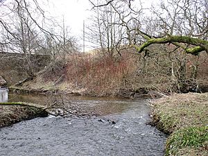
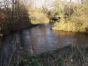
Luggie at the old ford at Waterside
|
|
| Country | Scotland |
| Physical characteristics | |
| River mouth | River Kelvin 55°56′40″N 4°09′29″W / 55.94435°N 4.15810°W |
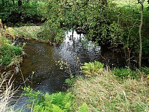
The Luggie Water is a stream that flows from Cumbernauld in Scotland. The name Cumbernauld comes from a Gaelic phrase meaning "the meeting of the waters." This might refer to the Luggie Water and the Red Burn, two streams that run through the town but never actually meet.
Water from the Luggie Water eventually flows west into the Firth of Clyde. It joins the River Kelvin at Kirkintilloch. The Red Burn, however, flows north and then east into the Firth of Forth via the Bonny Water and the River Carron. This makes Cumbernauld a special place, as it's a "watershed" where water flows in different directions to different seas. It's like a natural dividing line in the middle of Scotland.
Contents
What's in a Name?
The exact meaning of the name "Luggie" is a bit of a mystery. Some people think it means "bright" or "shining," perhaps because the stream looked clear compared to other local waters.
Old maps, like those by Timothy Pont, Charles Ross, William Forrest, and William Roy, show the Luggie Water. They sometimes spell its name in different ways.
The Luggie in Poems
The Luggie Water has inspired poets! David Gray (1838–61), a poet from Kirkintilloch, wrote many poems about the river. His most famous work is called "The Luggie". You can find his collection of poems, The Luggie and Other Poems, online.
Here's a part of one of his poems about the Luggie:
LONG yearnings had my soul to gaze upon
Fair Italy with atmosphere of fire;
On tawny Spain; on th' immemorial land
Where Time has dallied with the Parthenon
In beautiful affection and desire.
But when last even, effluently bland,
I saw sweet Luggie wind her amber waters
Thro' lawns of dew and glens of glimmering green,
And saw the comeliness of Scotland's daughters,
Their speaking eyes and modest mountain mien,
I blest the Godhead over all presiding,
Who placed me here, removed from human strife,
Where Luggie, in her clear unwearied gliding,
Is but the image of my inner life.
Another poet, Jim Carruth, who is Glasgow's poet laureate, wrote a poem called "Watershed." This poem is carved into the base of the "Arria, The Angel of the 'Naud'" statue by Andy Scott in Cumbernauld. The poem doesn't name the Luggie, but it talks about the idea of the watershed, inspired by Cumbernauld's Gaelic name.
Animals of the Luggie Water
Many different animals live near the Luggie Water. People have seen large mammals like otters, badgers, pine martens, foxes, mink, and roe deer along the riverbanks. Birdwatchers have spotted herons and kingfishers. Even eels have been found here, which are amazing fish that can swim all the way to the Caribbean Sea and back!
Where the Luggie Water Begins
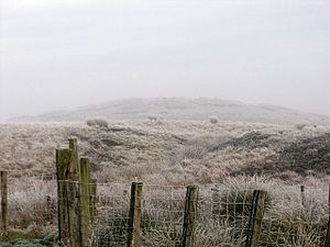
It's tricky to find one single "start" for the Luggie Water. A good candidate is Herd's Hill in Fannyside. This remote spot was once used by Covenanters, who were people who met secretly to listen to preachers.
Near Herd's Hill, at about 178 meters high, there are small streams and ditches. Some of these waters eventually flow to different towns like Linlithgow, Larbert, and Kirkintilloch.
One ditch, full of rushes, flows south and then west. It joins another stream at a place called 'Rumblybugs'. This is where maps officially mark the beginning of the Luggie Water. From Rumblybugs to where it meets the River Kelvin, the Luggie Water flows for about 18 kilometers (11 miles).
Streams Joining the Luggie
Many smaller streams, called tributaries, flow into the Luggie Water along its journey. Here are some of the main ones:
- Cameron Burn - This burn flows north and joins the Luggie at Tannoch bridge, near Luggiebank. It's quite a large stream.
- Shank Burn - Another big burn that flows from the south and joins the Luggie near Garngibboch.
- Gain Burn - This burn joins the Luggie from the south near Cumbernauld Rugby Club.
- Moss Water - Near Condorrat, the Luggie flows around the southern edge of the village. Older maps show it was joined by the Moss Water. In 1993, Broadwood Loch was created by building a dam on the Moss Water. This lake helps prevent flooding and is also used for fun activities.
- Mollins Burn - This burn joins the Luggie on the eastern edge of the village of Mollinsburn.
- Bothlin Burn - This is the biggest stream that joins the Luggie, meeting it at Oxgang in Kirkintilloch. The Bothlin Burn starts at Bishop Loch. It's also connected to the Forth & Clyde Canal, which used its water to keep the canal full.
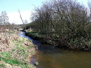
Even though one old description called the Luggie a "dull, sluggish, ditch-like stream," many parts of the river are actually quite beautiful, especially the glen at Luggiebank and the winding sections west of Mollins.
Bridges and Landmarks
There are many structures built by people along the Luggie Water. These include bridges for roads, trains, and people walking, as well as viaducts and weirs.
For example, at the site of an old mill in Lenziemill, you can see the remains of a weir. A weir is like a small dam that raises the water level. This one helped supply water to the old corn and flax mills.
Sometimes, unfortunately, people dump things like shopping trolleys and old mattresses into the river. Volunteers, like the Luggiewatch members from Kirkintilloch, help clean up these areas.
There's also a special memorial in Kirkintilloch. It remembers a brave 17-year-old named Hazleton Robert Robson, who sadly drowned in the Luggie Water while trying to save a young child.
{{gallery File:The Auld Bridge, Luggiebank.jpg|The Auld Bridge, Luggiebank File:Old weir on the Luggie - geograph.org.uk - 1739799.jpg|Old weir at Lenziemill File:Artistic Urban Graffiti under the A73 - geograph.org.uk - 1546624.jpg|Artistic Urban Graffiti under the A73 File:A73 Bridge - geograph.org.uk - 1546638.jpg|A73 Bridge - looking upriver on the right File:Railway bridge at Garngibboch - geograph.org.uk - 1538459.jpg|Railway bridge at Garngibboch near Greenfaulds }} {{gallery File:Garngibboch Bridge - geograph.org.uk - 1739693.jpg|Garngibboch Road Bridge File:Footbridge over Luggie at Dalshannon - geograph.org.uk - 1613164.jpg|Wooden footbridge near Summerfield Road, Dalshannon File:Like a Bridge Over Luggie Water - geograph.org.uk - 128791.jpg|Mattress by Bridge at Gartshore Road near Sauchenhall File:Railway viaduct over the Luggie - geograph.org.uk - 1573580.jpg|Railway viaduct at the Waterside Bing File:Memorial by the Luggie Water - geograph.org.uk - 1478259.jpg|Memorial at Eastside, Kirkintilloch }}
Another Luggie Burn
It's important to know that there's another stream called the Luggie Burn near Coatbridge. This one is a tributary of the North Calder Water and is not connected to the Luggie Water that flows through Cumbernauld.
 | Sharif Bey |
 | Hale Woodruff |
 | Richmond Barthé |
 | Purvis Young |


