
East Dunbartonshire facts for kids
Quick facts for kids
East Dunbartonshire
Aest Dunbartanshire
Siorrachd Dhùn Bhreatann an Ear |
|||
|---|---|---|---|
 |
|||
|
|||
| Sovereign state | United Kingdom | ||
| Country | Scotland | ||
| Lieutenancy area | Dunbartonshire | ||
| Admin HQ | Kirkintilloch | ||
| Government | |||
| • Body | East Dunbartonshire Council | ||
| Area | |||
| • Total | 67.4 sq mi (174.5 km2) | ||
| Area rank | Ranked 27th | ||
| Population
(2020)
|
|||
| • Total | 108,330 | ||
| • Rank | Ranked 20th | ||
| • Density | 1,607.9/sq mi (620.80/km2) | ||
| ONS code | S12000045 | ||
| ISO 3166 code | GB-EDU | ||
| Website | https://www.eastdunbarton.gov.uk/ | ||

East Dunbartonshire (Scots: Aest Dunbartanshire; Scottish Gaelic: Siorrachd Dhùn Bhreatann an Ear) is one of the 32 council areas of Scotland. It's located just north of Glasgow, a big city. It shares borders with Glasgow City Council Area to the south, North Lanarkshire to the east, Stirling to the north, and West Dunbartonshire to the west.
This area includes many nice towns and villages north of Glasgow. Some of these are Bearsden, Milngavie, Bishopbriggs, Kirkintilloch, Lenzie, Twechar, Milton of Campsie, Balmore, and Torrance. Many people who work in Glasgow live in these places. East Dunbartonshire also covers parts of the older areas known as Dunbartonshire, Lanarkshire, and Stirlingshire.
The council area was created in 1996. It was formed by combining the old areas of Bearsden and Milngavie and most of Strathkelvin. These areas used to be part of a larger region called Strathclyde.
Contents
History of East Dunbartonshire
East Dunbartonshire was officially formed in 1996. Before this, Scotland had different local government areas called "regions" and "districts." These were changed into new, single "council areas." East Dunbartonshire took over the areas that were once the Bearsden and Milngavie district and most of the Strathkelvin district. Both of these old districts were part of the larger Strathclyde region.
The Bearsden and Milngavie district was created in 1975. It included the towns of Milngavie and Bearsden, plus nearby areas from Dunbartonshire. The Strathkelvin district was also created in 1975. It covered Kirkintilloch and nearby areas from Dunbartonshire. It also included Bishopbriggs and its surrounding areas from Lanarkshire, and two parishes (church areas) called Baldernock and Campsie from Stirlingshire.
Life in East Dunbartonshire
East Dunbartonshire is known as a great place to live. In 2007, a survey by Reader's Digest magazine said it was the best place in Britain to raise a family. The area often scores well in surveys about quality of life. For example, in 2010, it was ranked third best in Scotland. In 2008, it was the only Scottish area to be in the top 20 places in Britain.
A study in 2016 also showed that East Dunbartonshire was the most successful council area in Scotland. It was even ranked as the ninth most successful in the whole United Kingdom.
Local Communities
East Dunbartonshire is divided into thirteen smaller areas called community council areas. Twelve of these areas have their own community councils, which help local people have a say in what happens in their neighbourhood.
- Baldernock*
- Bearsden East*
- Bearsden North*
- Bearsden West*
- Bishopbriggs*
- Campsie*
- Kirkintilloch*
- Lenzie*
- Milngavie*
- Milton of Campsie*
- Torrance*
- Twechar
- Waterside*
How East Dunbartonshire is Governed
| East Dunbartonshire | |
|---|---|
| Leadership | |
|
Gordan Low,
SNP Since 19 May 2022 |
|
|
Gerry Cornes
Since January 2009 |
|
| Structure | |
| Seats | 22 councillors |
 |
|
|
Political groups
|
Administration (8)
Other parties(14)
|
| Elections | |
| Single transferable vote | |
|
Last election
|
5 May 2022 |
|
Next election
|
6 May 2027 |
| Meeting place | |
 |
|
| 12 Strathkelvin Place, Kirkintilloch, G66 1XT | |
The East Dunbartonshire Council is in charge of running the area. It makes decisions about local services like schools, roads, and parks. The council has a leader and a Provost.
Council Leaders
The first leader of East Dunbartonshire Council was Charles Kennedy. He had also been the last leader of the old Strathkelvin District Council. Here are the people who have led the East Dunbartonshire Council since 1996:
| Councillor | Party | From | To | ||
|---|---|---|---|---|---|
| Charles Kennedy | Labour | 1 Apr 1996 | Oct 1999 | ||
| Keith Moody | Liberal Democrats | Oct 1999 | May 2003 | ||
| John Morrison | Liberal Democrats | 8 May 2003 | 3 May 2007 | ||
| Rhondda Geekie | Labour | 17 May 2007 | 4 May 2017 | ||
| Gordan Low | SNP | 23 May 2017 | 21 Dec 2017 | ||
| Vaughan Moody | Liberal Democrats | 20 Mar 2018 | May 2022 | Co-leaders | |
| Andrew Polson | Conservative | ||||
| Gordan Low | SNP | 19 May 2022 | |||
Council Members
After the election in 2022, the council is made up of different political parties. Here's how many councillors each party has as of July 2023:
| Party | Councillors | |
|---|---|---|
| SNP | 8 | |
| Liberal Democrats | 5 | |
| Labour | 4 | |
| Conservative | 2 | |
| Independent | 3 | |
| Total | 22 | |
The next election for the council is planned for 2027.
Council Building
Since 2012, the council's main office has been at 12 Strathkelvin Place in Kirkintilloch. This building is part of the Southbank Marina area, right next to the Forth and Clyde Canal. Before 2012, the council was based at Tom Johnston House in Kirkintilloch. That building was named after Tom Johnston, a famous politician who was born in Kirkintilloch. Tom Johnston House was taken down in 2015. The new council meeting room at Strathkelvin Place is now called the Tom Johnston Chamber.
Council Elections
Since 2007, elections for the council have happened every five years. They use a special voting system called "single transferable vote." This system helps make sure that different groups are fairly represented. Here are the results from past elections:
| Year | Seats | SNP | Liberal Democrats | Labour | Conservative | Independent / Other | |
|---|---|---|---|---|---|---|---|
| 1995 | 26 | 0 | 9 | 15 | 2 | 0 | |
| 1999 | 24 | 1 | 10 | 10 | 3 | 0 | |
| 2003 | 24 | 0 | 12 | 9 | 3 | 0 | |
| 2007 | 24 | 8 | 3 | 6 | 5 | 2 | |
| 2012 | 24 | 8 | 3 | 8 | 2 | 3 | |
| 2017 | 22 | 7 | 6 | 2 | 6 | 1 | |
| 2022 | 22 | 8 | 6 | 4 | 3 | 1 | |
Voting Areas (Wards)
.svg)
Since 2007, East Dunbartonshire has been divided into "wards" for elections. Each ward elects three councillors using the single transferable vote system. In 2017, the number of wards was changed to seven, and the number of councillors was reduced to 22. These are the current wards:
| # | Ward Name | Location | Seats | Population
(2020) |
|---|---|---|---|---|
| 1 | Milngavie |  |
3 | 13,572 |
| 2 | Bearsden North |  |
3 | 14,943 |
| 3 | Bearsden South |  |
3 | 13,318 |
| 4 | Bishopbriggs North and Campsie |  |
4 | 19,323 |
| 5 | Bishopbriggs South |  |
3 | 15,868 |
| 6 | Kirkintilloch East and North and Twechar |  |
3 | 18,251 |
| 7 | Lenzie and Kirkintilloch South |  |
3 | 13,475 |
Main Towns and Villages
Here are the largest towns and villages in East Dunbartonshire, listed by how many people live there:
| Settlement | Population (2020) |
|---|---|
| Bearsden | 28470 |
| Bishopbriggs | 23680 |
| Kirkintilloch | 21870 |
| Milngavie | 12840 |
| Lenzie | 8090 |
| Lennoxtown | 4260 |
| Milton of Campsie | 3910 |
| Torrance | 2320 |
| Twechar | 1340 |
Places to Visit
East Dunbartonshire has many interesting places to visit, including:
- Campsie Fells
- West Highland Way (a long walking path)
- Forth and Clyde Canal
- Antonine Wall (an ancient Roman wall)
- Mugdock Country Park
- Milngavie water treatment works
- River Kelvin
- Lillie Art Gallery
- Auld Kirk Museum
- Huntershill Village
- The Fort Theatre
- The Turret Theatre
- The Gadloch
Education in East Dunbartonshire
The area has a good education system. There are 8 secondary schools and 33 primary schools. The secondary schools are:
- Bearsden Academy, Bearsden
- Bishopbriggs Academy, Bishopbriggs
- Boclair Academy, Bearsden
- Douglas Academy, Milngavie
- Kirkintilloch High School, Kirkintilloch
- Lenzie Academy, Lenzie
- St Ninian's High School, Kirkintilloch
- Turnbull High School, Bishopbriggs
Images for kids
-
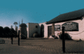
Huntershill Village
-
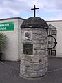
Thomas Muir Cairn - Erected by John SL Watson and unveiled by East Dunbartonshire's Provost John Dempsey (1997)
-
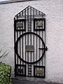
Scottish Political Martyrs Gate - Erected by John SL Watson and unveiled by East Dunbartonshire's Provost John Dempsey (1997)
-
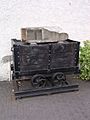
Miners of the world memorial hutch - created by John SL Watson and unveiled by leader of East Dunbartsonshire Council John Morrison (2003)
-
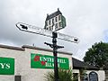
Finger Post marking the Old Glasgow-Stirling postal road
-
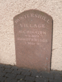
Huntershill Village Mile Stone
-
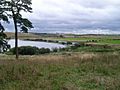
Southwest view across Gadloch Towards the distant Red Road Flats.


See also
 In Spanish: East Dunbartonshire para niños
