West Dunbartonshire facts for kids
Quick facts for kids
West Dunbartonshire
Wast Dunbairtonshire
Siorrachd Dhùn Breatann an Iar |
|||
|---|---|---|---|
 |
|||
|
|||
| Sovereign state | United Kingdom | ||
| Country | Scotland | ||
| Lieutenancy area | Dunbartonshire | ||
| Admin HQ | Dumbarton | ||
| Government | |||
| • Body | West Dunbartonshire Council | ||
| Area | |||
| • Total | 61.3 sq mi (158.8 km2) | ||
| Area rank | Ranked 31st | ||
| Population
(2020)
|
|||
| • Total | 89,130 | ||
| • Rank | Ranked 26th | ||
| • Density | 1,453.7/sq mi (561.27/km2) | ||
| ONS code | S12000039 | ||
| ISO 3166 code | GB-WDU | ||
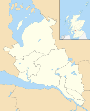
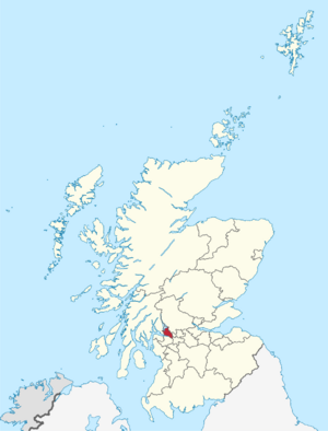
West Dunbartonshire is one of the 32 local government areas in Scotland. It is located north-west of Glasgow. Many towns and villages where people live and travel to Glasgow for work are found here. West Dunbartonshire shares borders with Argyll and Bute, East Dunbartonshire, Renfrewshire, and Stirling.
This area was created in 1996. It was formed from parts of the old Clydebank district and Dumbarton district. These areas used to be part of a larger region called Strathclyde.
West Dunbartonshire has three main towns: Clydebank, Dumbarton, and the Vale of Leven. It also includes countryside areas like the Kilpatrick Hills and the south-eastern side of Loch Lomond. The main office for the council is in Dumbarton, even though Clydebank is the biggest town.
Contents
History of West Dunbartonshire
West Dunbartonshire was officially created in 1996. This happened when a new law changed how local government worked in Scotland. The old system of regions and districts was replaced with new "council areas."
West Dunbartonshire took over the areas that used to be the Clydebank district and the eastern part of the Dumbarton district. Before this, people in the western part of the old Dumbarton district, like Helensburgh, voted to join Argyll and Bute instead of staying with Dumbarton.
The new area was first going to be called "Dumbarton and Clydebank." However, local leaders asked for the name to be changed to "West Dunbartonshire," and the government agreed.
Local Communities
West Dunbartonshire is divided into 17 smaller areas called community council areas. As of 2023, ten of these areas have their own community councils. These councils help local people have a say in what happens in their neighborhoods.
- Alexandria*
- Balloch and Haldane
- Bonhill and Dalmonach*
- Bowling and Milton*
- Clydebank East*
- Dalmuir and Mountblow
- Dumbarton East and Central*
- Dumbarton North
- Dumbarton West
- Duntocher and Hardgate
- Faifley*
- Kilmaronock*
- Linnvale and Drumry
- Old Kilpatrick*
- Parkhall, North Kilbowie and Central*
- Renton
- Silverton and Overtoun*
How West Dunbartonshire is Governed
| West Dunbartonshire | |
|---|---|
 |
|
| Leadership | |
|
Martin Rooney,
Labour Since 18 May 2022 |
|
|
Peter Hessett
Since 2022 |
|
| Structure | |
| Seats | 22 councillors |
 |
|
|
11 / 22
|
|
|
8 / 22
|
|
|
WDCP
|
1 / 22
|
|
2 / 22
|
|
| Elections | |
| Single transferable vote | |
|
Last election
|
6 May 2022 |
|
Next election
|
6 May 2027 |
| Meeting place | |
 |
|
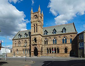
| Burgh Hall, 16 Church Street, Dumbarton, G82 1QL | |
The council is made up of 22 councillors. These councillors are elected from 6 different areas called wards.
Council Leaders
The person in charge of the council is called the Leader. Here are the leaders since 1996:
| Councillor | Party | From | To | |
|---|---|---|---|---|
| Mary Campbell | Labour | 1 Apr 1996 | Jun 1997 | |
| Andy White | Labour | Jun 1997 | 20 Dec 2006 | |
| Martin Rooney | Labour | 20 Dec 2006 | 12 Mar 2007 | |
| Denis Agnew | Independent | 12 Mar 2007 | May 2007 | |
| Iain Robertson | SNP | 16 May 2007 | 26 May 2010 | |
| Ronnie McColl | SNP | 26 May 2010 | 3 May 2012 | |
| Martin Rooney | Labour | 16 May 2012 | May 2017 | |
| Jonathan McColl | SNP | 17 May 2017 | May 2022 | |
| Martin Rooney | Labour | 18 May 2022 | ||
Council Buildings
The main office for the council is at the old Burgh Hall in Dumbarton. There is also an office in the main shopping area of Clydebank.
When the council was first formed in 1996, it used several buildings. Over time, the council brought most of its offices together into the Burgh Hall. This building was updated in 2018 with a modern office complex built behind the historic front.
Council Elections
Since 2007, elections for the council happen every five years. They use a system called "single transferable vote." This system helps make sure that more voices are heard in the council.
Here's a quick look at how many seats different parties have won:
| Year | Seats | Labour | SNP | Conservative | Independent / Other | |
|---|---|---|---|---|---|---|
| 1995 | 22 | 14 | 7 | 0 | 1 | |
| 1999 | 22 | 14 | 7 | 0 | 1 | |
| 2003 | 22 | 17 | 3 | 0 | 2 | |
| 2007 | 22 | 10 | 9 | 0 | 3 | |
| 2012 | 22 | 12 | 6 | 0 | 4 | |
| 2017 | 22 | 8 | 10 | 2 | 2 | |
| 2022 | 22 | 12 | 9 | 0 | 1 | |
After the 2022 election, one Labour councillor left their party. Also, one SNP councillor left their party. This means that no single party has a clear majority in the council anymore. This is called "no overall control."
Council Wards
For the 2007 election, six new wards were created. A ward is an area that elects councillors to represent it. Each ward elects several councillors.
| Ward number | Ward | Largest settlement | Additional settlements | Seats |
|---|---|---|---|---|
| 1 | Lomond | Balloch | Gartocharn, Jamestown, Levenvale, Mill of Haldane | 3 |
| 2 | Leven | Alexandria | Bonhill, Dalmonach, Renton, Dumbarton (northern parts) | 4 |
| 3 | Dumbarton | Dumbarton | Milton, Bowling | 4 |
| 4 | Kilpatrick | Duntocher | Faifley, Hardgate | 3 |
| 5 | Clydebank Central | Clydebank | 4 | |
| 6 | Clydebank Waterfront | Clydebank | Old Kilpatrick | 4 |
Main Towns and Villages
Here are the largest towns and villages in West Dunbartonshire, listed by how many people live there:
| Settlement | Population (2020) |
|---|---|
| Clydebank | 25620 |
| Dumbarton | 20480 |
| Bonhill | 9060 |
| Alexandria | 6710 |
| Duntocher | 6680 |
| Balloch | 6010 |
| Faifley | 4740 |
| Old Kilpatrick | 4470 |
| Renton | 2350 |
| Bowling | 560 |
Places to See
West Dunbartonshire has many interesting places to visit, including:
- Erskine Bridge
- Dumbarton Castle
- Inchmurrin, the biggest island in a freshwater loch in the British Isles
- Kilpatrick Hills
- Loch Lomond
- Loch Lomond and the Trossachs National Park
- Overtoun Bridge
- River Leven
See also
 In Spanish: West Dunbartonshire para niños
 | Aurelia Browder |
 | Nannie Helen Burroughs |
 | Michelle Alexander |


