Stirling (council area) facts for kids
Quick facts for kids
Stirling
Sruighlea
Stirlin |
|||
|---|---|---|---|
 |
|||
|
|||
| Sovereign state | United Kingdom | ||
| Country | Scotland | ||
| Lieutenancy area | Stirling and Falkirk | ||
| Admin HQ | Stirling | ||
| Government | |||
| • Body | Stirling Council | ||
| Area | |||
| • Total | 844 sq mi (2,187 km2) | ||
| Area rank | Ranked 9th | ||
| Population
(2020)
|
|||
| • Total | 94,330 | ||
| • Rank | Ranked 24th | ||
| • Density | 111.712/sq mi (43.132/km2) | ||
| ONS code | S12000030 | ||
| ISO 3166 code | GB-STG | ||
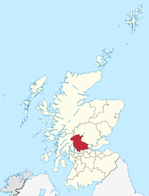
The Stirling council area (Scots: Stirlin; Scottish Gaelic: Sruighlea) is one of the 32 main local government areas in Scotland. It has a population of about 94,330 people (based on the 2017 estimate).
This area was created in 1975. It was first a smaller part of a larger region called Central. In 1996, the Central region was removed. Then, the Stirling Council took over all local government duties for the area.
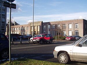
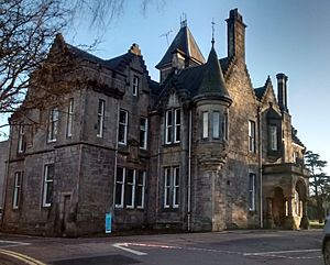
The main office for the Stirling council area is in the city of Stirling. The council's headquarters are at a building called Old Viewforth.
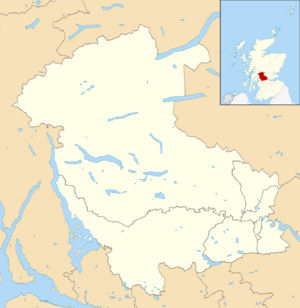
The Stirling area shares its borders with several other council areas. To the east is Clackmannanshire. To the south is North Lanarkshire. Falkirk is to the southeast. To the north and northeast is Perth and Kinross. Argyll and Bute is to the north and northwest. Finally, both East and West Dunbartonshire are to Stirling's southwest.
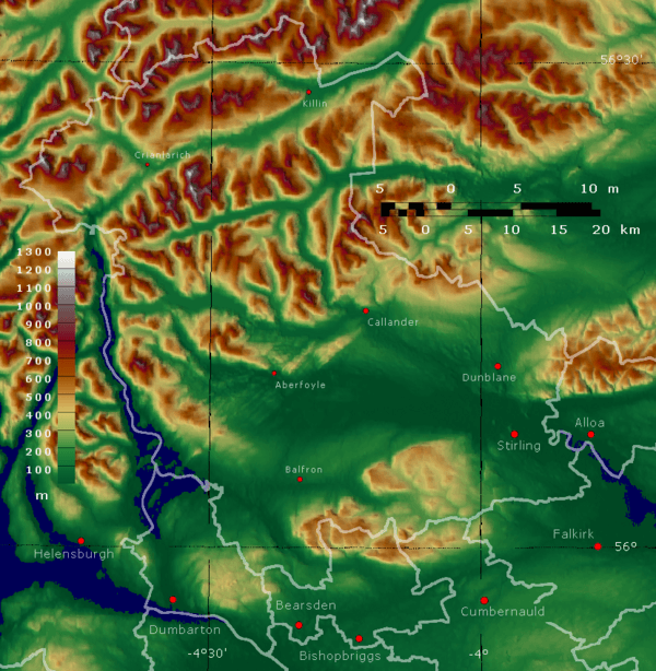
Most of the people in the Stirling area live in its southeast part. This includes the city of Stirling itself. It also includes nearby lowland towns like Bridge of Allan and Dunblane to the north. Bannockburn is right to the south. There are also three former coal mining towns: Cowie, Fallin, and Plean. These are often called the "Eastern Villages."
The rest of the council area has fewer people. It is mostly a rural, highland area in the north and west. The southern part of this rural area is a flat plain near the River Forth. It is bordered by the Touch Hills and the Campsie Fells to the south. North of the glen are the Trossachs mountains. The northern half of the council area is generally very mountainous.
Contents
History of Stirling Council
The Stirling district was formed in 1975. This happened under a law that changed how local government worked in Scotland. The old counties and towns were replaced with new regions and districts. Stirling became one of three districts within the Central region.
When it was created in 1975, the Stirling district included parts of two older counties. These were Stirlingshire and Perthshire. The new district combined five areas from Stirlingshire and four from Perthshire.
From Perthshire:
- Callander Burgh (a type of town)
- Doune Burgh
- Dunblane Burgh
- Western District, except for Ardoch (which went to Perth and Kinross)
From Stirlingshire:
- Bridge of Allan Burgh
- Central No. 1 District
- Stirling Burgh
- Western No. 1 District
- Western No. 2 District
In 1996, local government changed again. The regions and districts created in 1975 were removed. They were replaced with single council areas. The Central Region was abolished. Each of its three districts, including Stirling, became its own council area. This is how the current Stirling Council was formed.
How Stirling Council Works
| Stirling | |
|---|---|
 |
|
| Leadership | |
|
Carol Beattie
Since 2018 |
|
| Structure | |
| Seats | 23 councillors |
 |
|
|
Political groups
|
|
| Elections | |
| Single transferable vote | |
|
Last election
|
6 May 2022 |
|
Next election
|
6 May 2027 |
| Meeting place | |
 |
|
| Old Viewforth, Pitt Terrace, Stirling, FK8 2ET | |
Council Leaders
The first leader of the Stirling Council was Corrie McChord. He had also been the last leader of the Central Regional Council. Here are the leaders since 1996:
| Councillor | Party | From | To | |
|---|---|---|---|---|
| Corrie McChord | Labour | 1 Apr 1996 | 24 May 2007 | |
| Corrie McChord | Labour | 31 May 2007 | 12 Mar 2008 | |
| Graham Houston | SNP | 12 Mar 2008 | 17 May 2012 | |
| Corrie McChord | Labour | 17 May 2012 | 28 Feb 2013 | |
| Johanna Boyd | Labour | 28 Feb 2013 | 4 May 2017 | |
| Scott Farmer | SNP | 24 May 2017 | 19 May 2022 | |
| Chris Kane | Labour | 19 May 2022 | ||
Council Buildings
The Stirling Council operates from Old Viewforth in Stirling. The oldest part of this building was a house built in 1855. Stirlingshire County Council bought it in 1931 to use as its main office. A large new section was added in 1937.
From 1975 to 1996, Viewforth was the main office for the Central Regional Council. During this time, the Stirling District Council used the Municipal Buildings. These buildings were finished in 1918. When the local government changed in 1996, Stirling Council took over Viewforth. A newer building from 1972, called New Viewforth, was taken down in 2014.
Council Elections
Since 2007, elections for the council have been held every five years. They use a system called single transferable vote. Here are the election results since 1995:
| Year | Seats | SNP | Conservative | Labour | Green | Liberal Democrats | Independent / Other | Notes |
|---|---|---|---|---|---|---|---|---|
| 1995 | 22 | 2 | 7 | 13 | 0 | 0 | 0 | |
| 1999 | 22 | 2 | 9 | 11 | 0 | 0 | 0 | New ward boundaries. |
| 2003 | 22 | 0 | 10 | 12 | 0 | 0 | 0 | |
| 2007 | 22 | 7 | 4 | 8 | 0 | 3 | 0 | New ward boundaries. |
| 2012 | 22 | 9 | 4 | 8 | 1 | 0 | 0 | |
| 2017 | 23 | 9 | 9 | 4 | 1 | 0 | 0 | New ward boundaries. |
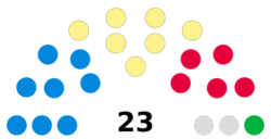
| 2022 | 23 | 8 | 7 | 6 | 1 | 0 | 1 | Labour minority administration with Conservative support. |
Who is on the Council Now?
After one change since the 2022 election, here is how the council is made up:
| Party | Councillors | |
|---|---|---|
| Conservative | 8 | |
| SNP | 7 | |
| Labour | 5 | |
| Independent | 2 | |
| Green | 1 |
Stirling Council Wards
The Stirling council area is divided into smaller areas called "wards." Each ward elects a certain number of councillors. Here are the wards:
| Ward Number |
Ward Name | Location | Seats |
|---|---|---|---|
| 1 | Trossachs and Teith |  |
3 |
| 2 | Forth and Endrick |  |
3 |
| 3 | Dunblane and Bridge of Allan |  |
4 |
| 4 | Stirling North |  |
4 |
| 5 | Stirling West |  |
3 |
| 6 | Stirling East |  |
3 |
| 7 | Bannockburn |  |
3 |
Communities in Stirling
The Stirling area has 42 community council areas. Each of these areas has its own community council as of 2023. These councils help local people have a say in their area.
- Arnprior
- Balfron
- Balquhidder, Lochearnhead and Strathyre
- Bannockburn
- Braehead and Broomridge
- Bridge of Allan
- Buchanan
- Buchlyvie
- Callander
- Cambusbarron
- Cambuskenneth
- Carron Valley and District
- Causewayhead
- Cornton
- Cowie
- Croftamie
- Drymen
- Dunblane
- Fintry
- Gargunnock
- Gartmore
- Hillpark and Milton
- Killearn
- Killin
- Kilmadock
- King's Park
- Kippen
- Logie
- Mercat Cross
- Plean
- Polmaise
- Port of Menteith
- Raploch
- Riverside
- St Ninians
- Strathard
- Strathblane
- Strathfillan
- Thornhill and Blairdrummond
- Throsk
- Torbrex
- Trossachs
Towns and Villages
The Stirling council area includes the city of Stirling. It also has many other towns, villages, and small groups of houses called hamlets. People also live in spread-out areas called dispersed settlements.
Here are the largest towns and villages by population:
| Settlement | Population (2020) |
|---|---|
| Stirling | 37910 |
| Dunblane | 9310 |
| Bannockburn | 6720 |
| Bridge of Allan | 5320 |
| Callander | 3080 |
| Fallin | 2850 |
| Cowie | 2720 |
| Doune | 2200 |
| Balfron | 2140 |
| Strathblane | 2000 |
Main Towns
- Bannockburn
- Bridge of Allan
- Callander
- Doune
- Dunblane
Villages
- Aberfoyle
- Ashfield
- Balfron
- Balmaha
- Balquhidder
- Blairlogie
- Blanefield
- Buchlyvie
- Cambusbarron
- Cambuskenneth
- Cowie
- Crianlarich
- Croftamie
- Deanston
- Drymen
- Fallin
- Fintry
- Gargunnock
- Gartmore
- Killearn
- Killin
- Kinlochard
- Kippen
- Milton of Buchanan
- Lochearnhead
- Plean
- Port of Menteith
- Strathblane
- Strathyre
- Thornhill
- Throsk
- Tyndrum
Hamlets
- Ardchullarie More
- Ardeonaig
- Arnprior
- Auchlyne
- Balfron Station
- Boquhan
- Buchanan Smithy
- Carbeth
- Dumgoyne
- Gartness
- Inverarnan
- Kilmahog
- Kinbuck
- Milton
- Mugdock
- Stronachlachar
Dispersed Settlements
- Ardchyle
- Auchtubh
- Blair Drummond
- Brig o' Turk
- Dalmary
- Dalrigh
- Inversnaid
- Rowardennan
- Ruskie
Interesting Places to Visit
The Stirling area has many cool places to explore!
- Carse of Lecropt
- Culcreuch Castle
- Inchmahome Priory (These are old church ruins on an island in the Lake of Menteith. Mary, Queen of Scots hid there in 1547!)
- Breadalbane Folklore Centre
- Cambuskenneth Abbey (This was once where the Scottish Parliament met.)
- Doune Castle
- Dunblane Cathedral
- Falls of Dochart
- Falls of Lochay
- Glen Dochart
- Glenfinlas
- Lake of Menteith
- Lecropt Kirk
- Loch Achray
- Loch Ard
- Loch Earn
- Loch Lomond and the Trossachs National Park
- Loch Katrine (This loch provides most of the drinking water for the city of Glasgow.)
- Loch Rusky
- Loch Venachar
- Moirlannich Longhouse
- Queen Elizabeth Forest Park (This park is managed by Forestry and Land Scotland.)
- Scottish Institute of Sport (This sports center is on the grounds of Stirling University.)
- Stirling Castle
- The University of Stirling
- The Trossachs
- Wallace Monument
- West Highland Way
See also
 In Spanish: Stirling (concejo) para niños
 | Valerie Thomas |
 | Frederick McKinley Jones |
 | George Edward Alcorn Jr. |
 | Thomas Mensah |


