Strathblane facts for kids
Quick facts for kids Strathblane
|
|
|---|---|
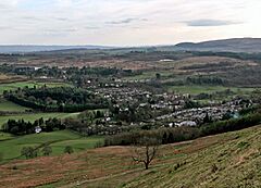 A view over Strathblane from Ballagan |
|
| Area | 17 sq mi (44 km2) |
| Population | 2,000 (2020) |
| • Density | 54/km2 (140/sq mi) |
| OS grid reference | NS561794 |
| • Edinburgh | 46 mi (74 km) E |
| • London | 358 mi (576 km) SSE |
| Civil parish |
|
| Council area | |
| Lieutenancy area |
|
| Country | Scotland |
| Sovereign state | United Kingdom |
| Post town | GLASGOW |
| Postcode district | G63 |
| Dialling code | 01360 |
| Police | Central Scotland |
| Fire | Central Scotland |
| Ambulance | Scottish |
| EU Parliament | Scotland |
| UK Parliament |
|
| Scottish Parliament |
|
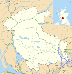
Strathblane (which means "the valley of the Blane" in Gaelic) is a village in central Scotland. It is located in the Stirling area. The village sits at the bottom of the Campsie Fells and the Kilpatrick Hills. It is also next to the Blane Water river.
Strathblane is about 19 kilometers (12 miles) north of Glasgow. It is also 23 kilometers (14 miles) east-southeast of Dumbarton. The village is a place where people live and then travel to work in bigger cities like Glasgow. About 1,811 people live in Strathblane.
Long ago, Strathblane was a larger area called a parish. This parish included three smaller villages: Edenkill, Netherton, and Mugdock. Mugdock was once the home of the important Earls of Lennox. The town of Lennoxtown is just east of Strathblane.
Close by, you can find the Trossachs National Park. There is also a famous long walking path called the West Highland Way that goes near the village.
The Blane Water river is very important to the area. One of its smaller streams, the Ballagan Burn, has a waterfall called the Spout of Ballagan. This waterfall shows 192 different layers of colored rocks. The Blane Water eventually flows into the Endrick River, which then goes into Loch Lomond.
Contents
A Look at Strathblane's Past
Historians believe Strathblane might have been the site of an old battle in the year 750. This battle was fought between the Britons and the Picts. During this fight, a leader named Talorgan was killed. Old records mention the battle took place near "Mugdock," which is part of the Strathblane area.
In the early 1800s, more people moved to Strathblane. This was because new factories opened nearby. A large factory that printed fabric (called calico) opened in Blanefield. It employed many adults and even 45 children under 14. There were also two bleach factories that employed 67 adults and 14 children. Workers often worked 10 to 11 hours a day, six days a week.
Today, you won't see these factories in the village. Strathblane is now a quiet, pretty place. Most people who live there travel to nearby towns for work.
The Edmonstone Family of Duntreath
The most important local family was the Edmonstones of Duntreath. They had old connections to the Kings of Scotland. In 1374, Sir John Edmonstone was an ambassador to France for King Robert II. Later, his son, Sir Archibald Edmonstone, made Duntreath their family home.
In 1425, another Sir William Edmondstone married Mary Stewart. She was a princess and the daughter of King Robert III. They had a son, also named Sir William Edmonstone. The family also gained a house at Colzium. This happened when the Livingstones of Kilsyth lost their estate because they supported the Jacobite cause.
More recently, Edward VII's friend Alice Keppel was part of the Edmonstone family. She was the great-grandmother of Camilla, Duchess of Rothesay. Camilla is the second wife of Prince Charles.
How Strathblane is Governed
Strathblane is part of the Stirling council area. This area handles local services like schools and roads. Before 1996, it was part of a larger region called Central Scotland.
For local elections, Strathblane is part of the Forth and Endrick area. This area chooses three local councillors. In the 2007 elections, one councillor was chosen from each of the Conservative, Labour, and Scottish National Parties.
The Strathblane community council helps represent the villages of Strathblane, Blanefield, and Mugdock. They work to improve the local area.
The Geography of Strathblane
Strathblane is located at the southern base of the Campsie Fells hills. It is about 80 meters (265 feet) above sea level. The hills around Strathblane are mostly made of a rock called basalt. The lower areas are made of Old Red Sandstone. The soil in the higher parts of the valley is sandy, and in the lower parts, it is clayey.
 |
Dumgoyne, Killearn | Campsie Fells | Fintry |  |
| Carbeth | Campsie Glen, Lennoxtown, Kilsyth | |||
| East Dunbartonshire | Milngavie, Bearsden, Glasgow | Baldernock, Torrance |
Population of Strathblane
The village of Strathblane has about 1,811 people living there. The larger Strathblane Community Council Area covers 44 square kilometers (17 square miles). This wider area has a population of 2,396 people.
The population of the parish has changed over time. In 1795, there were 620 people. By 1871, it had grown to 1,235. The population was 1,811 in the 2001 census.
| Year | 1801 | 1811 | 1821 | 1831 | 1841 | 1851 | 1861 | 1871 | 1881 | 1891 | 1901 | 1911 | 1921 | 1951 |
|---|---|---|---|---|---|---|---|---|---|---|---|---|---|---|
| Population | 734 | 795 | 748 | 1,033 | 894 | 1,010 | 1,388 | 1,235 | 1,343 | 1,671 | 880 | 1,024 | 1,275 | 1,354 |
| Source:A Vision of Britain through Time | ||||||||||||||
What Strathblane Offers
Tourism is an important part of Strathblane's economy. Visitors come to the area to enjoy walks and the beautiful scenery. The village has many local shops and services. These include a post office, library, grocery store, hairdressers, chemist, and a deli. There is also a hotel. The Blane Valley Inn closed in early 2020. A bank in Strathblane closed down in 2014.
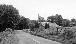
Long ago, Strathblane was connected to Glasgow by railway lines. These lines opened in 1867. However, as more people started using cars, the railway became less popular. It closed for passengers in 1951 and for freight in 1959.
Important Places in Strathblane
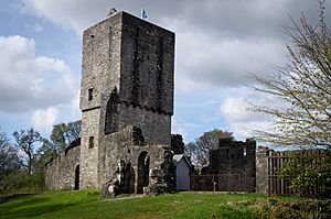
Mugdock Castle was a strong fortress for the Clan Graham family. This was from the mid-1200s. You can still see its ruins today in Mugdock Country Park. This park is at the southern edge of Strathblane, near Milngavie.
In 1921, a monument was built in Strathblane. It was made to remember the 25 men from the village who died in World War I. The monument was designed by Robert Lorimer. It has a square base with names carved into it. A tall, slender pillar rises from the base, topped with four shields and a cross.
The Duke of Montrose helped unveil the monument. He spoke about the great sacrifice these men made for their country. He said their deaths should inspire everyone to live noble and selfless lives.
Strathblane Parish Church was built in 1803. It is a Church of Scotland church. There is also a Catholic church in the village called St. Kessog.
Schools in Strathblane
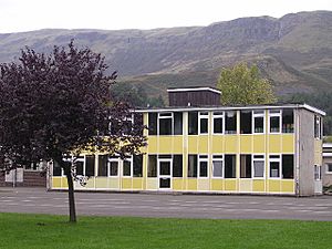
Strathblane Primary School is the local school for younger children. After primary school, students from Strathblane and Blanefield usually go to Balfron High School. However, some high schools in East Dunbartonshire, like Douglas Academy, are also quite close.
Sports and Activities
Blanefield Thistle F.C. is the local Association football team. There are also clubs and groups for other sports. These include bowls, darts, karate, and snooker.
Famous People from Strathblane
James Gordon, Baron Gordon of Strathblane is a well-known businessman and manager. He was given a special title called a Life Peerage.
Alfred Yarrow, who later became Sir Alfred Yarrow, was a local resident. He was the founder of Yarrow Shipbuilders. In 1911, he helped pay for the building of the Strathblane Village Club.
See also
 In Spanish: Strathblane para niños
 | James B. Knighten |
 | Azellia White |
 | Willa Brown |


