River Forth facts for kids
Quick facts for kids Forth |
|
|---|---|

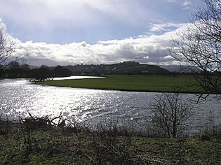
The River Forth meanders over fertile farmlands near Stirling
|
|

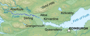
Course of River Forth
|
|
| Country | Scotland |
| Councils | Stirling |
| City | Stirling |
| Physical characteristics | |
| Main source | Confluence of Duchray Water and the Avondhu River below Loch Ard 33 m (108 ft) 56°10′52″N 4°24′30″W / 56.1810°N 4.4084°W |
| River mouth | Firth of Forth, North Sea UK 0 m (0 ft) 56°03′52″N 3°43′37″W / 56.0645°N 3.7270°W |
| Length | 47 km (29 mi) |
The River Forth is an important river in Scotland. It is about 47 km (29 mi) long. Its drainage basin (the area of land where all water drains into the river) covers a large part of Stirlingshire. This area is in Scotland's Central Belt.
In the upper part of the river, above Stirling, its name in Gaelic is Abhainn Dubh. This means "black river". After the river passes under the M9 motorway, where the tide starts to affect it, its name becomes Uisge For.
Contents
About the River Forth
The River Forth is one of Scotland's main rivers. It flows through beautiful landscapes, from hills to wide, flat plains. The river's journey ends in the Firth of Forth, which is a large estuary (where the river meets the sea) that opens into the North Sea.
Where Does the River Forth Start?
The River Forth begins its journey in the Scottish Highlands. It forms where two smaller rivers, the Duchray Water and the Avondhu River, join together. This meeting point is found below a lake called Loch Ard. The river starts at an elevation of about 33 m (108 ft) above sea level.
The River's Path to the Sea
As the River Forth flows, it winds its way through the historic region of Stirlingshire. It passes by the famous city of Stirling. Near Stirling, the river creates many bends and loops, known as meanders. These meanders flow through very fertile (good for farming) land.
The river continues to widen as it gets closer to the sea. Eventually, it reaches the Firth of Forth. This is a large, funnel-shaped bay where the river's fresh water mixes with the salty water of the North Sea. The Firth of Forth is a very important area for wildlife and industry.
Importance of the River Forth
The River Forth has been important for people for a very long time.
- Transport: In the past, it was a key route for boats and ships. They used it to carry goods and people.
- Trade: Towns and cities grew along its banks because of the easy access for trade.
- Farming: The fertile land around the river has been used for farming for centuries.
- Wildlife: The river and its estuary are home to many different kinds of plants and animals. This includes various fish, birds, and even seals in the wider parts.
Images for kids
-
The meandering Forth viewed from the Wallace Monument. The river flows from right to left, and the former limit of navigation was in the left distance.
-
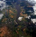
River Forth passing Cambus, Tullibody Inch, and Alloa Inch. Beyond that Alloa and Kincardine. The water is known as the Firth of Forth beyond the Clackmannanshire and Kincardine bridges although the transition point is unclear.
See also
 In Spanish: Río Forth para niños
 | Aurelia Browder |
 | Nannie Helen Burroughs |
 | Michelle Alexander |


