
Lake of Menteith facts for kids
Quick facts for kids Lake of Menteith |
|
|---|---|

Looking towards Port of Menteith
|
|

Lake of Menteith
Location in Stirling
|
|
| Coordinates | 56°10′28″N 4°17′32″W / 56.1744°N 4.2921°W |
| Type | freshwater loch |
| Primary outflows | River Forth |
| Max. length | 2.4 km (1.5 mi) |
| Max. width | 1.6 km (1 mi) |
| Surface area | 252 ha (620 acres) |
| Average depth | 6.02 m (19.75 ft) |
| Max. depth | 23 m (77 ft) |
| Shore length1 | 9.7 km (6.0 mi) |
| Surface elevation | 18 m (59 ft) |
| Islands | Inchmahome, Dog Isle, Inch Talla |
| 1 Shore length is not a well-defined measure. | |
The Lake of Menteith, also known as Loch Inchmahome, is a beautiful freshwater loch (which is what most lakes are called in Scotland) in Scotland. It's located in a flat area called the Carse of Stirling, near the River Forth and River Teith. It's famous for being one of the few bodies of water in Scotland officially called a "lake" instead of a "loch".
Contents
What's in a Name?
For a long time, until the early 1800s, people usually called this water body the "Loch of Menteith." But on an old map from 1654, it was already named "Loch Inche Mahumo." The only town right on the Lake of Menteith is called Port of Menteith.
Why is it Called a "Lake"?
The unusual name "Lake of Menteith" might have come from Dutch mapmakers in the 1500s. They might have changed the Scottish name Laich o Menteith, where "laich" means "low place."
Another idea is that the name became popular after 1838. That's when the UK Government's Ordnance Survey mapped the area. They might have called it a "lake" because it was already called that in popular books at the time.
Geography and Islands
The Lake of Menteith has several small islands. The biggest one is Inchmahome. On this island, you'll find Inchmahome Priory, which is a very old monastery.
Mary, Queen of Scots' Refuge
In 1547, Mary, Queen of Scots, found safety at Inchmahome Priory. She was only four years old at the time. She stayed there for three weeks after a big battle called the Battle of Pinkie Cleugh.
Winter Fun: Curling on the Ice
The lake isn't very deep, so it can completely freeze over in very cold winters. If the ice gets thick enough (at least 7 inches (18 cm)), a huge outdoor curling tournament is held. This event is called the Bonspiel, or the Grand Match.
Thousands of curlers might come to play, even though it doesn't happen very often. The last Grand Match was in 1979. A Bonspiel planned for 2010 had to be cancelled for safety reasons.

Other Scottish "Lakes"
Many people think the Lake of Menteith is the only body of water in Scotland called a "lake." But there are actually a few others! Some of these were even made by people.
Here are some examples:
- Pressmennan Lake
- The Lake of the Hirsel
- Lake Louise (at Skibo Castle)
- Raith Lake (in Kirkcaldy)
- Upper Lake and Kelly Lake (near Haddo House)
- Pitfour Lake
- Cally Lake (near Gatehouse of Fleet)
There's also a sea bay near Kirkcudbright called Manxman's Lake. Almost all other large bodies of water in Scotland are known as lochs.
Malling Roman Fort
There was once a Roman fort located to the west of the Lake of Menteith. This fort was part of a Roman defense line called the Gask Ridge. The Romans might have called this site "Lindon."
Discovery of the Fort
The fort was discovered in 1968 by David Wilson and Kenneth St Joseph. They were flying over an area called Flanders Moss and took aerial photographs. After that, they checked the ground using special tools to measure resistance and magnetic levels.
Images for kids
-
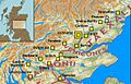
Forts and Fortlets associated with the Gask Ridge from south to north Balmuildy, Cadder, Castlecary, Mumrills, Camelon, Drumquhassle, Malling, Doune, Glenbank, Bochastle, Ardoch, Sheilhill, Strageath, Dalginross, Midgate, Bertha, Fendoch, Cargill, Cardean, Inchtuthil, Inverquharity, Stracathro

See also
 In Spanish: Lago de Menteith para niños
