Ben Vorlich, Loch Lomond facts for kids
Quick facts for kids Ben Vorlich |
|
|---|---|
| Beinn Mhùrlaig | |

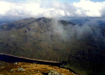
Ben Vorlich seen from Ben Vane with Loch Sloy in the valley
|
|
| Highest point | |
| Elevation | 943 m (3,094 ft) |
| Prominence | 632 m (2,073 ft) |
| Parent peak | Beinn Ime |
| Listing | Munro, Marilyn, County top (Dunbartonshire) |
| Naming | |
| English translation | hill of the bay |
| Language of name | Gaelic |
| Pronunciation | Gaelic |
| Geography | |
| Location | Arrochar Alps, Argyll and Bute, Scotland |
| Parent range | Arrochar Alps, Grampian Mountains |
| OS grid | NN295124 |
| Topo map | OS Landranger 56 |
Ben Vorlich, also known as Beinn Mhùrlaig in Gaelic, is a mountain in Scotland. It stands tall between the northern part of Loch Lomond and Loch Sloy. This mountain is part of the Arrochar Alps range. However, it stands a bit apart from the other peaks. Ben Vorlich is the highest point in the old county of Dunbartonshire.
What is Ben Vorlich Like?
Ben Vorlich forms a long ridge that runs from north to south. This ridge is on the western side of Loch Lomond. There is also a smaller ridge called Little Hills. This smaller ridge goes from the top of Ben Vorlich down to the shores of the loch.
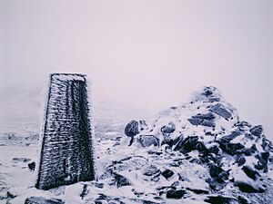
The main ridge has three small peaks. The one in the middle is the highest point. The peak to the south has a special marker called a trig point. This marker helps people measure the height and position of the mountain.

How to Climb Ben Vorlich?
Many mountains have one main path that most people use to climb them. But Ben Vorlich is different! There isn't just one popular way to reach its summit.
Most hikers choose to follow one of the mountain's ridges. You can reach parts of the southern ridge by using a track that leads to Loch Sloy. The Little Hills ridge can be climbed from a place called Ardvorlich, which is right by the loch. If you want to climb the northern ridge, you usually start between Ardlui and Inverarnan.
Getting There
The A82 road and the West Highland railway line run along the eastern side of Ben Vorlich. They follow the shoreline of Loch Lomond. This makes it easier for people to get close to the mountain.
 | Selma Burke |
 | Pauline Powell Burns |
 | Frederick J. Brown |
 | Robert Blackburn |

