Lap Corner, Indiana facts for kids
Quick facts for kids
Lap Corner
|
|
|---|---|
| Country | United States |
| State | Indiana |
| County | Clay |
| Township | Sugar Ridge |
| Elevation | 673 ft (205 m) |
| GNIS feature ID | 437627 |
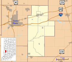
Lap Corner is a small place in Indiana, not officially a town or city. It's known as an "unincorporated community" because it doesn't have its own local government like a city would.
It's located in Clay County, specifically in the northern part of Sugar Ridge Township. You can find it just north of another community called Center Point. Even though it's small, Lap Corner is part of a bigger area called the Terre Haute Metropolitan Statistical Area. This means it's connected to the larger city of Terre Haute for things like jobs and services.
Contents
Understanding Unincorporated Communities
Have you ever wondered what an "unincorporated community" is? It's a group of homes and businesses that aren't part of an official city or town. This means they don't have their own mayor or city council.
How Unincorporated Areas are Governed
Instead of a city government, unincorporated communities like Lap Corner are usually governed by the larger county they are in. For Lap Corner, that's Clay County. The county government handles things like roads, police, and fire services for these areas.
Why Communities Stay Unincorporated
There are many reasons why a community might remain unincorporated. Sometimes, the residents prefer to keep things simple and avoid the extra taxes or rules that come with being a city. Other times, the community might be too small to form its own government.
Geography of Lap Corner
Lap Corner is located at specific geographic coordinates: 39°25′51″N 87°04′18″W / 39.43083°N 87.07167°W. These numbers are like an address for a spot on Earth.
What Do Coordinates Mean?
The numbers 39°25′51″N and 87°04′18″W tell us exactly where Lap Corner is. The "N" stands for North latitude, and the "W" stands for West longitude. These lines help mapmakers and GPS systems pinpoint locations anywhere in the world.
Elevation of Lap Corner
Lap Corner sits at an elevation of 673 feet above sea level. This means it's about 673 feet higher than the average level of the ocean. Knowing the elevation can be important for understanding the local climate and landscape.
Lap Corner's Place in Clay County
Lap Corner is located in Sugar Ridge Township, which is one of the many townships that make up Clay County. Townships are smaller divisions within a county, often used for local administration.
About Clay County, Indiana
Clay County is in the western part of Indiana. It was formed in 1825 and named after Henry Clay, a famous American statesman. The county seat, which is like the main administrative town, is Brazil.
The Terre Haute Metropolitan Area Connection
Lap Corner is part of the Terre Haute Metropolitan Statistical Area. A metropolitan area is a region that includes a large city and its surrounding communities that are closely linked to it. People living in these surrounding areas often commute to the main city for work, shopping, or entertainment.
This connection means that even though Lap Corner is a small, unincorporated community, it benefits from being near a larger city like Terre Haute, which offers more services and opportunities.


