Lardero facts for kids
Quick facts for kids
Lardero
|
||
|---|---|---|
|
Municipality
|
||
|
Lardero
|
||
|
||
| Country | ||
| Autonomous Community | ||
| Province | La Rioja | |
| Comarca | Logroño | |
| Area | ||
| • Total | 20 km2 (8 sq mi) | |
| Elevation
(AMSL)
|
438 m (1,437 ft) | |
| Population
(2018)
|
||
| • Total | 10,193 | |
| • Density | 510/km2 (1,300/sq mi) | |
| Time zone | UTC+1 (CET) | |
| • Summer (DST) | UTC+2 (CEST (GMT +2)) | |
| Postal code |
32890
|
|
| Area code(s) | +34 (Spain) + 941 (La Rioja) | |
| Website | www.aytolardero.org | |
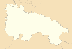
Lardero is a charming town located in the La Rioja region of Spain. It is a municipality, which means it has its own local government. The town is situated in the northern part of Spain.
Contents
Discover Lardero
Lardero is part of the Logroño area. This region is known for its beautiful landscapes. The town itself covers about 20 square kilometers (around 7.7 square miles).
People and Population
As of 2018, Lardero was home to over 10,000 people. The population has grown over the years. This makes Lardero a lively community.
Local Government
Like many towns, Lardero has a mayor who leads the local government. The mayor's name is José Antonio Elguea Nalda. He is part of the PP political party. The local government works to manage the town's services. These services include things like roads and public spaces.
Geography and Location
Lardero is located at an elevation of 438 meters (about 1,437 feet) above sea level. Its coordinates are 42°25′34″N 2°27′41″W. This location places it in a scenic part of La Rioja. The town experiences CET in winter and CEST in summer.
Connecting with Lardero
You can find more information about Lardero online. The town has an official website. It provides details about local events and services. The postal code for Lardero is 32890.
See also
 In Spanish: Lardero para niños
 | James B. Knighten |
 | Azellia White |
 | Willa Brown |


