Las Guijas Mountains facts for kids
Quick facts for kids Las Guijas Mountains |
|
|---|---|
| Highest point | |
| Elevation | 4,665 ft (1,422 m) |
| Dimensions | |
| Length | 11.7 km (7.3 mi) NW-SE |
| Width | 3.7 km (2.3 mi) NE-SW |
| Area | 33 km2 (13 sq mi) |
| Geography | |
| Country | United States |
| State | Arizona |
| Region | Sonoran Desert |
| County | Pima County, Arizona |
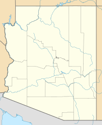
The Las Guijas Mountains are a small group of mountains in southern Pima County, Arizona. They stretch about 12 kilometers (7.5 miles) long and 4 kilometers (2.5 miles) wide. These mountains are surrounded by other ranges like the Cerro Colorado Mountains and the Baboquivari Mountains. The town of Arivaca is close by, to the southeast.
The tallest point in the Las Guijas Mountains is about 4,665 feet (1,422 meters) high. Another high point, Las Guijas Peak, is almost as tall, at 4,650 feet (1,417 meters).
What's in a Name?
The name Las Guijas comes from Spanish miners who worked in the area in the 1800s. Las guijas means "the rubble" or "the pebbles." This name was used because the gold they found was mixed in with gravel and rocks in the stream valleys.
Mountain Geology
The Las Guijas Mountains are made of different types of rock. On the southwest side, you can find a layer of rock up to 980 feet (300 meters) thick. This rock is called tuff of Pajarito and formed from volcanic ash during the Jurassic period. It came from a large volcanic area called the Cobre Ridge Cauldera.
On the northeast side of the mountains, there is a type of granite rock. This granite also formed during the Jurassic period, when hot, melted rock cooled slowly underground.
 | DeHart Hubbard |
 | Wilma Rudolph |
 | Jesse Owens |
 | Jackie Joyner-Kersee |
 | Major Taylor |


