Cerro Colorado Mountains facts for kids
Quick facts for kids Cerro Colorado Mountains |
|
|---|---|
| Highest point | |
| Peak | Colorado Peak |
| Elevation | 5,319 ft (1,621 m) |
| Dimensions | |
| Length | 6.8 km (4.2 mi) NNW |
| Width | 4.0 km (2.5 mi) NNE |
| Area | 21 km2 (8.1 sq mi) |
| Geography | |
| Country | United States |
| State | Arizona |
| Region | Sonoran Desert |
| County | Pima County |
| Borders on | Sierrita Mountains and Las Guijas Mountains |
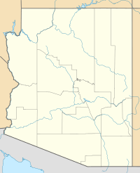
The Cerro Colorado Mountains are a small mountain range in southern Pima County, Arizona, USA. The highest point in these mountains is called Colorado Peak. It stands about 5,319 feet (1,621 meters) tall. These mountains are shaped like a long ridge running from north-northwest to south-southeast. They also have shorter ridges that extend out to the east-northeast.
Contents
About the Cerro Colorado Mountains
The higher parts of the Cerro Colorado Mountains cover an area of about 21 square kilometers (8 square miles). They are about 6.8 kilometers (4.2 miles) long and 4.0 kilometers (2.5 miles) wide.
Where are they located?
The Cerro Colorado Mountains are surrounded by other interesting places.
- The foothills of the Sierrita Mountains are about 7 miles (11 km) to the north.
- The Batamote Hills and Penitas Hills are also nearby, to the north and northwest.
- The Las Guijas Mountains are about 12 kilometers (7.5 miles) to the southwest.
- The Sierra Colorado silver mining area is located in the hills between these mountains and the Las Guijas range.
- Saucito Mountain, which is part of the Tumacacori Mountains, is about 11 kilometers (6.8 miles) southeast.
- Arivaca Junction is about 17.5 kilometers (10.9 miles) directly east, in the Santa Cruz River valley.
- The Santa Rita Mountains are across the Santa Cruz Valley to the east.
- The wide Altar Valley is about 15 kilometers (9.3 miles) to the west. Beyond it are the Baboquivari Mountains.
A road called Arivaca Road runs through the valley southeast of the Cerro Colorado Mountains. This road connects Arivaca Junction in the east with Arivaca in the southwest.
The Cerro Colorado Mine
The Cerro Colorado Mine is also known as the Heintzelman Mine or Silver Queen Mine. Spanish explorers first found this mine around 1750. It was actively mining for valuable metals from 1856 to 1884. It then operated again from 1901 to 1937.
What was mined there?
Early mining at Cerro Colorado was done by the Sonora Exploration & Mining Company. This company was owned by famous people like Charles Poston and Samuel Colt. They mined about 3,000 tons of ore from the mine. This ore contained a lot of valuable metals:
- About 100 ounces of silver per ton.
- About 0.1 ounces of gold per ton.
- Smaller amounts of lead and copper.
The best ore ever found at the mine had over 12,000 ounces of silver per ton! In 1859, the average ore had about 770 ounces of silver per ton. Since that year, the average has been around 225 ounces of silver per ton. Miners dug for ore up to 350 feet deep.
 | Emma Amos |
 | Edward Mitchell Bannister |
 | Larry D. Alexander |
 | Ernie Barnes |


