Arivaca, Arizona facts for kids
Quick facts for kids
Arivaca, Arizona
|
|
|---|---|
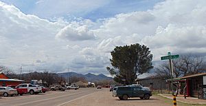
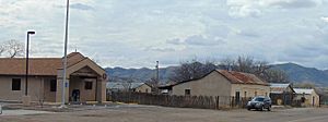
Arivaca, facing west down Main Street, 2015
|
|
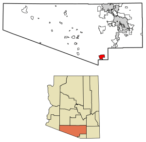
Location of Arivaca in Pima County, Arizona.
|
|
| Country | United States |
| State | Arizona |
| County | Pima |
| Area | |
| • Total | 27.78 sq mi (71.94 km2) |
| • Land | 27.78 sq mi (71.94 km2) |
| • Water | 0.00 sq mi (0.00 km2) |
| Elevation | 3,643 ft (1,110 m) |
| Population
(2020)
|
|
| • Total | 623 |
| • Density | 22.43/sq mi (8.66/km2) |
| Time zone | MST (no DST) |
| FIPS code | 04-03320 |
Arivaca (in the O'odham language: Ali Wa:pk) is a small community in Pima County, Arizona, United States. It is not officially a city or town. Arivaca is about 11 miles (18 km) north of the Mexican border. It is also about 35 miles (56 km) northwest of Nogales, a border crossing point.
People from Europe first settled in this area around 1695. However, the community of Arivaca itself was started in 1878. Arivaca uses the ZIP code 85601. In 2020, about 623 people lived in Arivaca.
Contents
Arivaca's Story: A Look Back
How Arivaca Began
The very early history of Arivaca is not fully clear. It was likely a village for the Pima or Tohono O'odham tribes. This village was probably left empty after a revolt in 1751. Later, Spanish settlers started small mines in the area.
In 1833, a large piece of land, about 8,677 acres (35 km²), was approved as a Mexican land grant. This land became known as the La Aribac ranch. The name "Aribac" comes from a Pima word meaning "small springs." In 1856, Charles Poston bought this ranch. Mining operations for the Heintzelman Mine were then set up in Arivaca.
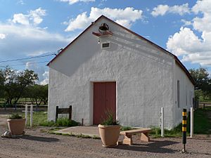
The U.S. Post Office opened in Arivaca on April 10, 1878. Noah W. Bernard was the first Postmaster. The post office is still open today with ZIP code 85601. Pedro Aguirre, who was a freighter and rancher, created a stop for stagecoaches in Arivaca. He also owned the Buenos Aires Ranch. In 1879, he built the historic Arivaca Schoolhouse. This schoolhouse was added to the National Register of Historic Places in 2012. It is the oldest school building still standing in Arizona.
During the Mexican Revolution, Arivaca was a camp for several United States Cavalry units. These included the Connecticut National Guard (1916), the Utah Cavalry (1917), and the 10th Cavalry (1917–1920).
Mining in Arivaca
The Arivaca mining district has over 100 old mines. These mines are found in the Las Guijas Mountains to the northwest, the San Luis Mountains to the southwest, and Cobre Ridge to the southeast of the town. People have mined Gold, silver, lead, copper, and tungsten here. Mining started during the Spanish colonial times and continued off and on until the 1950s.
Arivaca Today
Arivaca was a very small place for a long time. In 1960, only 26 people lived there. Power lines from Trico Electric Cooperative arrived in 1956. This helped the area grow. In 1972, the Arivaca Ranch sold 11,000 acres (45 km²) to a developer. This land was divided into smaller plots of 40 acres (16 ha) each. Four years later, the dirt road to Arivaca was paved.
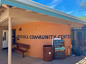
In the 1980s and 1990s, many new people moved to Arivaca. The community grew and added important services. These included a medical clinic, a fire department, an arts council, a human resource office, a community center, and a branch of the Pima County Public Library.
In 2012, the Arivaca Schoolhouse was recognized as a historic place. An old nursing home was turned into the Arivaca Action Center. This center focuses on education, arts, wellness, and helping the community. It offers space for meetings, guests, gardening, and physical therapy.
Border Area and Community Efforts
Arivaca is located near the U.S.-Mexico border. This area is sometimes used by people seeking asylum or trying to cross the border. Because of this, there have been efforts to use technology to secure the border. One project, called Project 28, tested towers with radar and cameras. These towers would send information to Border Patrol.
Community groups like No More Deaths have been active in Arivaca since 2004. They work to help migrants and refugees in the desert. As of 2014, there was a U.S. Border Patrol checkpoint in the town. This checkpoint is a place where Border Patrol agents check vehicles.
Arivaca's Location and Weather
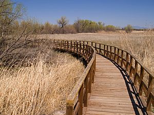
The community of Arivaca is on the north side of the Arivaca Creek valley. It is about 3,643 feet (1,110 meters) above sea level. The Las Guijas Mountains are to the northwest. The foothills of the San Luis Mountains are to the south. A part of the Buenos Aires National Wildlife Refuge is located in the Arivaca Creek valley, southeast of the town.
Climate in Arivaca
Arivaca has a semi-arid climate. This means it is generally dry, but not a true desert. It gets some rain, but not a lot.
Population of Arivaca
| Historical population | |||
|---|---|---|---|
| Census | Pop. | %± | |
| 1860 | 61 | — | |
| 1890 | 236 | — | |
| 1910 | 2,480 | — | |
| 1920 | 596 | −76.0% | |
| 1930 | 539 | −9.6% | |
| 2010 | 695 | — | |
| 2020 | 623 | −10.4% | |
| U.S. Decennial Census | |||
Arivaca first appeared on the U.S. Census in 1860. It was called "Aravica Mines" then. At that time, 61 people lived there. It did not appear on the 1900 census. Later, it was listed as the "Arivaca Precinct" from 1910 to 1930. This included the area around the village. In 2010, Arivaca was made a census-designated place (CDP). This means it's a special area for census counting.
Learning in Arivaca
Children in Arivaca go to Sopori Elementary School and Sahuarita Middle School. For high school, they attend Sahuarita High School. All these schools are part of the Sahuarita Unified School District.
What Arivaca Does for Business
In 2011, people in the community started a group called Arivaca Alive. Their goal was to bring more visitors to the community. This helps local businesses. They also wanted to show visitors what Arivaca is like. The group started "First Saturdays in Arivaca" with different themes each month.
In 2013, Arivaca Alive began to promote Arivaca as a weekend travel spot. They focused on eco tourism attractions. These include:
- Birdwatching
- Hiking
- Boating
- Gardening
- Exploring old "ghost towns"
The group also works to publicize other events throughout the year. These include Dia de los Muertos, the Arivaca Memories & Music Festival, the Arivaca Film Festival, Cinco de Mayo, and the Fourth of July Parade.
Getting Around Arivaca
Arivaca Road connects the community to I-19 at Amado. This is about 23 miles (37 km) northeast. The road also connects to Arizona State Route 286. This route is about 12 miles (19 km) west in Altar Valley.
See also
 In Spanish: Arivaca (Arizona) para niños
 | Jackie Robinson |
 | Jack Johnson |
 | Althea Gibson |
 | Arthur Ashe |
 | Muhammad Ali |


