Tumacacori Mountains facts for kids
Quick facts for kids Tumacacori Mountains |
|
|---|---|

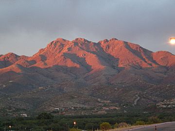
Sunset on the Tumacacori Mountains, June 2008
|
|
| Highest point | |
| Peak | Unnamed peak |
| Geography | |
| Country | United States |
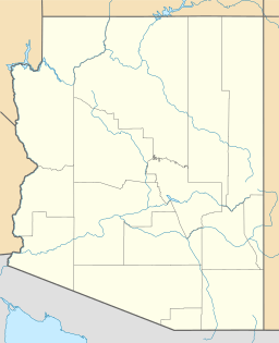
| State | Arizona |
| Region | Sonoran Desert (N & NE) |
The Tumacacori Mountains are a cool mountain range in southern Arizona, USA. They stretch across Santa Cruz and Pima counties. The tallest spot in these mountains is a peak that doesn't have a name, reaching about 5,736 feet (1,748 meters) high!
Exploring the Tumacacori Highlands
The Tumacacori Highlands are a group of mountains all connected together. You can find them in the western part of Santa Cruz County. They are northwest of a town called Nogales. To their east is the Santa Cruz River Valley. A big road, Interstate 19, runs through this valley.
Across the valley to the east, you can see the tall Santa Rita Mountains. There are also the smaller San Cayetano Mountains right next to Nogales. The Tumacacori Highlands stretch from north to south. Here are the main parts you would find if you traveled through them:
- Tumacacori Mountains
- Peck Canyon – This is a canyon with a road called Peck Canyon Road.
- Atascosa Mountains – These mountains are about 6 by 9 miles in size.
- Ruby Road – This road leads to Ruby, Arizona. You can also find Pena Blanca Lake here.
- Pajarito Mountains
- Mexico-Arizona border
- Sierra La Esmeralda – This name means "the Emerald Mountains."
There's a part of Santa Cruz County that sticks out like a "bootheel" to the southwest. This area has a place called Cobre Ridge. It connects to a smaller range called the San Luis Mountains to the northwest. These mountains are in the southeast part of the Altar Valley and border the Buenos Aires National Wildlife Refuge.
At the southeastern base of the Tumacacori Mountains, you'll find historical mission communities. These are part of the Tumacacori National Historical Park in Tumacacori.
 | Selma Burke |
 | Pauline Powell Burns |
 | Frederick J. Brown |
 | Robert Blackburn |


