Atascosa Mountains facts for kids
Quick facts for kids Atascosa Mountains |
|
|---|---|

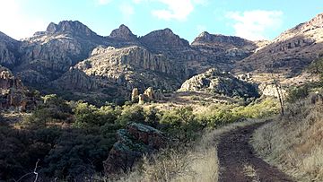
Rock Corral Canyon in the Atascosa Mountains, December 2013
|
|
| Highest point | |
| Peak | Atascosa Peak |
| Elevation | 6,440 ft (1,960 m) |
| Dimensions | |
| Length | 6 mi (9.7 km) N-S & E-W |
| Width | 6 mi (9.7 km) |
| Geography | |
| Country | United States |
| State | Arizona |
| Region | Sonoran Desert (N & NE) |
| Borders on |
|
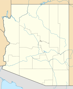
The Atascosa Mountains are a mountain range in Arizona, United States. They are located in the western part of Santa Cruz County. These mountains sit between the larger Tumacacori Mountains to the north and the smaller Pajarito Mountains to the south. The Pajarito Mountains are right on the border with Mexico, next to the Sierra La Esmeralda range in Sonora, Mexico.
About the Atascosa Mountains
The Atascosa Mountains are part of a larger area called the Tumacacori Highlands. The Pajarito Mountains are also part of these highlands.
The tallest point in the Atascosa Mountains is Atascosa Peak. It stands at 6,440 feet (1,963 meters) high. Close by, to the northeast, is Ramanote Peak, which is 6,047 feet (1,843 meters) tall.
Peña Blanca Lake is near the southern edge of the Atascosa Mountains. This lake is fed by Calabasas Canyon, which eventually flows into the Santa Cruz River. Ruby Road goes past the western side of the Atascosa Mountains. Peck Canyon Road borders the northern part and helps people reach the higher areas in the middle and north of the mountains.
The Tumacacori Highlands
The Tumacacori Highlands are a group of connected mountain ranges. They are found in the western part of Santa Cruz County. These highlands are located northwest of Nogales. To the east, they are bordered by the Santa Cruz River Valley. Interstate 19 runs north and south through this valley.
Across the valley to the east, you can see the tall Santa Rita Mountains. Closer to Nogales, to the northeast, are the smaller San Cayetano Mountains.
The mountain ranges in the Tumacacori Highlands are connected in a line from north to south:
- Tumacacori Mountains
- Peck Canyon (where Peck Canyon Road is)
- Atascosa Mountains (about 6 miles by 9 miles in size)
- Ruby Road (which leads to Ruby, Arizona) and Peña Blanca Lake
- Pajarito Mountains
- The Mexico-Arizona border
- Sierra La Esmeralda (also known as the Emerald Mountains)
A small part of Santa Cruz County, shaped like a "bootheel," extends to the southwest. This area includes Cobre Ridge. It is connected to the northwest by a small range called the San Luis Mountains. These mountains are in the southeast of the Altar Valley and are next to the Buenos Aires National Wildlife Refuge.
Historical mission communities are located at the base of the Tumacacori Mountains. You can find them at Tumacácori National Historical Park in Tumacacori.
See also
 In Spanish: Sierra Atascosa para niños
 | Georgia Louise Harris Brown |
 | Julian Abele |
 | Norma Merrick Sklarek |
 | William Sidney Pittman |


