Lee Valley Lake facts for kids
Quick facts for kids Lee Valley Lake |
|
|---|---|
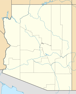
| Location | Apache County, Arizona |
| Coordinates | 33°56′28.40″N 109°30′3.24″W / 33.9412222°N 109.5009000°W |
| Type | Reservoir |
| Basin countries | United States |
| Surface area | 35 acres (14 ha) |
| Average depth | 10 ft (3.0 m) |
| Max. depth | 20 ft (6.1 m) |
| Surface elevation | 9,420 ft (2,870 m) |
Lee Valley Lake is a special place in Arizona. It's the highest lake in the state! It sits super high up, at about 9,420 feet (2,871 meters) above sea level. You can find it in the beautiful Apache–Sitgreaves National Forests, close to Mount Baldy.
The lake is about 35 miles from a town called Pinetop-Lakeside. You can get there by following Arizona highways 260 and 273, then forest road 113. In winter, usually from December to early April, the roads get covered in snow. This means you can't easily reach the lake during those months.
About Lee Valley Lake
Lee Valley Lake is a man-made lake, also known as a reservoir. It covers about 35 acres (14 hectares) of water. The deepest part of the lake is about 20 feet (6 meters), and its average depth is around 10 feet (3 meters).
The lake is located on Lee Valley Creek. This creek is very important because it's a special place for the Apache trout to recover. The Apache trout is the official state fish of Arizona!
Normally, the creek's water flows into the East Fork of the Little Colorado River. But the lake has a special overflow area called a spillway. This spillway sends extra water to the West Fork of the Little Colorado River. Both the East and West Forks are also important for Apache trout recovery. This means Lee Valley Lake is right in the middle of three key areas for helping the Apache trout thrive.
Fish Species in the Lake
Lee Valley Lake is a great spot for fishing! It's home to two main types of fish:
- Apache trout (This fish is considered threatened, meaning its numbers are low and it needs protection.)
- Arctic grayling (These fish were brought here from other places.)
 | Sharif Bey |
 | Hale Woodruff |
 | Richmond Barthé |
 | Purvis Young |


