Leeuwarderadeel facts for kids
Quick facts for kids
Leeuwarderadeel
Ljouwerteradiel
|
|||
|---|---|---|---|

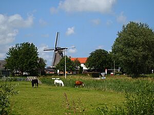
Wind mill in Leeuwarderadeel
|
|||
|
|||

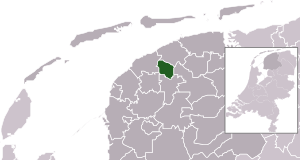
Location in Friesland
|
|||
| Country | Netherlands | ||
| Province | Friesland | ||
| Merged | 2018 | ||
| Area | |||
| • Total | 41.46 km2 (16.01 sq mi) | ||
| • Land | 40.91 km2 (15.80 sq mi) | ||
| • Water | 0.55 km2 (0.21 sq mi) | ||
| Elevation | 1 m (3 ft) | ||
| Highest elevation | 1.7 m (5.6 ft) | ||
| Lowest elevation | 0.6 m (2.0 ft) | ||
| Population
(May 2014)
|
|||
| • Total | 10,264 | ||
| • Density | 251/km2 (650/sq mi) | ||
| Time zone | UTC+1 (CET) | ||
| • Summer (DST) | UTC+2 (CEST) | ||
| Postcode |
9050–9057 9071–9072
|
||
| Area code | 0518, 058 | ||
Leeuwarderadeel was a special place in the northern Netherlands. It used to be a municipality, which is like a local government area. Its main town, or capital, was called Stiens.
Leeuwarderadeel was located in the province of Friesland. This area is known for its flat landscapes and many waterways.
Contents
A Look Back: History of Leeuwarderadeel
Leeuwarderadeel was an independent municipality for a very long time. However, things changed on January 1, 2018. On that day, Leeuwarderadeel joined with the larger municipality of Leeuwarden. This means it is no longer a separate municipality.
Exploring Leeuwarderadeel's Villages
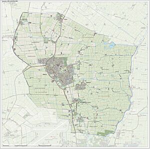
Even though Leeuwarderadeel is no longer a separate municipality, the villages that were once part of it still exist. These communities are home to many people. Here are some of the main villages that were in Leeuwarderadeel:
- Bartlehiem
- Britsum
- Cornjum
- Finkum
- Hijum
- Jelsum
- Oude Leije
- Stiens
The Landscape of Leeuwarderadeel
The area where Leeuwarderadeel was located has a typical Dutch landscape. It is mostly flat, with some parts even below sea level. There are many canals and ditches that help manage the water. The highest point in the area is about 1.7 meters (5.6 feet) above sea level, and the lowest is about 0.6 meters (2 feet) above sea level.
See also
 In Spanish: Leeuwarderadeel para niños
 | Janet Taylor Pickett |
 | Synthia Saint James |
 | Howardena Pindell |
 | Faith Ringgold |


