
Left Hand, West Virginia facts for kids
Quick facts for kids
Left Hand
|
|
|---|---|

Left Hand WV Post Office
|
|

Left Hand
Location in West Virginia

Left Hand
Location in the United States
|
|
| Country | United States |
| State | West Virginia |
| County | Roane |
| Elevation | 728 ft (222 m) |
| Population
(2009)
|
|
| • Total | 390 [1] |
| Time zone | UTC-5 (Eastern (EST)) |
| • Summer (DST) | UTC-4 (EDT) |
| ZIP codes |
25251
|
| GNIS feature ID | 1541751 |
Left Hand is a small place in West Virginia, United States. It is known as an unincorporated community. This means it is a group of homes and businesses that does not have its own local government. Instead, it is part of the larger Roane County.
Left Hand is located in the southeastern part of Roane County. It sits along West Virginia Route 36. The community is southeast of Spencer, which is the main town of Roane County. Left Hand even has its own post office, which is still open today. The community got its name from a nearby stream called Lefthand Run creek.
Learning in Left Hand
Left Hand is home to a school that serves local students. This school is called "Geary Elementary/Middle School." It provides education for children in both elementary and middle school grades.
Images for kids
-
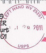
A postmark from Left Hand, West Virginia.

