Legore Lake facts for kids
Quick facts for kids LeGore Lake |
|
|---|---|
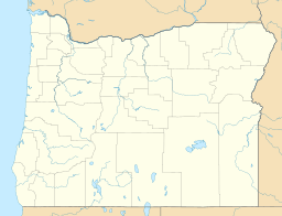
| Location | Eagle Cap Wilderness, Wallowa County, Oregon, US |
| Coordinates | 45°18′35″N 117°20′48″W / 45.3096°N 117.3466°W |
| Type | Tarn |
| Primary outflows | Falls Creek |
| Basin countries | United States |
| Max. length | 193 yards (176 m) |
| Max. width | 124 yards (113 m) |
| Surface elevation | 8,950 ft (2,730 m) |
LeGore Lake is a special kind of mountain lake called a tarn. It is found high up in the Eagle Cap Wilderness in northeastern Oregon, United States. This beautiful lake holds a record: it is the highest true lake in Oregon! It sits at an amazing elevation of 8,950 feet (2,730 m) above sea level.
LeGore Lake is located close to some tall mountains known as Twin Peaks. Getting to the lake is an adventure itself. You can reach it by following a challenging 4-mile (6.4 km) hiking trail. This trail climbs about 4,000 feet (1,219 m) in elevation. Along the way, hikers pass by the old LeGore mine, which is how the lake got its name.
Contents
What is a Tarn Lake?
A tarn is a lake that forms in a cirque. A cirque is a bowl-shaped hollow. This hollow is carved out by a glacier high up in the mountains. When the glacier melts, it leaves behind a natural basin. This basin then fills with water, creating a tarn.
Tarns are often found in areas that were once covered by glaciers. They are usually very clear and cold. LeGore Lake is a perfect example of this type of lake.
Location and Surroundings
LeGore Lake is located in the Wallowa Mountains of northeastern Oregon. These mountains are part of the larger Blue Mountains range. The lake is within the Eagle Cap Wilderness. This is a protected area where nature is kept wild.
The wilderness area is known for its rugged peaks and clear alpine lakes. It offers stunning views and a chance to experience nature. The area around LeGore Lake is very remote. This means it is far from towns and cities.
The LeGore Mine
The lake is named after the LeGore mine. This mine was likely an old mining operation. It would have been used to extract valuable minerals from the earth. Mines like this were common in the past. They helped people find resources.
Today, the mine is part of the hiking trail. It serves as a historical landmark. It reminds visitors of the area's past.
Reaching the Lake
The hike to LeGore Lake is quite challenging. It is a 4-mile (6.4 km) trail. The trail gains a lot of elevation. This means it goes uphill for most of the way. Hikers need to be prepared for a steep climb.
Despite the difficulty, the views along the trail are rewarding. Hikers pass through forests and open areas. They can see amazing mountain scenery. Reaching the lake feels like a great accomplishment.
Activities at LeGore Lake
LeGore Lake is a popular spot for outdoor activities. Many people visit for hiking and exploring. The clear, cold water is inviting. However, swimming might be very chilly!
The area is perfect for nature lovers. Visitors can enjoy the peace and quiet of the wilderness. It's a great place for photography. You can capture the beauty of the lake and the mountains.
Protecting the Wilderness
Because LeGore Lake is in a wilderness area, it is important to protect it. Visitors should follow "Leave No Trace" principles. This means packing out all trash. It also means staying on marked trails.
Protecting these natural places helps keep them beautiful. It ensures that future generations can also enjoy them. The Eagle Cap Wilderness is a special place. LeGore Lake is one of its hidden gems.
 | Georgia Louise Harris Brown |
 | Julian Abele |
 | Norma Merrick Sklarek |
 | William Sidney Pittman |


