Leto, Florida facts for kids
Quick facts for kids
Leto, Florida
|
|
|---|---|
| Country | United States |
| State | Florida |
| County | Hillsborough |
| Time zone | UTC-5 (Eastern (EST)) |
| • Summer (DST) | UTC-4 (EDT) |
| ZIP code |
33614
|
| Area code(s) | 813 |
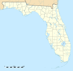
Leto is a community located in northwestern Hillsborough County, Florida, in the United States. It is an "unincorporated community," which means it is not officially part of a city or town.
Leto is part of a larger area called Egypt Lake-Leto. This area is known as a "census-designated place" (CDP). A CDP is a special area that the government defines just for counting people during the census. From 1970 to 1990, Leto was its own separate CDP. For a short time in 1990, it was even called West Park. In 1990, about 10,347 people lived in Leto.
Where is Leto Located?
Leto is found about five miles northwest of Tampa. Its exact location is around 28 degrees north and 82.5 degrees west. The land in Leto is about 45 feet above sea level.
Leto shares its borders with several other places:
- To the south, you'll find Tampa International Airport.
- To the east is Egypt Lake.
- To the north is Carrollwood.
- To the west is Town 'n' Country.
Main Roads in Leto
Getting around Leto is easy with these major roads:
- Dale Mabry Highway
- Waters Avenue
- Lambright Street
Schools in Leto
The schools in Leto are part of the Hillsborough County Schools system. A big school called Leto High School is located right within the community.
Quick Facts About Leto
- The ZIP code for Leto is 33614.
- Here's how the population has changed over the years:
- 1970: 8,458 people
- 1980: 9,003 people
- 1990: 10,347 people


