Liggett, Indiana facts for kids
Quick facts for kids
Liggett, Indiana
|
|
|---|---|

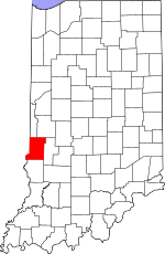
Vigo County's location in Indiana
|
|
| Country | United States |
| State | Indiana |
| County | Vigo |
| Township | Sugar Creek |
| Elevation | 512 ft (156 m) |
| Time zone | UTC-5 (Eastern (EST)) |
| • Summer (DST) | UTC-4 (EDT) |
| ZIP code |
47885
|
| Area code(s) | 812, 930 |
| GNIS feature ID | 437878 |
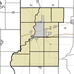
Liggett is a small, quiet place located in Vigo County, Indiana. It's known as an "unincorporated community." This means it's a group of homes and buildings that doesn't have its own local government, like a city or town would. Instead, it's managed by the larger Sugar Creek Township. Liggett is also part of the Terre Haute metropolitan area, which means it's close to the bigger city of Terre Haute and shares some of its services and economy.
A Glimpse into Liggett's Past
The community of Liggett probably got its name from the Liggett family. They were some of the very first people to settle in this area a long time ago.
Where is Liggett?
Liggett is located in a specific spot in Indiana. You can find it at these coordinates: 39°28′45″N 87°29′01″W / 39.47917°N 87.48361°W. This tells you its exact position on a map. The area is about 512 feet (or 156 meters) above sea level. This measurement is called its elevation.
 | Sharif Bey |
 | Hale Woodruff |
 | Richmond Barthé |
 | Purvis Young |


