
Lime City, Ohio facts for kids
Quick facts for kids
Lime City, Ohio
|
|
|---|---|

Lime City, Ohio
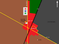
Location in Ohio

Lime City, Ohio
Location in the United States
|
|
| Country | United States |
| State | Ohio |
| County | Wood |
| Elevation | 646 ft (197 m) |
| Time zone | UTC-5 (Eastern (EST)) |
| • Summer (DST) | UTC-4 (EDT) |
| Area code(s) | 419 and 567 |
| GNIS feature ID | 1064997 |
Lime City is a small community located in Wood County, Ohio, in the United States. It's called an "unincorporated community" because it doesn't have its own local government, like a city or a village. Instead, it's part of a larger area called Perrysburg Township.
Lime City is found where Lime City Road meets U.S. Route 20, which is also known as Fremont Pike. Even though it doesn't have its own post office, Lime City uses the same zip code, 43551, as the nearby city of Perrysburg.
History of Lime City
Lime City was officially planned and marked out on a map in 1887. It got its name because of the important local industry that produced "lime". Lime is a material used in building and farming.
This community even had its own post office for many years. The Lime City post office was open from 1874 until 1953.
Education in Lime City
Students from Lime City attend schools that are part of the Rossford Exempted Village School District. There used to be a school right in Lime City called Lime City Elementary.
Today, younger students from the Lime City area attend Glenwood Elementary. This school was once a "sister" school to the old Lime City Elementary. Glenwood Elementary serves students from Pre-Kindergarten through 2nd grade.
Images for kids
-
General vicinity of Lime City, Ohio

