List of Michigan State Historic Sites in Alger County facts for kids
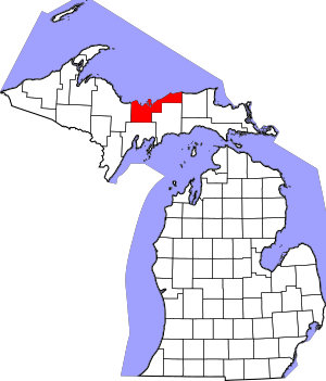
Welcome to Alger County, Michigan! This area is full of amazing places that tell stories about the past. These special spots are called Michigan State Historic Sites. They are important because they help us learn about Michigan's history. Some of these sites are also listed on the National Register of Historic Places, which means they are important to the history of the whole country!
Contents
- Cool Historic Places in Alger County
- Au Sable Light Station: A Guiding Light
- Bay Furnace: Where Iron Was Made
- First National Bank and Post Office: A Busy Corner
- Grand Island: An Island of History
- Grand Marais: A Town with a Story
- Lobb House: A Home from the Past
- Mikulich General Store: The Heart of the Community
- Pacific Hotel: A Place to Stay
- Paulson House: A Quiet Retreat
- Pictured Rocks: Nature's Art Gallery
- Other Historic Places in Alger County
- See also
Cool Historic Places in Alger County
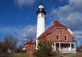
Au Sable Light Station: A Guiding Light
Imagine a tall tower helping ships find their way in the dark! That's what the Au Sable Light Station did. This historic lighthouse is located about 7 miles west of Grand Marais, right on Au Sable Point. It was built to guide boats safely along the shores of Lake Superior. It's a beautiful spot to visit and learn about how lighthouses worked long ago.
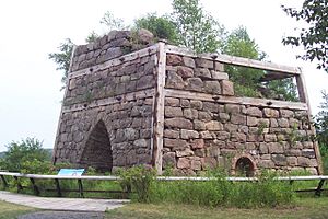
Bay Furnace: Where Iron Was Made
The Bay Furnace is a cool place to see what's left of an old iron-making factory. It's located northwest of Christmas, in the Hiawatha National Forest. Back in the day, this furnace was used to turn iron ore into pig iron, which was a big part of Michigan's early industry. It's a reminder of the hard work and innovation from the past.
First National Bank and Post Office: A Busy Corner
In the heart of Munising, you'll find the old First National Bank and Post Office building. This building was once a very busy place where people handled their money and sent their mail. It shows us what everyday life was like in Munising many years ago.
Grand Island: An Island of History
Grand Island is a large island located in Munising Bay on Lake Superior. This island is not just beautiful with its forests and cliffs, but it's also packed with history. Native Americans lived here for thousands of years, and later, it became a place for early settlers and loggers. Today, it's a National Recreation Area where you can explore nature and history.
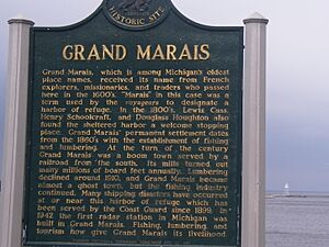
Grand Marais: A Town with a Story
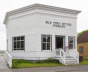
The town of Grand Marais itself is considered a historic place! There's an informational marker at Bay Shore Park that tells you all about its past. Grand Marais was an important fishing and logging town on Lake Superior. The Grand Marais Post Office Building is another historic spot in town, showing how important communication was in the past.
Lobb House: A Home from the Past
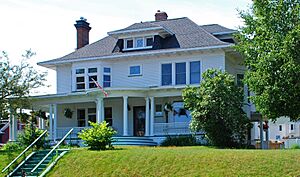
The Lobb House is an old home located in Munising. It's a great example of the kind of houses people lived in long ago. Looking at historic homes like this helps us understand how families lived and what their lives were like in earlier times.
Mikulich General Store: The Heart of the Community
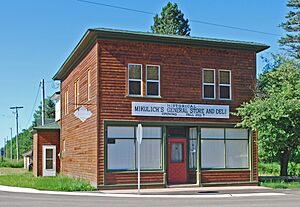
The Mikulich General Store in Traunik was more than just a place to buy groceries. General stores like this were the center of small communities. People would come here not only for supplies but also to catch up on news and socialize. It was a vital part of daily life for many years.
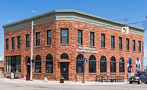
Pacific Hotel: A Place to Stay
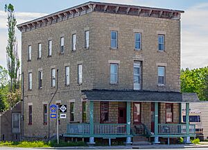
The Pacific Hotel in Chatham was once a busy hotel, offering a place for travelers and locals to stay. Hotels like this played a big role in the growth of towns, providing comfort and services to people passing through or working in the area.
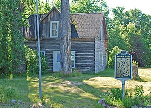
Paulson House: A Quiet Retreat
The Paulson House is located south of Au Train, nestled in the Hiawatha National Forest. This historic house gives us a glimpse into the lives of people who lived in more remote, natural settings. It's a peaceful spot that connects us to the past.
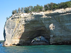
Pictured Rocks: Nature's Art Gallery
While not a building, the Pictured Rocks along Lake Superior are a truly historic and natural wonder. Located east of Munising, these colorful sandstone cliffs have been shaped by wind and water over thousands of years. They are a breathtaking example of nature's artistry and have been important to Native Americans and early explorers for centuries.
Other Historic Places in Alger County
Alger County has many other interesting historic sites that tell us about its past. These include:
- The American Fur Company Log Cabin No. 3 in Munising, which reminds us of the early fur trade.
- The Burt and Gamble Railway Grade near Grand Marais, showing where old train tracks once ran.
- The Curtis and Miller Cook Sawmill near Grand Marais, a reminder of the logging industry.
- An informational marker about Lake Superior itself, located west of Munising, highlighting the importance of this Great Lake.
- The Tyoga Historical Pathway near Deerton, which marks an old trail or route.
These places, even if they are just remnants or markers, help us piece together the rich history of Alger County.
See also


