
National Register of Historic Places listings in Sacramento County, California facts for kids


Welcome to Sacramento County, California! This area is full of amazing historic places that tell us stories about the past. Many of these special spots are listed on the National Register of Historic Places. Think of it like a Hall of Fame for buildings, neighborhoods, and other important sites across the United States.
There are 108 places in Sacramento County that are on this list. Six of them are even more special and are called National Historic Landmarks. These landmarks are considered super important to the history of the entire country!
Contents
What is the National Register?
The National Register of Historic Places is the official list of places in the United States that are worth saving. These places could be buildings, structures, objects, sites, or even entire neighborhoods. They are chosen because they have a special meaning in American history, architecture, archaeology, engineering, or culture.
When a place is added to the National Register, it means it's recognized for its importance. This can help protect it and sometimes even provide money for its upkeep. A National Historic Landmark is an even higher honor, given to places that are truly outstanding and important to the whole nation's history.
Historic Places in Sacramento County
Sacramento County has a rich history, from the Gold Rush days to modern times. Let's explore some of the cool places that have been preserved!
Famous Landmarks
Sacramento County is home to six National Historic Landmarks. These are places that have played a big role in the story of the United States.

Built in 1895, this powerhouse was a huge deal! It was one of the first places to send electricity over long distances using alternating current (AC). This power helped light up Sacramento and even ran its streetcars. It was a big step forward in how we use electricity.

Locke is a unique town built by and for Chinese immigrants in the early 1900s. It's the only town in the United States built exclusively by Chinese people for their own community. Walking through Locke feels like stepping back in time, showing an important part of California's history.
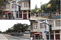
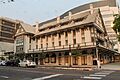
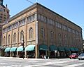
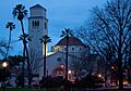
This area was the heart of Sacramento during the Gold Rush. It was a busy port where steamboats arrived, and it was the western end of the Pony Express and the first transcontinental railroad. Today, it's a lively area with historic buildings, shops, and restaurants, showing what life was like in the 1800s.
.jpg)
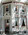
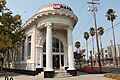
Located in the B. F. Hastings Bank Building in Old Sacramento, this was the very last stop for the famous Pony Express riders. The Pony Express was a super-fast mail service that used horseback riders to deliver letters across the country before telegraphs were common.
.jpg)
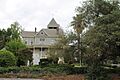
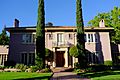
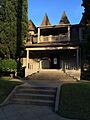
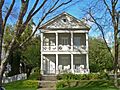
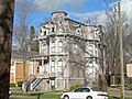
This grand mansion was once the home of Leland Stanford, a very important person in California history. He was a governor, a U.S. Senator, a railroad builder (one of the "Big Four" who built the first transcontinental railroad), and he founded Stanford University. The house is now a state park and looks amazing after being restored.

Built in 1839 by John Sutter, this fort was a trading post and agricultural colony before the Gold Rush. It was one of the first European settlements in California's Central Valley and played a key role in the early history of the state. It's now a state historic park where you can learn about pioneer life.
Other Cool Historic Spots
Beyond the National Historic Landmarks, many other places in Sacramento County are on the National Register. Each has its own unique story!
Buildings with a Story

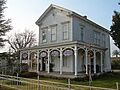
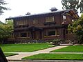
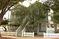
This beautiful mansion, built in 1877, served as the official home for California's governors from 1903 to 1967. It's a great example of Victorian architecture and has seen many important people pass through its doors.

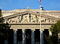
The California State Capitol building is where the state's government works. It's a grand building with a dome, similar to the U.S. Capitol in Washington D.C. It was completed in 1874 and is a symbol of California's government and history.

The E. B. Crocker Art Gallery, now part of the Crocker Art Museum, was built in the 1870s. It's one of the oldest art museums in the Western United States and holds an amazing collection of art.

The Delta King is a historic steamboat that used to carry passengers between Sacramento and San Francisco. It was built in 1927 and is now a floating hotel, restaurant, and theater in Old Sacramento.
- I Street Bridge
.jpg)
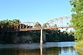
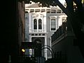
This bridge, built in 1911, is special because it has a rotating section that can swing open to let boats pass through. It connects Sacramento with West Sacramento and is an important part of the city's transportation history.

This historic train station, built in 1926, was a major hub for the Southern Pacific Railroad. It's a beautiful building that reminds us of the golden age of train travel and Sacramento's role as a railroad center.

The Tower Bridge, completed in 1935, is a famous landmark in Sacramento. It's a "vertical lift" bridge, meaning the middle section can be lifted straight up to let tall ships pass underneath. Its golden color makes it stand out!
Unique Districts
- Alkali Flat Historic Districts

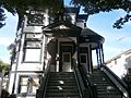
There are three historic districts in the Alkali Flat area: Central, North, and West. These neighborhoods are some of the oldest in Sacramento, with many buildings from the late 1800s and early 1900s. They show how Sacramento grew and developed over time.
- Isleton Chinese and Japanese Commercial Districts

Isleton has special districts that highlight the history of Chinese and Japanese communities in California's Delta region. These areas include buildings that were once shops, homes, and community centers for these immigrant groups.
- Walnut Grove Chinese-American Historic District and Walnut Grove Japanese-American Historic District


Similar to Isleton, Walnut Grove has distinct historic areas that show the cultural heritage of its Chinese and Japanese residents. These districts preserve the unique architecture and community life of these important groups in California's history.
Places from the Past
- Chung Wah Cemetery

This cemetery in Folsom is a historic burial ground, especially important for its connection to the Chinese community that helped build California. It's a quiet place that tells a lot about the lives of early immigrants.
- Sacramento City Cemetery

Established in 1849, this is Sacramento's oldest cemetery. It's not just a burial ground; it's also a beautiful garden with many historic monuments and trees. Many early pioneers and important figures from Sacramento's past are buried here.
- Joe Mound
This site is an ancient Maidu Indian village near what is now Discovery Park. While there's no marker, it's recognized as an important archaeological site that shows where Native American communities lived long ago.
Places That Are No Longer Here
Sometimes, historic places are removed from the National Register because they are destroyed or changed too much. Sacramento County has a few examples of this:
- Alhambra Theatre
This grand movie palace in Sacramento was built in 1927 but was sadly torn down in 1973. It was a beautiful example of a classic theater.
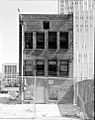
- Sego Milk Plant
Also known as the Utah Condensed Milk Company Plant, this building was destroyed by a fire in 1992 and was later removed from the list.
- Bennett Mound
This was another ancient Native American site, but it was destroyed by farming activities.
Images for kids
-
Alkali Flat Central Historic District
-
Alkali Flat North Historic District
-
Alkali Flat West Historic District
-
Alta Mesa Farm Bureau Hall
-
American River Grange Hall No. 172
-
Blue Anchor Building
-
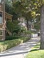
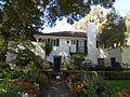
Old house in Boulevard Park
-
Brewster Building
-
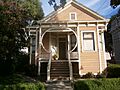
Brewster House
-
Brighton School
-
Calpak Plant No. 11
-
Capitol Extension District
-
J.C. Carly House
-
Cohn House
-
Coolot Company Building
-
Cranston-Geary House
-
Dunlap's Dining Room
-
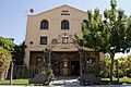
Eastern Star Hall
-
William Ehrhardt House
-
Elk Grove Historic District
-
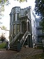
Fire Station No. 6
-
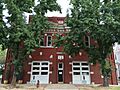
Firehouse No. 3
-
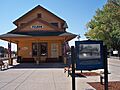
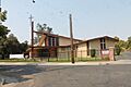
Folsom Depot
-
Mary Haley Galarneaux House
-
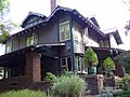
Julia Morgan House
-
John T. Greene House
-
Heilbron House
-
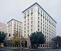
Hotel Regis
-
Hotel Senator
-
Edward P. Howe, Jr., House
-
Hubbard-Upson House
-
Imperial Theatre
-
J. Neely Johnson House
-
Theodore Judah School
-
Kuchler Row
-
Charles Lais House
-
Lawrence Warehouse
-
Libby, McNeil and Libby Fruit and Vegetable Cannery
-
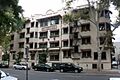
Maydestone Apartments
-
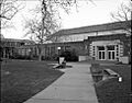
C. K. McClatchy High School
-
Merchants National Bank of Sacramento
-
Mesick House
-
New Helvetia Historic District
-
Old Fair Oaks Bridge
-
Old Tavern
-
PG&E Powerhouse
-
Ruhstaller Building
-
Sacramento Air Depot Historic District
-
Sacramento Bank Building
-
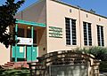
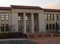
Sacramento City Library
-
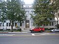
Sacramento Hall of Justice
-
Sacramento Junior College Annex and Extensions
-
Sacramento Masonic Temple
-
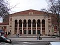
Sacramento Memorial Auditorium
-
Shiloh Baptist Church
-
Slocum House
-
SMUD Headquarters Building
-
Southern Pacific Railroad Section Superintendent House
-
Travelers' Hotel
-
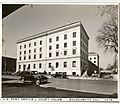
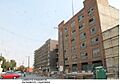
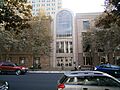
U.S. Post Office, Courthouse and Federal Building
-
Van Voorhies House
-
Anton Wagner Duplex
-
Walnut Grove Commercial/Residential Historic District
-
Walnut Grove Gakuen Hall
-
Westminster Presbyterian Church
-
Julius Wetzlar House
-
Winters House
-
Edwin Witter Ranch


_-_HDR.JPG)


.jpg)
.JPG)

.JPG)


,_Sacramento,_CA_-_DSC03854.JPG)


.JPG)


.JPG)


.jpg)


