List of archaeological sites in Mexico City facts for kids
This article lists amazing ancient places in Mexico City that were built long before Christopher Columbus arrived in the Americas. These places are called Pre-Columbian archaeological sites. They show us how people lived in Mexico thousands of years ago!
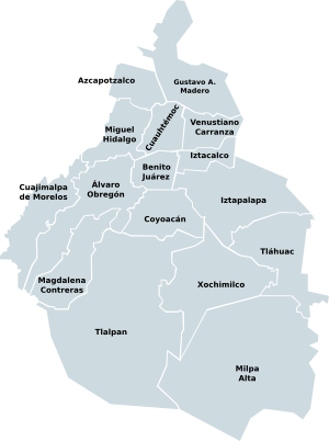
This list only includes sites found within the 16 main areas of Mexico City. It does not include ancient objects or buildings kept in museums. It also does not include sites outside Mexico City, even if they are close by.
These special places are protected by the Mexican government. They are considered important national treasures. The Instituto Nacional de Antropología e Historia (INAH) is the group that helps protect them.
Some of these ancient sites are so important that UNESCO has named them World Heritage Sites. This means they are recognized as very special places for everyone in the world to protect. These include parts of the Historic center of Mexico City, Xochimilco, and the main campus of the UNAM.
Contents
Discovering Ancient Mexico City
Have you ever wondered what Mexico City was like thousands of years ago? Long before it became a huge modern city, different ancient civilizations lived here. They built amazing cities, temples, and homes. Archaeologists study these sites to learn about their history, culture, and daily lives.
What is an Archaeological Site?
An archaeological site is a place where people lived or did important things a very long time ago. Scientists called archaeologists dig up and study the remains of these ancient places. They find old buildings, tools, pottery, and even bones. These findings help us understand how ancient people lived.
Why are These Sites Important?
These ancient sites are like giant history books made of stone and earth. They teach us about the people who came before us. By protecting them, we save important parts of Mexico's past for future generations. It's like keeping a family photo album, but for a whole country!
Exploring Mexico City's Oldest Sites
The ancient sites in Mexico City were built at different times. Some are thousands of years old, while others are hundreds of years old. Let's explore some of the most famous ones, starting with the oldest.
Cuicuilco: An Ancient City's Secrets
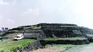
Cuicuilco is one of the oldest cities ever found in the Valley of Mexico. It was a very important city-state a long, long time ago. People lived here between 800 BC and 400 BC. Imagine a city that existed over 2,000 years ago!
Cuicuilco is famous for its unique circular pyramid. Most ancient pyramids in Mexico are square or rectangular. The circular shape of Cuicuilco's pyramid makes it very special. It shows us how different ancient cultures built their structures.
Mixcoac: A Tepanec Settlement
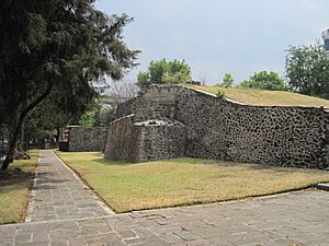
The Archaeological site of Mixcoac was once a settlement of the Tepanec people. They were a powerful group in the Valley of Mexico. Later, the Mexicas (also known as the Aztecs) briefly occupied this area. This site was active from about 900 BC until 1521 AD, which is when the Spanish arrived. It shows how different groups lived in the same area over many centuries.
Cerro de la Estrella: A Ritual Place
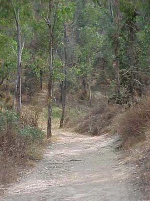
The Archaeological site of Cerro de la Estrella is a hill that was very important for ancient rituals. It was connected to the Cuicuilco culture. Around 200 BC, people performed special ceremonies here. This site is still important today for some traditional ceremonies.
Copilco: A Ceremonial Center
Copilco was another important place for ancient ceremonies. Different groups, like the Chichimecas, Tepanecas, and Cuicuilcas, used this site. It was active around 500 AD.
Cuahilama: A Meeting Place of Cultures
Cuahilama was a ceremonial center used by several different ancient cultures. It was active between 1200 and 1500 AD. This site shows how different groups shared and used important places for their traditions.
Aztec Empire's Grandeur
The Aztec Empire was one of the most powerful civilizations in ancient Mexico. They built incredible cities and temples, and Mexico City is built right on top of their ancient capital, Tenochtitlan.
Templo Mayor: The Heart of Tenochtitlan
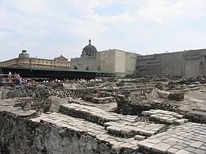
The Templo Mayor was the main temple of Tenochtitlan, the capital city of the Aztec Empire. It was built between 1325 and 1487 AD. This huge temple was dedicated to two important Aztec gods: Huitzilopochtli, the god of war and the sun, and Tlaloc, the god of rain and agriculture.
When you visit Templo Mayor today, you can see the different layers of the temple. The Aztecs often built new temples on top of older ones. This site is in the very center of modern Mexico City, showing how the past and present are connected.
Tlatelolco: A Sister City
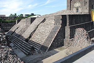
The Archaeological site of Tlatelolco is the remains of another Aztec city-state. It was founded in 1338 AD, not long after Tenochtitlan. Tlatelolco was known for its huge market, where people from all over the empire came to trade goods.
Today, Tlatelolco is part of the "Plaza de las Tres Culturas" (Plaza of the Three Cultures). This plaza shows buildings from three different time periods: ancient Aztec ruins, a Spanish colonial church, and modern Mexican buildings. It's a great place to see how history has unfolded in Mexico.
Baths of Chapultepec: An Ancient Oasis
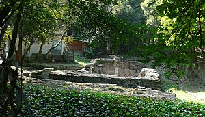
The Baths of Chapultepec are ancient baths that were used by both Pre-Columbian people and later by Spanish colonists. They date back to the 14th century. Chapultepec Park was a special place for Aztec rulers, who used it as a retreat and a place for recreation. These baths show how people enjoyed water and nature even hundreds of years ago.
Ticomán: An Otomi Settlement
Ticomán was a settlement of the Otomi people. The Otomi are one of the oldest indigenous groups in Mexico. This site gives us clues about their way of life and how they lived in the northern part of Mexico City.
See also
- Teotihuacan, a famous ancient city about 40 kilometres (25 mi) northeast of Mexico City.
 | Valerie Thomas |
 | Frederick McKinley Jones |
 | George Edward Alcorn Jr. |
 | Thomas Mensah |


