Historic center of Mexico City facts for kids
Quick facts for kids
Historic center of Mexico City
Centro Histórico de la Ciudad de México
|
|
|---|---|
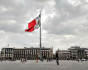
The Zócalo also known as Plaza de la Constitución with the Mexican flag waving in the center and to the right behind it, the Old Portal de Mercaderes
|
|
| Country | |
| City | |
| Borough | Cuauhtémoc |
| Population
(2020)
|
|
| • Total | 61,229 |
| 21,782,000 | |
| Time zone | UTC−6 (CST) |
| • Summer (DST) | UTC−5 (CDT) |
| Official name: Historic Centre of Mexico City and Xochimilco | |
| Type: | Cultural |
| Criteria: | ii, iii, iv, v |
| Designated: | 1987 (11th session) |
| Reference #: | 412 |
| Region: | Latin America and the Caribbean |
The Historic Center of Mexico City (in Spanish: Spanish: Centro Histórico de la Ciudad de México) is the main and oldest part of Mexico City. It is often called the Centro or Centro Histórico. This area is centered around the Zócalo, which is the main plaza. It stretches out in all directions for many blocks, reaching the Alameda Central park in the west. The Zócalo is the biggest plaza in Latin America and can hold almost 100,000 people!
This important part of the city is in the borough of Cuauhtémoc. It covers just over nine square kilometers and includes 668 city blocks. There are about 9,000 buildings here, and 1,550 of them are considered historically important. Most of these old buildings were built between the 1500s and the 1900s.
The Historic Center is divided into two areas to help protect its heritage. Zone A includes the ancient city built before the Spanish arrived and its growth until Mexico became independent. Zone B covers other buildings from the 19th century that are important for keeping the area's history and architecture alive.
This is where the Spanish began building modern Mexico City in the 1500s. They built it on the ruins of Tenochtitlan, which was the capital of the Aztec Empire. Because it was once the heart of the Aztec Empire and later the center of Spanish rule in New Spain, the Centro Histórico has many historical sites from both eras. It also has a large number of museums. This rich history is why it is a World Heritage Site.
Contents
- History of the Center
- The Zócalo and Nearby Places
- Places North of the Zócalo
- Places South of the Zócalo
- Places West of the Zócalo
- Places East of the Zócalo
- Around the Alameda Central Park
- Barrio Chino (Chinatown)
- Architecture Styles
- Education
- Recent Changes (20th and 21st Centuries)
- Getting Around
- See also
History of the Center
The historic downtown of Mexico City is mostly where the ancient Aztec city of Tenochtitlan used to be. Tenochtitlan was founded around 1325. The Aztecs planned their city very well. They had streets and canals that lined up with the main directions (north, south, east, west), creating neat square blocks.
The island city was divided into four main neighborhoods called calpullis. These were separated by major roads leading to places like Tepeyac and Iztapalapa. The center of these roads was the heart of the city and the Aztec world. Here, you would find the Templo Mayor (main temple), palaces for the Aztec emperors (called tlatoani), and homes for nobles. There were also two famous Aztec schools: the Telpuchcalli for everyday studies and the Calmecac for training priests. When the Spanish arrived, the city had aqueducts (water channels) and a large wall built to protect it from floods.
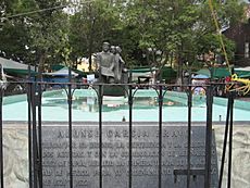
After the Spanish conquered the city, its layout mostly stayed the same. This was thanks to Alonso Garcia Bravo, who oversaw much of the rebuilding. Many main roads, like Tenayuca and Tlacopan, were kept but renamed. The main city divisions also remained, but Christian names were added, like San Juan Moyotla. Much of the historic center was actually built using stones and rubble from the destroyed Aztec city.
In the 1600s and 1700s, some Spaniards became very rich from mining and trade. Their wealth can be seen in the many beautiful mansions in the Centro. Examples include the Palace of Iturbide and the Casa de Azulejos (House of Tiles). The House of Tiles was built in the 1500s in an Arab style. Its famous blue and white tiles were added in 1747.
In the early 1900s, many streets north and west of the Zócalo were renamed after countries in Latin America. This was done by José Vasconcelos, who was the Minister of Public Education.
The Zócalo and Nearby Places
The Zócalo, or main plaza, has always been a place for big events. These include cultural shows, art displays, and even large public gatherings. For example, in 2008, a skateboarding and BMX event brought 50,000 young people here. The Festival de México is an annual event with art and academic programs. In 2008, it had 254 performances from over 20 countries. The Zócalo is also a common place for national protests.
Right next to the Zócalo are several important buildings: the Palacio Nacional, the Metropolitan Cathedral, the Templo Mayor (with its museum), and the Nacional Monte de Piedad building.
The Palacio Nacional (National Palace) takes up the entire east side of the Zócalo. It holds the offices of the President of Mexico, the national treasury, and the national archives. Inside, you can see amazing murals by Diego Rivera that show the history of Mexico from ancient times to the Spanish conquest. This palace was built starting in 1521 on the ruins of Moctezuma II's palace. It was originally owned by Hernán Cortés's family. Later, the King of Spain bought it to house the viceroys (Spanish rulers) of New Spain. Every September 15th, the president rings the "Bell of Dolores" from a central balcony here to celebrate Mexico's Independence Day.
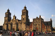
The Mexico City Metropolitan Cathedral is at the north end of the Zócalo. It is dedicated to the Virgin Mary. This spot was once part of the Aztec Sacred Precinct. The first church was built here between 1524 and 1532. A new, larger cathedral began construction in 1562. Even though it wasn't fully finished, it was first used in 1656. The cathedral was finally completed in 1813 with new additions designed by Manuel Tolsa.
Because Mexico City was built on a lakebed, the ground has been sinking over time. This caused damage to the cathedral. From 1989 to 2000, a lot of engineering work was done to fix the building and stop it from sinking unevenly. This work helped save this important historical building.
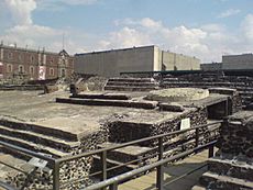
The Templo Mayor archaeological site and museum is just northeast of the Zócalo. This was the main temple of the ancient Aztec city. It was destroyed by Hernán Cortés in the 1520s and its exact location was forgotten for a long time. In 1978, workers found a huge stone disk of the Aztec goddess Coyolxauhqui. This led to excavations that uncovered the ruins of the pyramid, which was built in many layers. According to legend, this is where the Aztecs saw the sign to settle: an eagle on a nopal cactus with a snake in its beak. This image is still the symbol of Mexico today.
The Nacional Monte de Piedad building is a national pawn shop. It was started in 1775 and is one of the biggest second-hand shops in the world. This site was once home to the last Aztec ruler, Moctezuma II. After the conquest, Hernán Cortés took these houses for himself. They were so large that one writer said the residence was "not a palace but rather another city."
Places North of the Zócalo
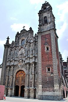
Santo Domingo refers to the Church of Santo Domingo and the plaza next to it. They are located three blocks north of the Mexico City Metropolitan Cathedral. The church is officially called the Señor de la Expiación Chapel. It is all that remains of the first convent built in New Spain.
South of the church is Plaza San Domingo. On its west side, you'll find the Portal de Evangelistas. Here, scribes with typewriters and old printing machines offer their services. They help people who can't read or write, often acting like lawyers or counselors. In the middle of the plaza, there is a statue of Josefa Ortiz de Domínguez, a hero of the Mexican War of Independence.
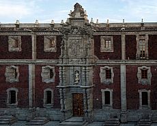
The San Ildefonso College is now a museum and cultural center. It is known as the birthplace of the Mexican muralism art movement. San Ildefonso started as a famous Jesuit boarding school. After a period of change, it became the National Preparatory School, a very respected educational institution. The school closed in 1978 but reopened in 1994 as a museum. The museum has permanent and temporary art and history exhibits. You can also see many murals painted on its walls by famous artists like José Clemente Orozco and Diego Rivera.
Other interesting places north of the Zócalo include:
- The Secretaría de Educación Pública (Public Education Ministry)
- The Centro Cultural de España (Cultural Center of Spain)
- The Museum Archive of Photography
- The Lirico Theatre
- The Antigua Escuela de Economía (Old School of Economics)
- The Colegio Nacional
- The Old Customs building
- The Palace of the Inquisition (Museum of Mexican Medicine)
Places South of the Zócalo
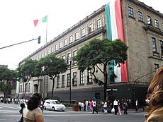
The Supreme Court of Justice of the Nation is just off the main plaza. It was built between 1935 and 1941. Before the Spanish conquest, this site was used for a ritual dance called "Dance of the Flyers." The inside of the building has four murals painted by José Clemente Orozco in 1941. There is also a mural by American artist George Biddle called "War and Peace."
Other notable sites south of the Zócalo are:
- The Temple of Saint Augustine
- The original El Palacio de Hierro department store
- The original Liverpool department store
- The Saint Augustine House
- The Chapel of the Most Holy Conception of Tlaxcoaque, one of the oldest churches in Mexico City
- The Church of San Bernardo
Places West of the Zócalo
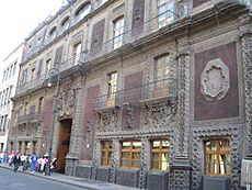
The Palace of Iturbide is a large, grand home on Madero Street. It was built in the 1700s as a wedding gift for a daughter of a wealthy count. It got its name because Agustín de Iturbide, Mexico's first emperor after independence from Spain, lived there and accepted his crown. Today, this restored building is home to the Fomento Cultural Banamex and is called the Palacio de Cultura Banamex.
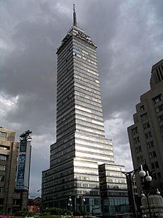
The Torre Latinoamericana is one of the most famous skyscrapers in Latin America. It was built between 1948 and 1956 and stands 182 meters tall (including its antenna). It was the tallest tower in Mexico for a while. This building is famous for surviving two major earthquakes, one in 1957 and another in 1985, thanks to its special design.
The Museo Nacional de Arte (MUNAL) is Mexico's National Art Museum. It is located in a beautiful neoclassical building. The museum has a collection that shows the history of Mexican art from ancient times to the early 1900s. Outside, you can see a large statue of Charles IV of Spain on horseback, made by Manuel Tolsá. This statue was moved several times before finding its current home in 1979.
The Palacio de Correos de Mexico (Postal Palace of Mexico City), also known as the "Correo Mayor" (Main Post Office), is a stunning building from the early 1900s. It looks like an Italian Renaissance palace. It was designed by Italian architect Adamo Boari, who also helped design the Palacio de Bellas Artes across the street.
Other interesting places west of the Zócalo include:
- The Casa de los Azulejos, a mansion covered in blue and white tiles
- The Colegio de Minería (College of Mining)
- The Mexican Army Museum
- The Garden of the Triple Alliance
- The Cámara de Senadores (Senate Chambers)
- The Museo de Estanquillo (museum of cartoons and magazines)
- The Temple of San Felipe Neri "La Profesa"
- The Interactive Museum of Economics
- The Santa Clara church - Library of Congress
- The Chamber of Deputies
- The Teatro de la Ciudad
- The Academia Mexicana
Places East of the Zócalo
The Museo de la Secretaría de Hacienda y Crédito Público is an art museum located at Moneda Street #4. It is in what used to be the Palacio del Arzobispado (Palace of the Archbishopric). This building was constructed in 1530 on the base of a destroyed Aztec pyramid dedicated to the god Tezcatlipoca. The museum now has an exhibit about this god and a large art collection.
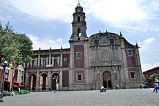
La Santísima Church is located at the corner of La Santísima and Emiliano Zapata streets. Its full name is Temple and Hospital of the Most Holy Trinity. The church was built between 1755 and 1783 for a hospital and hospice for priests next door. The church is still used for religious services, but the old hospital buildings are now privately owned. This church is also famous because it has sunk almost three meters since it was built!
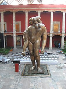
The José Luis Cuevas Museum is just off the main plaza. It is in a building that used to be a convent for the Church of Santa Ines. This convent was founded in 1600. It existed until 1861, when all convents and monasteries in the country were closed by law. The convent's church and residence hall were separated. The church still operates, but the residence hall became private property. Artist José Luis Cuevas bought the property to restore it and create this museum, which features his art and contemporary Latin American art.
The House of the First Print Shop in the Americas is at the corner of Moneda and Licenciado Primo Verdad streets. This was the very first place where books and other materials were printed in the New World. The house was built in 1524 and is located on the edge of what was once the sacred area of the Templo Mayor.
Other interesting places east of the Zócalo include:
- The Cathedral Nuestra Señora de Balvanera and Sanctuary of San Charbel
- The Palacio de la Autonomia de UNAM (Palace of UNAM's Autonomy)
- The Departamento de Estadistica Nacional (Dept. of National Statistics) building
Around the Alameda Central Park
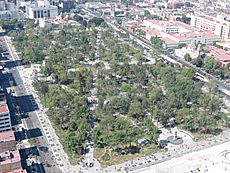
Alameda Central is a public park in downtown Mexico City. It is next to the Palacio de Bellas Artes. It's a green space with paved paths, fountains, and statues, and it's often used for city events. This area used to be an Aztec marketplace. After the Spanish conquest, it was used by the Catholic Church for public burnings. The park was created in 1592 by Viceroy Luis de Velasco. Its name comes from the Spanish word álamo, meaning "poplar tree," which were planted here. By the late 1800s, the park had a bandstand and gas lamps. On the south side of the park, there's a large white monument called the Hemiciclo a Juárez. It honors Benito Juárez, one of Mexico's most loved presidents.
Other notable sites around the Alameda Central are:
- The Palacio de Bellas Artes
- The Teatro Hidalgo
- The Parish of Santa Cruz, Mexico City
- The Museo Nacional de la Estampa (National Print Museum)
- The Franz Mayer Museum
- The Parish of La Santa Vera Cruz de San Juan de Dios
- The Ex Temple of Corpus Christi
Barrio Chino (Chinatown)
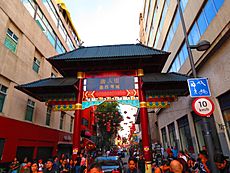
Mexico City's Chinatown, known as "Barrio Chino", is very small. It covers two blocks on Dolores Street, just south of the Palacio de Bellas Artes. It mainly has restaurants and shops that import goods. It's small because many descendants of Chinese immigrants either married into Mexican families or were forced to leave the country in the 1930s. Still, it is considered the main gathering place for the roughly 3,000 families of Chinese heritage in Mexico City.
Architecture Styles
The Historic Center of Mexico City shows off many different building styles, even though most are from the Spanish colonial period.
- Baroque: Examples include the Palacio de Iturbide, Casa de los Azulejos, Palacio Nacional, and Palacio de los Condes de Valparaíso.
- Neoclassical: You can see this style in the Palacio de Mineria.
- Italianate style: The Palacio de Correos is a good example.
- Art Nouveau: The Palacio de Bellas Artes shows this style.
- Beaux-Arts: The Museo Nacional de Arte and the Banco de México are in this style.
- Art Deco: The interior of the Palacio de Bellas Artes and parts of the Banco de México feature Art Deco.
- Functionalist: The Torre Latinoamericana is an example of this style.
Education
Recent Changes (20th and 21st Centuries)
Challenges and Decline
For a long time, the Historic Center was where wealthy and important people lived. But in the early 1900s, these families started moving to newer neighborhoods west and southwest of the Centro. The area remained a center for business, politics, and learning until the mid-1900s. Around that time, the main university, UNAM, moved most of its facilities to a new campus.
The decline of the city center happened for a few reasons. In the 1940s, the city government froze rents. This meant that until 1998, people were still paying rent prices from the 1950s! Landlords had no reason to keep their buildings in good shape, so many fell apart. The 1985 earthquake also damaged many buildings, which were never fixed. This led to empty lots and rundown areas. As a result, about 100,000 people moved out of the "Colonia Centro," making the area very quiet at night.
By the 1980s, many old mansions were abandoned or turned into crowded homes for the poor. Sidewalks and streets became crowded with vendors. For many visitors, Mexico City's reputation for pollution, traffic, and crime made them want to leave the city quickly. Many restaurants, even good ones, would close early because the area wasn't very safe at night.
Saving Old Churches
Many historic churches in the oldest parts of the city are in bad shape and could be lost. Efforts to save them are difficult because of disagreements between the Church and the government. These churches are both active religious places and historical landmarks, which makes their legal situation tricky. By law, religious groups cannot ask the government for money, but government agencies like the National Council for Culture and Arts (CONACULTA) have a say in how these historical places are cared for.
There are disagreements about how bad the damage is. CONACULTA believes that none of the 68 religious buildings in the oldest part of the city are about to collapse. However, the Archdiocese of Mexico thinks the problems are serious and dangerous to both people and the buildings' "priceless artistic and historic value." Some churches, like San Lorenzo Diácono y Mártir, Our Lady of Loreto, and La Santísima Trinidad, need quick attention to avoid collapsing. Pieces of buildings have fallen from San Lorenzo and Loreto churches, causing damage. Another issue is that fewer people live in the historic center, so these churches are often empty, and the diocese doesn't have enough money for repairs.
Bringing the Center Back to Life
Starting in the early 2000s, the government began investing a lot of money into the Historic Center. They partnered with the Fundación Centro Histórico, an organization started by Carlos Slim, a wealthy businessman. This group bought many old buildings to fix them up. This effort was recognized in 2006 when the Historic Center was included in the 2006 World Monuments Watch.
Work began by improving 34 blocks just north of the Zócalo. Old drainage systems were dug up, and water supply was improved. Architects were put in charge of each of the thirteen main streets to restore the fronts of over 500 buildings. More recent projects have focused on the southwest parts of the area, improving streets like República de El Salvador and Pino Suárez. During this work, ancient artifacts from before the Spanish conquest have been found.
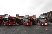
Across the historic center, streets have been made for walking only, buildings have been restored, and new museums have opened. In the 1990s, after many arguments, most street vendors were moved to other parts of the city. To encourage people to return, the new mayor's home was built near the Zócalo. The government has also buried electric and telephone cables and replaced old asphalt with paving stones. They installed nearly 100 security cameras to help with crime. All these changes have led to new fancy restaurants, bars, and trendy shops opening. Young people are also moving into apartments downtown. To attract more tourists, there are new red double-decker tour buses.
By 2004, over 5 billion pesos (about 438 million US dollars) had been invested in the city center. This has created 15,000 jobs, and property owners are now interested in improving their buildings. It has also brought in outside investments.
Getting Around
Tour buses, called "Turibuses," are a popular way for tourists to see the historic center and other parts of the city. These buses take visitors to different tourist spots and cultural sites.
The Mexico City Metro (subway) is the most common way for locals to get around the historic center. Several stations serve the area:
- Zócalo/Tenochtitlan station serves the Zócalo.
- Allende station serves the northern zone.
- Bellas Artes, Hidalgo, and Juárez stations cover the Alameda park area.
- San Juan de Letrán, Salto del Agua, Isabel la Católica, Pino Suárez, and Merced stations cover the southern zones.
The Mexico City Metrobús service also covers the area with its Line 4 route.
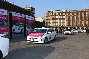
Another common way to get around is by taxi. These are regulated by the Mexico City government, and you can even call one using the government app "Mi Taxi."
Cycle rickshaws, known as "ciclotaxi," used to be a common way to explore the historic center. However, their use has decreased a lot since the late 2010s.
See also
 In Spanish: Centro Histórico de la Ciudad de México para niños
- List of pre-columbian archaeological sites in Mexico City
- List of colonial churches in Mexico City
- Barrios Mágicos of Mexico City
 | Delilah Pierce |
 | Gordon Parks |
 | Augusta Savage |
 | Charles Ethan Porter |


