List of beaches in the U.S. Virgin Islands facts for kids
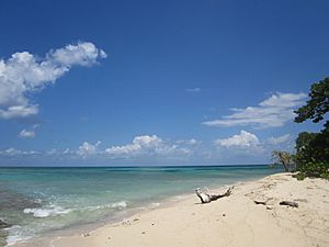
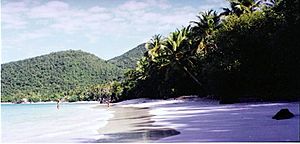
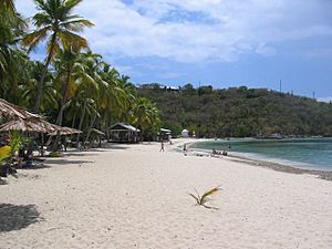
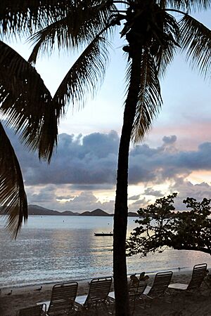
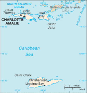
The following is a list of beaches in the United States Virgin Islands by district/island of the United States Virgin Islands, a territory of the United States. Beaches are on the Caribbean Sea to the south or Atlantic Ocean to the north.
Saint Croix
Name | Coordinates |
---|---|
Altona Lagoon Beach | 17°44′52″N 64°41′30″W / 17.74775°N 64.69153°W |
Buccaneer Beach | 17°45′21″N 64°41′02″W / 17.75581°N 64.68375°W |
Cane Bay Beach | 17°46′27″N 64°48′35″W / 17.77414°N 64.80959°W |
Carlton Beach | 17°40′56″N 64°50′01″W / 17.6822°N 64.83348°W |
Cathys Fancy Beach | 17°45′27″N 64°43′25″W / 17.75747°N 64.72375°W |
Cay Beach | 17°44′57″N 64°42′12″W / 17.74914°N 64.7032°W |
Chenay Beach | 17°45′42″N 64°39′37″W / 17.76164°N 64.66014°W |
Coakley Bay | 17°45′39″N 64°38′38″W / 17.76081°N 64.64375°W |
Columbus Landing | 17°46′52″N 64°45′41″W / 17.78108°N 64.76125°W |
Cormorant Beach Club | 17°46′33″N 64°44′36″W / 17.7758°N 64.7432°W |
Cottongarden Bay Beach | 17°45′33″N 64°35′04″W / 17.75914°N 64.58458°W |
Cramer's Park Beach | 17°45′37″N 64°34′53″W / 17.76025°N 64.58125°W |
Davis Beach | 17°45′45″N 64°49′56″W / 17.76247°N 64.83209°W |
Divi (at Divi Carina Bay Resort) | 17°45′14″N 64°35′28″W / 17.754°N 64.591°W |
Dorsch (Sand Castle on the Beach) | 17°42′05″N 64°53′09″W / 17.70135°N 64.88585°W |
Frederikstead Beach (Fort Frederick Beach), Frederiksted Pier | 17°43′01″N 64°53′02″W / 17.71689°N 64.88386°W |
Grapetree Beach | 17°44′45″N 64°36′08″W / 17.74581°N 64.60236°W |
Grassy Point Beach | 17°44′03″N 64°36′42″W / 17.73414°N 64.61153°W |
The Grotto (Buccaneer resort) | |
Haypenny Bay (Manchenil) | |
Issac Bay Beach | 17°45′03″N 64°34′18″W / 17.75081°N 64.5718°W |
Jack Bay Beach | |
Judiths Fancy Beach | 17°46′30″N 64°44′33″W / 17.77497°N 64.74237°W |
LaGrange Beach | 17°43′18″N 64°53′07″W / 17.72164°N 64.88515°W |
Mermaid Beach (Buccaneer) | |
Monks Bath Beach | 17°45′45″N 64°53′11″W / 17.76247°N 64.88626°W |
North Star Beach | 17°45′55″N 64°49′29″W / 17.76525°N 64.82459°W |
Pelican Cove Beach | 17°45′57″N 64°44′07″W / 17.76581°N 64.73514°W |
Protestant Cay | |
Prune Beach | 17°45′43″N 64°39′07″W / 17.76192°N 64.65181°W |
Rainbow Beach | 17°44′04″N 64°53′22″W / 17.73442°N 64.88931°W |
Reef Beach | 17°45′17″N 64°36′11″W / 17.7547°N 64.60319°W |
Saint Croix Country Club Beach | 17°43′09″N 64°53′04″W / 17.71914°N 64.88431°W |
Salt River Beach (Columbus Landing) | 17°46′52″N 64°45′41″W / 17.78108°N 64.76125°W |
Sandy Point | |
Shoy's Beach | 17°45′36″N 64°40′51″W / 17.75997°N 64.68097°W |
Sprat Hall Beach | 17°44′33″N 64°53′32″W / 17.74247°N 64.89209°W |
Sugar Beach | 17°45′11″N 64°43′00″W / 17.75303°N 64.71653°W |
Tamarind Reef Beach | 17°45′40″N 64°40′02″W / 17.76108°N 64.66709°W |
Turtle Beach/Cove, Buck Island | |
West Beach | 17°47′20″N 64°37′41″W / 17.78886°N 64.62792°W |
Saint John
Name | Coordinates |
---|---|
Annaberg Beach | 18°21′49″N 64°43′28″W / 18.36356°N 64.72458°W |
Blue Cobblestone Beach | 18°18′11″N 64°42′10″W / 18.30301°N 64.70264°W |
Boatman Point Beach | 18°19′01″N 64°46′29″W / 18.3169°N 64.77486°W |
Brown Bay Beach | 18°21′39″N 64°42′21″W / 18.36079°N 64.70597°W |
Caneel Bay Beach | 18°20′53″N 64°47′04″W / 18.34801°N 64.78458°W |
Cinnamon Bay Beach | 18°21′23″N 64°45′08″W / 18.35634°N 64.75236°W, |
Cocoloba Beach | 18°18′55″N 64°45′35″W / 18.31523°N 64.75986°W |
Cruz Bay Beach | 18°19′49″N 64°47′50″W / 18.33023°N 64.79736°W |
Denis Bay | 18°21′10″N 64°46′32″W / 18.35273°N 64.77569°W |
Ditleff Beach | 18°18′58″N 64°46′00″W / 18.31607°N 64.7668°W |
Fish Bay | 18°19′10″N 64°45′51″W / 18.3194°N 64.76403°W |
Francis Bay Beach | 18°21′54″N 64°44′36″W / 18.36495°N 64.74347°W |
Gibney Beach (aka Oppenheimer Beach) | 18°21′09″N 64°46′36″W / 18.35245°N 64.77653°W |
Grootpan Bay | 18°18′40″N 64°42′57″W / 18.311236°N 64.715906°W |
Hansen Bay Beach | 18°20′33″N 64°40′31″W / 18.34245°N 64.67541°W |
Hart Bay Beach | 18°18′50″N 64°46′51″W / 18.31384°N 64.78097°W |
Haulover Beach | 18°20′54″N 64°40′45″W / 18.34829°N 64.6793°W |
Hawknest Beach | 18°20′49″N 64°46′38″W / 18.3469°N 64.77736°W |
Honeymoon Bay Beach | 18°20′22″N 64°47′39″W / 18.33931°N 64.79429°W |
Johns Folly Beach | 18°19′01″N 64°42′08″W / 18.3169°N 64.70236°W |
Jumbie Bay | 18°21′08″N 64°46′27″W / 18.35218°N 64.77403°W |
Kiddel Bay | 18°18′34″N 64°42′47″W / 18.30945°N 64.712975°W |
Lameshur Bay | 18°18′58″N 64°43′38″W / 18.31611°N 64.72722°W |
Leinster Bay | 18°22′03″N 64°43′42″W / 18.36745°N 64.72847°W |
Little Cinnamon Bay Beach | 18°21′14″N 64°45′20″W / 18.35384°N 64.75569°W |
Little Maho Beach | 18°21′44″N 64°44′39″W / 18.36218°N 64.74403°W |
Little Reef Bay Beach | 18°19′18″N 64°45′03″W / 18.32162°N 64.75097°W |
Long Bay Beach | 18°20′13″N 64°40′27″W / 18.3369°N 64.6743°W |
Maho Bay Beach18°21′24″N 64°44′54″W / 18.35662°N 64.74847°W | |
Peter Bay Beach | 18°21′09″N 64°45′39″W / 18.35245°N 64.76097°W |
Reef Bay Beach | 18°19′01″N 64°45′24″W / 18.3169°N 64.7568°W |
Salt Pond Beach | 18°18′31″N 64°42′19″W / 18.30857°N 64.70514°W |
Salomon Beach | 18°20′18″N 64°47′43″W / 18.33829°N 64.79514°W |
St. Mary's Creek Beach | 18°21′53″N 64°44′16″W / 18.36468°N 64.73791°W |
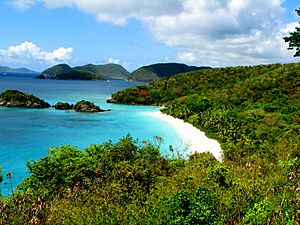
Trunk Bay | 18°21′06″N 64°46′13″W / 18.35162°N 64.77014°W |
Waterlemon Cay Beach | 18°22′01″N 64°43′22″W / 18.3669°N 64.72291°W |
Saint Thomas
There are forty major beaches in Saint Thomas.
Name | Coordinates |
---|---|
Bluebeard Beach | 18°19′29″N 64°50′18″W / 18.32468°N 64.83847°W |
Bolongo Bay | 18°18′42″N 64°53′45″W / 18.31162°N 64.8957°W |
Brewers Bay Beach | 18°20′37″N 64°58′38″W / 18.34357°N 64.97709°W |
Coki Beach (Coki Point) | 18°20′59″N 64°51′56″W / 18.34968°N 64.86542°W |
Cowpet Bay | 18°18′58″N 64°50′31″W / 18.31607°N 64.84208°W |
Dorothea Bay | 18°22′13″N 64°57′44″W / 18.37023°N 64.96209°W |
Great Bay | 18°19′17″N 64°50′16″W / 18.32134°N 64.83764°W |
Hull Bay Beach | 18°22′09″N 64°57′25″W / 18.36912°N 64.95681°W |
Limetree Beach | 18°19′01″N 64°54′48″W / 18.3169°N 64.9132°W |
Lindbergh Beach | 18°20′07″N 64°57′52″W / 18.33523°N 64.96431°W |
Lindquist Beach (Smith Bay, Cabes Point) | 18°20′23″N 64°51′01″W / 18.33968°N 64.85014°W |
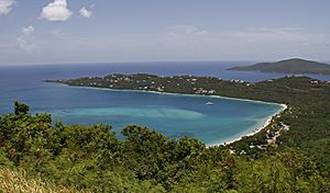
Magens Bay (Little Magens) | 18°22′15″N 64°56′09″W / 18.37079°N 64.9357°W |
Mandahl Bay Beach | 18°21′39″N 64°53′50″W / 18.36079°N 64.89709°W |
Morningstar Beach | 18°19′13″N 64°55′11″W / 18.32016°N 64.91982°W |
Sapphire Beach | 18°20′06″N 64°57′01″W / 18.33505°N 64.95034°W |
Secret Harbor Beach | 18°19′05″N 64°51′11″W / 18.31801°N 64.85292°W |
Sugar Bay (Wyndham) | 18°21′54″N 65°00′03″W / 18.36487°N 65.0007°W |
Vessup Bay | 18°19′31″N 64°51′01″W / 18.32523°N 64.85014°W |
Water Bay (aka Pineapple or Renaissance Bay) | 18°20′51″N 64°51′50″W / 18.34745°N 64.86375°W |
Water Island
The following beaches are in Water Island, a sub-district of the Saint Thomas District.
Name | Coordinates |
---|---|
Honeymoon Beach | 18°18′51″N 64°57′39″W / 18.31412°N 64.9607°W |
Limestone Beach | |
Revenge Beach | 18°18′34″N 64°57′12″W / 18.3094°N 64.9532°W |
Sprat Bay | |
Waterlemon Cay Beach | 18°22′01″N 64°43′22″W / 18.3669°N 64.72291°W |
See also
- List of beaches
All content from Kiddle encyclopedia articles (including the article images and facts) can be freely used under Attribution-ShareAlike license, unless stated otherwise. Cite this article:
List of beaches in the U.S. Virgin Islands Facts for Kids. Kiddle Encyclopedia.