List of lakes of Calhoun County, Arkansas facts for kids
Calhoun County, Arkansas, is home to over 40 named lakes and reservoirs. These important bodies of water are a big part of the county's natural environment. They also offer places for fun activities and are vital for local communities.
Contents
What are Lakes and Reservoirs?
Lakes: Nature's Ponds
A lake is a large area of water surrounded by land. Lakes are usually natural. They form in many ways, like from glaciers, volcanoes, or rivers changing course. Lakes can be big or small, deep or shallow. They are home to many different plants and animals.
Reservoirs: Man-Made Lakes
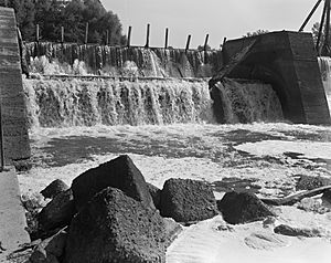
A reservoir is like a lake, but it is made by people. Engineers build a dam across a river or stream. This dam holds back the water, creating a large pool. Reservoirs are very useful. They store water for drinking, farming, and making electricity. They can also help control floods.
Lakes in Calhoun County
Calhoun County has many natural lakes. These lakes are often connected to river systems. They are important for local wildlife, like fish and birds. Many people enjoy fishing or boating on these lakes. Here are some of the lakes you can find:
- Big Johnson Lake, 33°30′14″N 092°42′29″W / 33.50389°N 92.70806°W, about 92 feet (28 m) above sea level.
- Cobeen Brake, 33°21′20″N 092°31′15″W / 33.35556°N 92.52083°W, about 79 feet (24 m) above sea level.
- Cross Current Brake, 33°21′29″N 092°31′35″W / 33.35806°N 92.52639°W, about 75 feet (23 m) above sea level.
- Ditch Lake, 33°21′58″N 092°33′15″W / 33.36611°N 92.55417°W, about 79 feet (24 m) above sea level.
- Grapevine Lake, 33°17′05″N 092°25′46″W / 33.28472°N 92.42944°W, about 79 feet (24 m) above sea level.
- Mud Lake, 33°20′43″N 092°31′24″W / 33.34528°N 92.52333°W, about 79 feet (24 m) above sea level.
- Signboard Brake, 33°20′08″N 092°30′42″W / 33.33556°N 92.51167°W, about 75 feet (23 m) above sea level.
- Tupelo Gum Brake, 33°22′10″N 092°33′24″W / 33.36944°N 92.55667°W, about 79 feet (24 m) above sea level.
- Big Horseshoe Brake, 33°25′22″N 092°33′30″W / 33.42278°N 92.55833°W, about 79 feet (24 m) above sea level.
- Black Lake, 33°26′25″N 092°33′10″W / 33.44028°N 92.55278°W, about 79 feet (24 m) above sea level.
- Black Lake Slough, 33°25′50″N 092°33′26″W / 33.43056°N 92.55722°W, about 82 feet (25 m) above sea level.
- Blackwater Lakes, 33°27′37″N 092°40′07″W / 33.46028°N 92.66861°W, about 89 feet (27 m) above sea level.
- Cages Lake, 33°25′05″N 092°37′37″W / 33.41806°N 92.62694°W, about 79 feet (24 m) above sea level.
- Cooks Lake, 33°25′37″N 092°32′55″W / 33.42694°N 92.54861°W, about 79 feet (24 m) above sea level.
- Crane Lake, 33°23′12″N 092°34′36″W / 33.38667°N 92.57667°W, about 79 feet (24 m) above sea level.
- Duck Roost Lake, 33°22′39″N 092°34′27″W / 33.37750°N 92.57417°W, about 79 feet (24 m) above sea level.
- Hades Lake, 33°23′34″N 092°34′49″W / 33.39278°N 92.58028°W, about 82 feet (25 m) above sea level.
- Half Moon Lake, 33°27′36″N 092°40′40″W / 33.46000°N 92.67778°W, about 85 feet (26 m) above sea level.
- Hollingsworth Brake, 33°23′52″N 092°32′50″W / 33.39778°N 92.54722°W, about 79 feet (24 m) above sea level.
- Little Bay Lake, 33°25′35″N 092°37′47″W / 33.42639°N 92.62972°W, about 85 feet (26 m) above sea level.
- Little Horseshoe Brake, 33°22′45″N 092°32′52″W / 33.37917°N 92.54778°W, about 79 feet (24 m) above sea level.
- Long Lake, 33°23′21″N 092°33′22″W / 33.38917°N 92.55611°W, about 79 feet (24 m) above sea level.
- Moro Bay, 33°18′15″N 092°21′16″W / 33.30417°N 92.35444°W, about 79 feet (24 m) above sea level.
- Scott Water, 33°41′51″N 092°19′41″W / 33.69750°N 92.32806°W, about 151 feet (46 m) above sea level.
- Snow Lake, 33°23′17″N 092°34′16″W / 33.38806°N 92.57111°W, about 79 feet (24 m) above sea level.
- Spoon Lake, 33°26′24″N 092°40′34″W / 33.44000°N 92.67611°W, about 79 feet (24 m) above sea level.
- Tom Cook Brake, 33°26′48″N 092°33′14″W / 33.44667°N 92.55389°W, about 79 feet (24 m) above sea level.
- Viney Brake, 33°23′22″N 092°33′11″W / 33.38944°N 92.55306°W, about 79 feet (24 m) above sea level.
- Walker Lake, 33°33′29″N 092°43′35″W / 33.55806°N 92.72639°W, about 92 feet (28 m) above sea level.
Reservoirs in Calhoun County
Reservoirs are also very important for Calhoun County. They help manage water resources and can be used for recreation. One notable reservoir is the Ouachita River Reservoir. It was created by a dam on the Ouachita River.
Here are some of the reservoirs in the county:
- Artificial Lake, 33°20′37″N 092°30′50″W / 33.34361°N 92.51389°W, about 82 feet (25 m) above sea level.
- Covington Pond, 33°41′28″N 092°36′42″W / 33.69111°N 92.61167°W, about 203 feet (62 m) above sea level.
- Harrell Lake, 33°31′17″N 092°20′36″W / 33.52139°N 92.34333°W, about 194 feet (59 m) above sea level.
- Lake Cathay, 33°46′04″N 092°29′43″W / 33.76778°N 92.49528°W, about 289 feet (88 m) above sea level.
- Lake Lansdale, 33°47′5″N 092°27′57″W / 33.78472°N 92.46583°W, about 299 feet (91 m) above sea level.
- Little Mud Lake, 33°20′21″N 092°31′29″W / 33.33917°N 92.52472°W, about 79 feet (24 m) above sea level.
- Middle Pond, 33°40′09″N 092°32′23″W / 33.66917°N 92.53972°W, about 239 feet (73 m) above sea level.
- North Pond, 33°40′37″N 092°33′08″W / 33.67694°N 92.55222°W, about 249 feet (76 m) above sea level.
- Ouachita River Reservoir, 33°18′06″N 092°27′49″W / 33.30167°N 92.46361°W, about 79 feet (24 m) above sea level.
- South Pond, 33°39′58″N 092°31′07″W / 33.66611°N 92.51861°W, about 243 feet (74 m) above sea level.
- Tri-County Lake, 33°46′58″N 092°21′40″W / 33.78278°N 92.36111°W, about 197 feet (60 m) above sea level.
See also
 | Ernest Everett Just |
 | Mary Jackson |
 | Emmett Chappelle |
 | Marie Maynard Daly |


